


 Country:
 City:
City:


Author: City of Ennepetal – Department 6 “Klutertwelt”
Airy heights and babbling brooks, Ennepetal


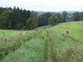
The partly redesigned circular walk offers views of the Heilenbecke valley and two of its tributaries. At the start, the walk follows the Heilenbecker-Hangweg with virtually no incline. Other stops along the route include the village of Wittenstein with its old half-timbered houses, the Grimmelsberg and the Königsfeld spa clinic.
Details
Creation:
Last update:
–
–
Last review:
–
–
-
 Activity: Walking
 -
 Distance: 9.16 mi
 -
 Average duration: 5h 15
 -
 Difficulty: Moderate
 -
-
 Back to start: Yes
 -
 Ascent: + 1,148 ft
 -
 Descent: - 1,135 ft
 -
-
 Highest point: 1,165 ft
 -
 Lowest point: 640 ft
Waypoints
- S/E : mi 0 - alt. 843 ft
- S/E : mi 9.16 - alt. 843 ft
Notes
Other walks in the area
To the left and right of the Heilenbecke, Ennepetal
 Tourism professional5.13 mi
+702 ft
-702 ft
3h 00
Tourism professional5.13 mi
+702 ft
-702 ft
3h 00
 Easy
Easy
 Departure from Ennepetal (Regierungsbezirk Arnsberg)
The regional walking route “Left and Right of the Heilenbecke” is a circular walk from Uhlenbart via Rüggeberg, the Heilenbecke Dam, Ravenschlag and Wittenstein back to the starting point. Dense forests, meadows, quiet woodland paths and views of the Bergisch landscape characterise the route. The historic village of Wittenstein adds a touch of regional history to the scenic impressions.
Around Voerde, Ennepetal
4.13 mi
+397 ft
-387 ft
2h 15
Easy
Departure from Ennepetal (Regierungsbezirk Arnsberg)
The circular walking route around Ennepetal-Voerde begins and ends at the fairground. The route leads through Lindenstraße, along Friemannweg and via Vilvoorder Straße into the rural surroundings featuring fields, hills, farmsteads and wooded hillsides. Further stops include Störringen, Gut Braband and the Ferdinand Bilstein site. The circular route then leads back to the starting point.
Herbringhauser Acht
 Visorando Member
 9.71 mi
+817 ft
-794 ft
5h 10
Moderate
Departure from Remscheid (Regierungsbezirk Düsseldorf)
9.71 mi
+817 ft
-794 ft
5h 10
Moderate
Departure from Remscheid (Regierungsbezirk Düsseldorf)
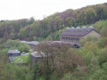
This walk starts in Remscheid-Lüttringhausen, near the A1 motorway, crosses the Herbringhausen Dam, follows the Herbringhausen Stream to the River Wupper and back, circles round Herbringhausen, then follows a figure-of-eight route back up to the dam and returns to the starting point. Parts of the route follow the Röntgenweg and the Wuppertal Circular Walk.
Through the Muttental and Bommerholz to the Mining Trail
 10.15 mi
+915 ft
-935 ft
5h 30
Moderate
Departure from Witten (Regierungsbezirk Arnsberg)
10.15 mi
+915 ft
-935 ft
5h 30
Moderate
Departure from Witten (Regierungsbezirk Arnsberg)
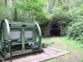
The route takes you through Muttental and Bommerholz, partly along the so-called Mining Trail, which offers small, museum-like insights into mining, down to the Hardenstein ruins on the River Ruhr and back to the starting point.
Short loop with views of the Volme, Dahlerbrück
1.61 mi
+318 ft
-322 ft
1h 00
Easy
Departure from Schalksmühle (Regierungsbezirk Arnsberg)
The A10 ‘Kleine Runde mit Volmeblick’ is a regional walking trail that winds its way through the characteristic landscape of the Märkischer Kreis. This path offers walkers unique perspectives on the Volme Valley and its natural surroundings in Schalksmühle. The carefully designed route allows walkers to immerse themselves in the local flora and fauna, whilst experiencing a harmonious interplay of woodland sections and open vantage points. The route is designed to reflect the region’s topographical features whilst offering both relaxation and an experience of nature. The views of the Volme, nestled amongst the rolling hills, are a defining feature of this tour and invite you to explore the scenic diversity of this area. The route is characterised by its manageable nature, which encourages a deep appreciation of the surroundings and provides a comprehensive insight into the region’s distinctive features.
Muttental Mining Circular Walk
 6.32 mi
+653 ft
-636 ft
3h 30
Moderate
Departure from Witten (Regierungsbezirk Arnsberg)
6.32 mi
+653 ft
-636 ft
3h 30
Moderate
Departure from Witten (Regierungsbezirk Arnsberg)
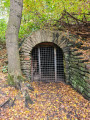
The historic Muttental Mining Circular Walk passes not only the Hardenstein Castle ruins on the banks of the Ruhr but also the Nachtigall Colliery. Here you’ll find a museum with an interesting exhibition.
Around the Dhünn Dam
 13.73 mi
+1,440 ft
-1,444 ft
7h 35
Moderate
Departure from Odenthal (Cologne Government Region)
13.73 mi
+1,440 ft
-1,444 ft
7h 35
Moderate
Departure from Odenthal (Cologne Government Region)
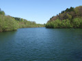
This tour takes you around the Dhünn Dam, Germany’s second-largest drinking-water reservoir, in the Bergisches Land.The Bergisches Land does not take its name from its landscape, as one might suppose, but from its former rulers, the Dukes of Berg.
For more walks, use our search engine .
The GPS track and description are the property of this route's author. Please do not copy them without permission.

