


 Country:
 City:
City:


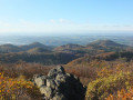
(Start/Finish) The starting point is the large hiking car park on the Margarethenhöhe, on Königswinterer Straße, near house number 9. We leave the car park onto the road heading north. After about 125 metres, we keep to the left, then turn right after a few metres and left again at the next junction. We follow the gravel path a few metres in a north-westerly direction and turn right again. We follow the path and soon cross a gravel track. After a further 230 m, we come across another gravel track, which we follow to the left. From here, we follow the signposts to the summit of the Großer Ölberg.
(1) Head back down the hill and, at the bottom, turn right. After a few metres, you’ll reach a junction. Turn left here and continue straight on until you come to the ‘Kapellenwanderung’ path. After 90 metres, leave the path heading south-south-west (slightly to the left). After almost a kilometre, you’ll come to another gravel track and, after a few metres, reach a junction.
(2) Here, we follow the Beethoven Wanderweg (B) northwards and reach Rosenau after approximately 550 metres. (3) On the western side of Rosenau, we leave the village via a path heading south, soon cross a gravel track and continue southwards, before rejoining the Beethoven Wanderweg, which we follow south (straight ahead) as far as a bridge.
(4) At the fork behind the bridge, we leave the Beethoven Wanderweg heading west (to the right). We follow the path for about 870 m and turn left, heading south. After a further 570 m, we turn left twice, passing right by the Michhäuschen.
(5) We follow the path to the next junction, where we rejoin the Beethoven Trail (B). There, we turn right and then immediately left again. At the junction a few metres further on, we leave the Beethoven Hiking Trail (B) for a short circular route, continuing straight on round the Schallenberg until we rejoin the Beethoven Hiking Trail (B) and follow it to the right over the Geisberg to Drachenfelsstraße. Here we leave the Beethoven Hiking Trail (B) to the right. At the junction after approx. 250 m, we keep to the right and follow the path round the Jungfernhard until we rejoin Drachenfelsstraße.
(6) Here, we follow the path eastwards (to the right). After about 120 metres, we leave the path to the right and, after a few steps, turn right again. After a further 230 metres, we come to a five-way junction. Here, we turn right again. We follow the path southwards to the Erpelntalskopf.
(7) We leave the site via the Lohrbergrundweg heading east and follow the path to the junction at the Löwenburger Obstwiese. Here we turn right, towards Löwenburg, past the Löwenburger Hof; at the fork we keep to the right and, a few metres further on, turn right onto a steep path. At the fork we turn left and continue climbing the hill until we reach Löwenburg.
(8) We leave Löwenburg and, after about 170 m, turn sharply right onto a path. We then follow the path downwards as it curves to the right. The path leads back above the Löwenburger Hof onto the track leading to the junction at the orchard. Here, we turn briefly left and then immediately right again, heading north. From here, we follow the path for almost 500 m.
(9) At this fork, we turn left, then after a few steps we have to turn right and, 5 m further on, left again. We follow this path for about 235 m until we reach a junction. Here we turn right. After about 100 m, we cross a path. A further 140 m on, we come across another path.
(10) We cross the path heading north and follow the path until we reach a road which takes us north-west past the Waldhotel Sophienhof and, after a few metres, to the end of the walk. (Start/Finish)
 Visorando Member
 Difficult
 Association / Club / Walk leader
 Tourist office
