


Refine your search for walks in Montricher-Albanne
Montricher-Albanne walks


 Karellis - Croix de Albiez
 Visorando Member
 4.62 mi
 +1,230 ft
 -1,230 ft
 3h 10
3h 10
 Moderate
 Departure from Montricher-Albanne (Savoie)
Easy walk for families. Passeggiata facile per famiglie.
Lake Pramol, starting from Les Karellis
2.58 mi
+577 ft
-564 ft
1h 40
 Easy
Departure from Montricher-Albanne (Savoie)
Easy
Departure from Montricher-Albanne (Savoie)
A fairly easy walk, despite a rather steep start. As the lake is accessible by car (via a good tarmac road), it can get quite busy, particularly with anglers.
You can return via the tarmac road; it’s not as scenic as going down through the forest, but it’s quicker and easier.
From Saint-Martin-de-la-Porte to Serpolière
 3.82 mi
+492 ft
-489 ft
2h 10
Easy
Departure from Saint-Martin-de-la-Porte (Savoie)
3.82 mi
+492 ft
-489 ft
2h 10
Easy
Departure from Saint-Martin-de-la-Porte (Savoie)
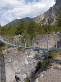
A walk through woods and vineyards, very pleasant in spring or autumn for observing the flora and fauna.
Lac de Pramol from Col d'Albanne
 2.24 mi
+420 ft
-420 ft
1h 25
Easy
Departure from Montricher-Albanne (Savoie)
2.24 mi
+420 ft
-420 ft
1h 25
Easy
Departure from Montricher-Albanne (Savoie)
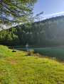
A short family walk from the Col d'Albanne to the pretty Pramol Lake.
This route is not particularly difficult and runs almost exclusively through the forest. It can be enjoyed alone or in a group.
Côte de Lancheton and the Roches Rouges
 8.18 mi
+3,317 ft
-3,317 ft
6h 40
Moderate
Departure from Saint-Julien-Mont-Denis (Savoie)
8.18 mi
+3,317 ft
-3,317 ft
6h 40
Moderate
Departure from Saint-Julien-Mont-Denis (Savoie)
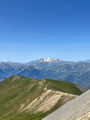
A circular walk in a remote corner of the Maurienne, along a fairly wide ridge path surrounded by mountain pastures and their cows, always with the Grand Perron des Encombres and the Cime de la Scia in view.
 La Cochette via Les Moulins
 3.31 mi
+581 ft
-584 ft
2 hrs
Easy
Departure from Albiez-Montrond (Savoie)
3.31 mi
+581 ft
-584 ft
2 hrs
Easy
Departure from Albiez-Montrond (Savoie)
A short, easy hike on foot or snowshoes along forest paths, starting from Albiez Montrond. Pass through the hamlet of La Cochette and return via Les Contamines, via a steep climb.
The ridges from Perron to Bréquin
 Association / Club / Walk leader
 13.91 mi
+5,827 ft
-5,814 ft
7 hrs
13.91 mi
+5,827 ft
-5,814 ft
7 hrs
 Very difficult
Departure from Saint-Martin-de-la-Porte (Savoie)
Very difficult
Departure from Saint-Martin-de-la-Porte (Savoie)
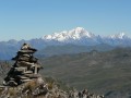
A ridge walk, partly off-trail, culminating at Mont Bréquin with a magnificent view over the Maurienne Valley and the surrounding Alps.
Col des Encombres - Lac de la Montagnette
 7.19 mi
+2,674 ft
-2,674 ft
5h 40
Moderate
Departure from Saint-Martin-de-la-Porte (Savoie)
7.19 mi
+2,674 ft
-2,674 ft
5h 40
Moderate
Departure from Saint-Martin-de-la-Porte (Savoie)
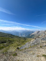
Hike in an open and unobstructed landscape. Few markings, a few directional signs at strategic points. The Montagnette lake is a good place for a picnic break. It is possible to see ibex and birds of prey. There is a large flock of sheep near the passes.
Circular Grand Perron des Encombres path via the ridge path
 5.84 mi
+2,838 ft
-2,831 ft
5h 10
Moderate
Departure from Saint-Martin-de-la-Porte (Savoie)
5.84 mi
+2,838 ft
-2,831 ft
5h 10
Moderate
Departure from Saint-Martin-de-la-Porte (Savoie)
A beautiful and fairly short walk through the mountain pastures leading to the Grand Perron des Encombres, which dominates the area and offers a superb panoramic view of all the neighbouring mountain ranges: Écrins, Belledonne, Mont Blanc, etc.
Yellow markings and signposts.
The Grand Perron des Encombres from La Saussaz
 5.21 mi
+2,782 ft
-2,759 ft
4h 50
Moderate
Departure from Saint-Martin-de-la-Porte (Savoie)
5.21 mi
+2,782 ft
-2,759 ft
4h 50
Moderate
Departure from Saint-Martin-de-la-Porte (Savoie)
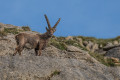
This hike takes you to the Grand Perron des Encombres, starting from La Saussaz. The access road is narrow but paved all the way to the start of the hike. The view from the summit is extraordinary. An exceptional 360° panorama with Mont Blanc dominating the scene and, above all, the near certainty of encountering ibex.
The Midi Face circular loop
7.46 mi
+3,435 ft
-3,415 ft
6 hrs
Very difficult
Departure from Valloire (Savoie)
A challenging hike with a significant elevation gain (all in one go) and some technical sections with exposed sections.
There are a few sections where you’ll need to take care. As a reward, a spectacular view awaits you, including, in particular, Mont Blanc, the Aiguilles d’Arves and the Écrins Glacier. You’ll also enjoy a sense of tranquillity at the top of the ridges, with a constant 360° view.
Circular Grand Châtelard loop via the Grand Truc
 10.15 mi
+3,822 ft
-3,839 ft
8h 00
10.15 mi
+3,822 ft
-3,839 ft
8h 00
 Difficult
Departure from Jarrier (Savoie)
Difficult
Departure from Jarrier (Savoie)
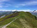
Please note: This walk is particularly long (make sure you take plenty of water in hot weather, as the route is exposed to the sun from start to finish).
It is possible not to complete the entire route. You can descend directly via the Col de Cochemin (without going via the Grand Truc).
Montvernier hairpin bends and the Bérold circuit from Pontamafrey
 6.20 mi
+1,762 ft
-1,739 ft
4h 25
Moderate
Departure from Pontamafrey-Montpascal (Savoie)
6.20 mi
+1,762 ft
-1,739 ft
4h 25
Moderate
Departure from Pontamafrey-Montpascal (Savoie)
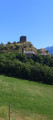
An unusual hike, half tarmac (with little traffic) and half footpath, through some remarkable landscapes. Beautiful views of the Montvernier hairpin bends, the Bérold Tower, the Aiguilles d’Arves and Saint-Jean-de-Maurienne. The descent along the Ravoire torrent is also well worth a look.
Valloire - Les Verneys par le Parcours Vert
 4.40 mi
+1,161 ft
-1,155 ft
3h 00
Moderate
Departure from Valloire (Savoie)
4.40 mi
+1,161 ft
-1,155 ft
3h 00
Moderate
Departure from Valloire (Savoie)
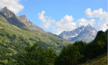
This loop, with a reasonable elevation gain for the region, will take you along paths to discover the magnificent landscapes of Valloire.This hike is offered as a trail run by the Valloire Tourist Office.The Devil's Bridge is broken. However, a replacement footbridge has been put in place, allowing you to follow the original route.
The Pain de Sucre at the start of Valloire
 7.17 mi
+2,277 ft
-2,260 ft
5h 15
Moderate
Departure from Valloire (Savoie)
7.17 mi
+2,277 ft
-2,260 ft
5h 15
Moderate
Departure from Valloire (Savoie)
A classic hike around the Valloire ski resort.
This is a circular starting and ending in Valloire.
comment from a hiker on 02/08/2023
A sign after the hamlet of Poingt Ravier indicates that the return route from Albanette to Valloire is closed.
At (10), only a pedestrian crossing remains. On arrival in Valloire, a municipal decree is displayed indicating that traffic on this road is prohibited, particularly for pedestrians, and that failure to comply with this decree may result in a fine.
Circular walk from Valloire, with views of the Aiguille Noire, Mont Thabor and the Écrins
 9.43 mi
+4,042 ft
-4,039 ft
7h 50
Difficult
Departure from Valloire (Savoie)
9.43 mi
+4,042 ft
-4,039 ft
7h 50
Difficult
Departure from Valloire (Savoie)
A lovely circular walk from Valloire that climbs through the hamlets overlooking the village with views of the Aiguille Noire, then along the ski runs to reach the pretty ridge separating the Valloire and Valmeinier valleys. After a small summit at 2,600 m offering a stunning view of Mont Thabor, the Aiguilles d’Arves and, behind them, the Galibier and the Écrins peaks (Meije, Râteau, Pelvoux, etc.), the descent takes you via the Pas des Griffes and the hamlets of Mérégers and Les Selles along a very pleasant, smooth trail to complete the circular route and return to Valloire.
Ascent beneath the Aiguilles d'Arves
 7.69 mi
+2,818 ft
-2,779 ft
6h 00
Difficult
Departure from Albiez-Montrond (Savoie)
7.69 mi
+2,818 ft
-2,779 ft
6h 00
Difficult
Departure from Albiez-Montrond (Savoie)
Close to the Aiguilles d'Arves, starting from the Relais 1900 above Chalmieu (Montrond), there is a climb to reach a point slightly above Basse du Gerbier. The climb is beautiful and requires some effort to warm up.
The descent can be made via the same route or via the Gros Crey and Bon Ventre ridges (caution: tricky section), which is longer and more exposed.
At the foot of the Aiguilles d'Arves - Basse du Gerbier
6.59 mi
+2,234 ft
-2,238 ft
5h 00
Moderate
Departure from Albiez-Montrond (Savoie)
A superb hike in a magnificent setting at the foot of the Aiguilles d'Arves. The coolness of the torrent, the landscape ravaged by erosion, flower-filled mountain pastures, the whistling of marmots and shy chamois complete the picture.
A comfortable walk has been created passing through (1) and (2).
From Grange Bernard to the Refuge de Terre Rouge
 5.14 mi
+1,896 ft
-33 ft
4h 00
Moderate
Departure from Valmeinier (Savoie)
5.14 mi
+1,896 ft
-33 ft
4h 00
Moderate
Departure from Valmeinier (Savoie)
First stage of the Petit tour du Mont Thabor hike
A short walk around Mont Thabor
24.52 mi
+8,251 ft
-8,238 ft
3 days
Difficult
Departure from Valmeinier (Savoie)
A hike packed with kilometres – both in distance and in elevation gain!A 360° viewpoint on Mont Thabor between the Vanoise and Écrins.Find all the reviews for this hike on the first stage’s pagehttps://www.visorando.com/randonnee-peti...
Circular loop around Valloire
 7.20 mi
+2,552 ft
-2,539 ft
5h 30
Difficult
Departure from Valloire (Savoie)
7.20 mi
+2,552 ft
-2,539 ft
5h 30
Difficult
Departure from Valloire (Savoie)
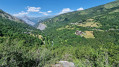
This walk offers a 360° panoramic view of Valloire as you pass through the higher ground (around 200 m above Valloire) and discover the hamlets surrounding it.
The trails are varied (fields, woodland, 4x4 tracks) and you can join or leave the walk at several points.
Some fairly steep slopes make this a fairly challenging walk.
Tour du Grand Coin
 14.09 mi
+6,509 ft
-6,506 ft
2 days
Difficult
Departure from Pontamafrey-Montpascal (Savoie)
14.09 mi
+6,509 ft
-6,506 ft
2 days
Difficult
Departure from Pontamafrey-Montpascal (Savoie)
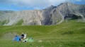
A two-day hike with a bivouac around the Grand Coin above Saint-Jean-de-Maurienne.
It offers the chance to explore a little-known and rarely visited area on the edge of the Vanoise National Park.
Montpascal – Valbuche
8.10 mi
+4,413 ft
-1,834 ft
5 hrs
Very difficult
Departure from Pontamafrey-Montpascal (Savoie)
First day of a two-day hike in the Maurienne with a bivouac.
Hike completed in 2016 with a break at the Col de la Baisse, another above the Chalet des Brunes and a final one at the Chalet du Tovet.
Note: The route shown is based on my GPS watch, which I never paused, which explains the circular patterns in certain places.
The Thabor Circuit in 5 days
 50.44 mi
+16,581 ft
-16,614 ft
5 days
Difficult
Departure from Valmeinier (Savoie)
50.44 mi
+16,581 ft
-16,614 ft
5 days
Difficult
Departure from Valmeinier (Savoie)
This 5-day route takes you from mountain hut to mountain hut along theGRP® Tour du Thabor route, offering fabulous high-mountain landscapes and panoramic views at altitudes often exceeding 2,500 metres. The ascent of Mont Thabor to nearly 3,200 metres gives you the feeling of being on top of the world, where you’ll experience the effects of high altitude.
Valmeinier 1800 – Refuge du Thabor
 9.69 mi
+5,079 ft
-2,690 ft
10 hrs
Very difficult
Departure from Valmeinier (Savoie)
9.69 mi
+5,079 ft
-2,690 ft
10 hrs
Very difficult
Departure from Valmeinier (Savoie)
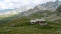
The route begins on theGRP® Tour du Mont Thabor trail, starting from the Petite Station in Valmeinier 1800. You’ll pass the Col des Marches, Lake Bissorte, the Refuge des Marches, Lake des Batailléres, the pass of the same name, Lake Long and Lake Rond before arriving at the Refuge du Thabor.
From the Col de Chaussy to Fontanious
2.79 mi
+2,126 ft
-2,126 ft
3 hrs
Moderate
Departure from Pontamafrey-Montpascal (Savoie)
A sunny walk starting from the Col de Chaussy.
This is a south-facing route where you can enjoy plenty of sunshine even in the middle of winter.
The route is the start of the trail leading to the Grand Coin.
The lakes of Curtalés, Rond, Cornu and Vert from Valmeinier
 9.91 mi
+2,690 ft
-2,684 ft
6h 55
Moderate
Departure from Valmeinier (Savoie)
9.91 mi
+2,690 ft
-2,684 ft
6h 55
Moderate
Departure from Valmeinier (Savoie)
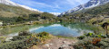
A lovely hike through the Neuvache valley to reach Lac Curtalés and the neighbouring lakes, with a detour to the beautifully coloured Lac Vert. The ascent follows a balcony path on the right bank of the Neuvache, offering superb views of the valley and the mountains. The return route, following the left bank along the stream, offers some pleasant shaded areas during hot weather.
Yellow markings and signposts to help you find your way.
Grands Lacs via the Terre Rouge refuge
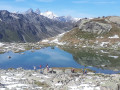 8.66 mi
+2,559 ft
-2,559 ft
6h 15
Moderate
Departure from Valmeinier (Savoie)
8.66 mi
+2,559 ft
-2,559 ft
6h 15
Moderate
Departure from Valmeinier (Savoie)
This hike consists of two loops that meet at the Terre Rouge refuge.
The lower loop allows you to admire the Neuvache valley from a balcony trail as you climb. On the descent, the route often runs alongside the torrent itself.
The upper loop takes place in a more mineral environment at the base of the western slope of Mont Thabor.
The markings for these loops are varied.
Circular of the lakes in the Neuvache valley above Valmeinier
11.89 mi
+3,343 ft
-3,323 ft
8h 25
Difficult
Departure from Valmeinier (Savoie)
A magnificent hike along the Neuvache river, which will take you to Lac des Glaciers in a magnificent alpine cirque dominated by Roche du Chardonnet, Pointe des Angelières, Mont Thabor and Pic du Thabor via Lac Vert, Lac Curtalès, Lac Rond, Lac Cornu, Lac Bri and an unnamed lake.The diversity of the environments, including forests, mountain pastures and mineral landscapes, is what makes this magnificent but demanding hike so interesting. It is aimed at experienced hikers who are used to long walks on varied terrain and are accustomed to navigating by map and visually, particularly between Lac Bri and Lac des Glaciers and at the start of the descent from the latter.Visorando app recommended.