Circular Grand Châtelard loop via the Grand Truc

Please note: This walk is particularly long (make sure you take plenty of water in hot weather, as the route is exposed to the sun from start to finish).
It is possible not to complete the entire route. You can descend directly via the Col de Cochemin (without going via the Grand Truc).

Details

3175480
Creation:
Last update:
Last review:
  • Walking
    Activity: Walking
  • ↔
    Distance: 10.15 mi
  • ◔
    Average duration: 8h 00 
  • ▲
    Difficulty: Difficult

  • ⚐
    Back to start: Yes
  • ↗
    Ascent: + 3,822 ft
  • ↘
    Descent: - 3,839 ft

  • ▲
    Highest point: 7,241 ft
  • ▼
    Lowest point: 4,442 ft

Photos

Description of the walk

Park in the small car park (limited spaces) by the roadside in the hamlet of Pierre Brune.

(S/E) Continue straight ahead along the road, then turn left almost immediately onto the footpath. Start climbing a fairly steep slope and, after a slight levelling off, reach a crossroads of footpaths.

(1) Follow the signposted path alongside the sheep fences. You’ll reach another junction with a wayside shrine.

(2) Stay on the left-hand path and continue the climb. Turn left and reach the signpost for the Hauts de Plan Souffrance (1,900 m).

(3) Turn right towards the Étang des Chamossières. Reach the lake, walk round it and rejoin the signposted path. Follow it to the right to reach the summit of the Grand Châtelard.

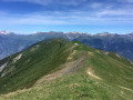
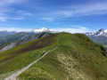
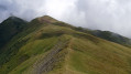
(4) Continue along the long, well-marked ridge to reach the Col de Cochemin.

(5) Carry on along the Crêt de la Raverotte to reach the Col de Cressua.

(6) Continue straight ahead to reach the Crêt Massuet.

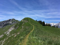
(7) Continue along the ridge and, via the Crêt Morandet, reach the summit of the Grand Truc.

(8) Return along the same route to the Crêt Massuet.

(7) Turn right downhill onto the path, which becomes shaded in places. At the edge of the forest, you’ll come to a wooden pond.

(9) Continue the descent, veering to the left to reach the hamlet of Les Chambeaux and, more specifically, the Notre-Dame Chapel.

(10) Continue down into the village, cutting across the road via the footpaths. Join the road at the hamlet of La Tuvière.

(11) Turn left onto the road to return to the Pierre Brune car park (S/E).

Waypoints

  1. S/E : mi 0 - alt. 4,570 ft - Car park at the hamlet of Pierre Brune
  2. 1 : mi 0.6 - alt. 5,423 ft - Sheep pasture
  3. 2 : mi 0.91 - alt. 5,384 ft - Oratory
  4. 3 : mi 1.78 - alt. 6,329 ft - Hauts de Plan Souffrance
  5. 4 : mi 2.36 - alt. 7,028 ft - Grand Châtelard
  6. 5 : mi 3.37 - alt. 6,365 ft - Col de Cochemin (1939m)
  7. 6 : mi 4.27 - alt. 6,775 ft - Col de Cressua (2065m)
  8. 7 : mi 4.77 - alt. 6,942 ft - Crêt Massuet
  9. 8 : mi 5.53 - alt. 7,234 ft - The Grand Truc
  10. 9 : mi 7.23 - alt. 6,220 ft - Bassin
  11. 10 : mi 8.08 - alt. 5,689 ft - Notre-Dame Chapel
  12. 11 : mi 9.62 - alt. 4,442 ft - The hamlet of La Tuvière
  13. S/E : mi 10.15 - alt. 4,567 ft - Car park at the hamlet of Pierre Brune

Notes

(1) Please be aware that there are herds here in summer, guarded by mountain dogs.

Alternatives:
(5) Take the path on the left leading to the hamlet of Les Chambeaux (10).
(6) Take the path on the left, which also leads back to the hamlet of Les Chambeaux (10).

Worth a visit

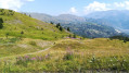
Between (3) and (4) Chamossières Lake: this lake overlooks the valley and offers an incredible view of the Aiguilles d’Arves.

Reviews and comments

3.8 / 5
Based on 3 reviews

Reliability of the description
3.7 / 5
Ease of following the route
3.3 / 5
Route interest
4.3 / 5
sempervivum
sempervivum

Overall rating : 5 / 5

Date of your route : Mar 20, 2026
Reliability of the description : ★★★★★ Very good
Ease of following the route : ★★★★★ Very good
Route interest : ★★★★★ Very good
Very busy route : No

I only completed part of the snowshoe hike (a steep descent via the Col de Cochemin, point 5) due to the depth of the snow and the lack of tracks (I didn’t see a soul all day). The view from the summit (orientation table) is incredible, taking in the Vanoise, the Aiguilles d’Arve, the Ecrins, Belledonne, Les Bauges and La Lauzière! A magnificent day, very wild on the Chamossières plateau; I disturbed a few chamois. I highly recommend it

Machine-translated

la gazelle
la gazelle
• Edited:

Overall rating : 1.7 / 5

Date of your route : Jul 04, 2023
Reliability of the description : ★☆☆☆☆ Very disappointing
Ease of following the route : ★☆☆☆☆ Very disappointing
Route interest : ★★★☆☆ Average
Very busy route : No

There were no signposts from the start. We had to cross some very steep meadows to reach the sheep pastures and the ‘Plan de la Souffrance’ at 1,900 metres.
At the summit of the Grand Chatelard, we couldn’t find the path or the Col de Cochemin, despite the GPS.
We ended up at Pré St-André and had to tackle an hour’s walk up a very steep grassy slope to reach Les Chambeaux.

Machine-translated

blandinem42
blandinem42
• Edited:

Overall rating : 4.7 / 5

Date of your route : Oct 28, 2022
Reliability of the description : ★★★★★ Very good
Ease of following the route : ★★★★☆ Good
Route interest : ★★★★★ Very good
Very busy route : No

A lovely walk along the ridges above Jarrier. You can park at the Léard car park (very well signposted from Jarrier), which means you don’t have to leave your car by the roadside at Pierre Brune and allows you to start the walk just before point 11.
We didn’t complete the whole circuit; we took the descent at the Col de Cressua (point 6).
Thank you for this route!

Machine-translated

Other walks in the area

For more walks, use our search engine .

The GPS track and description are the property of this route's author. Please do not copy them without permission.