Country:

 City:
City:


Reach the hamlet of Point Ravier by car from Valloire, where there is a small car park just at the entrance to the hamlet on the left. You can also walk up from Valloire, but this will only make the hike more difficult (and take longer).
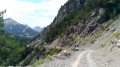
(S/E) Continue due south, join the 4x4 track that starts at the fountain in the centre of the hamlet, then begin climbing to the right until you reach the first fork (alt. 1,690 m).
(1) Leave the 4x4 track and carry on straight ahead to reach Le Pain de Sucre. With Le Pain de Sucre on your right, you’ll see a path branching off to the left and leading uphill.
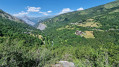
(2) Take this path and, a few hundred metres further on, the steep climb begins. You’ll arrive at Le Bonhomme de Pierre. You can already enjoy the view over the Maurienne Valley and the many peaks surrounding it.
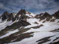
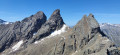
(3) Continue up the path along the ridge to reach the highest point of the walk at an altitude of 2,558 metres. There are spectacular views of numerous peaks, both nearby – such as the Aiguilles d’Arves – and further afield – such as Mont Blanc (on a clear day) and the Écrins massif.
(4) After taking in the views, resume your walk along the path, which begins a gentle descent, passing beneath the Paroi du Midi (on the south-eastern side).
(5) Take care here, as there are two or three sections with a very steep gradient requiring caution, before reaching the Col du Midi.
(6) Do not descend on the north side but carry on straight ahead. The path is much less defined but will be visible. Feel free to climb up slightly if you prefer to have better grip on the grassy sections rather than walking on the sloping earth, which is sometimes snow-covered. You will then reach the Pas de Perpuité.
(7) This is a large boulder on the ridge. Go round it on the right (south-facing slope) without any difficulty. Continue along the Crey du Meigno ridge, always keeping a minimum distance from the north-facing slope (which is sheer). Carry on until you reach an altitude of 2,340 m (the end of the Crey du Meigno ridge, before the descent becomes steeper).
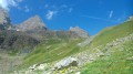
(8) This is where the descent towards Point Ravier really begins, and it starts with a short off-trail section as the path has completely disappeared beneath the grass. Try to follow the route by zigzagging downwards until you spot the alpine chalet, which you’ll reach through the tall grass.
(9) Continue on your way, following the GPS track; the most important thing is to reach the waypoint at an altitude of 2,090 m, as this is where you’ll find a visible path again.
(10) Follow this path to the Solèdes alpine chalet.
(11) Head back down to the left, along the 4x4 track, to the first junction you passed on the way up.
(1) Turn right and, following the reverse route of your outward journey, head to Point Ravier, then back to the car park (S/E).



 Visorando Member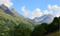
 Moderate
 Difficult
 Easy
Easy  Association / Club / Walk leader