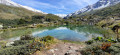
Circular loop around Valloire

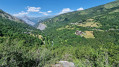
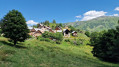
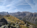
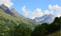
This walk offers a 360° panoramic view of Valloire as you pass through the higher ground (around 200 m above Valloire) and discover the hamlets surrounding it.
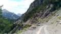
The trails are varied (fields, woodland, 4x4 tracks) and you can join or leave the walk at several points.
Some fairly steep slopes make this a fairly challenging walk.

Details

36251394
Creation:
Last update:
Last review:
  • Walking
    Activity: Walking
  • ↔
    Distance: 7.20 mi
  • ◔
    Average duration: 5h 30 
  • ▲
    Difficulty: Difficult

  • ⚐
    Back to start: Yes
  • ↗
    Ascent: + 2,552 ft
  • ↘
    Descent: - 2,539 ft

  • ▲
    Highest point: 5,610 ft
  • ▼
    Lowest point: 4,482 ft

Photos

Description of the walk

Park in the car park in the hamlet of L’Archaz.

(S/E) Walk to the end of the path through the hamlet, then head down alongside the stream to the lower part of the hamlet. After the fountain, follow the path that crosses over the stream until you reach a T-junction. Turn left, continue downhill and reach the footbridge over the Neuvachette.

(1) Cross the footbridge and begin a steep climb; turn left, then immediately right onto the path. You will then pass under the Sétaz cable car to reach the hamlet of Le Giez.

(2) Continue down the Green trail to the right to quickly reach the Saint-Pierre Chapel.

(3) Follow the track to the stream.

(4) Take the road opposite until you reach the Route du Galibier (D902). Cross it carefully and continue straight ahead until you reach a footpath, the Chemin de Marguerand. At the road, turn right and head uphill to Les Clots; on leaving this hamlet, you’ll come to a crossroads with a sign reading: Association Foncière Pastorale du Crey Rond.

(5) Take this path to the left and climb up to reach the Pré Vessin junction. Turn slightly right and continue uphill until, at the top of the climb, you reach the junction with the path leading to the Gorges de l’Enfer.

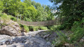
(6) Head down to the right and, after a few hairpin bends, you’ll reach the gorges. Cross the suspension bridge and take the winding path, which heads off to the left into the forest.

(7) At the four-way junction, continue to the right until you reach the hamlet of Point Ravier.

(8) Walk through the hamlet, following the road to its end, where there is a small car park on the right.
Just before this, take a path branching off to the right and head down towards Valloire through the forest, where numerous signs provide information about the flora. You’ll come to a Y-junction.

(9) Turn right towards Valloire to quickly reach the D81d. Turn right onto it to reach the Chapelle Sainte-Thècle junction.

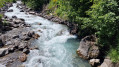
(10) Take the path on the left and head down to the stream. Caution: do not get too close – the current is strong, and as the stream flows into the valley, there is little chance of survival if you fall in.
Continue along the path and head uphill to reach the D902.

(11) Cross the road carefully and take the path on the left that runs parallel to the road. You’ll emerge at the hamlet of Les Granges.

(12) Walk through the hamlet and head uphill along the path towards l’Archaz. You will then come to the Piste 4x4 des Lutins. Head uphill to the left and follow it for quite a while up a steep slope until you reach the hamlet of Point Rogereuil.

(13) Pass through Point Rogereuil and look out for a small path on the right that descends between the trees. Follow it until you reach the point directly below the Crêt de la Brive cable car.

(14) Take the track opposite, then the road, to return to the car park in the hamlet of L’Archaz (S/E).

Waypoints

  1. S/E : mi 0 - alt. 5,190 ft - L’Archaz car park
  2. 1 : mi 0.27 - alt. 5,069 ft - Footbridge over the - Neuvachette (cours d'eau)
  3. 2 : mi 0.74 - alt. 5,253 ft - The hamlet of Le Giez
  4. 3 : mi 1.16 - alt. 4,993 ft - Saint-Pierre Chapel
  5. 4 : mi 1.34 - alt. 4,885 ft - Torrent - Valloirette (rivière)
  6. 5 : mi 1.63 - alt. 4,997 ft - Les Clots hamlet
  7. 6 : mi 2.18 - alt. 5,545 ft - Junction with the path to the Gorges de l’Enfer
  8. 7 : mi 3.25 - alt. 5,466 ft - Four-way junction
  9. 8 : mi 3.76 - alt. 5,404 ft - Le Poingt Ravier
  10. 9 : mi 4.52 - alt. 4,682 ft - Y-junction
  11. 10 : mi 4.76 - alt. 4,547 ft - Sainte-Thècle Chapel
  12. 11 : mi 5.23 - alt. 4,787 ft - D902
  13. 12 : mi 5.52 - alt. 4,918 ft - Les Granges
  14. 13 : mi 6.57 - alt. 5,604 ft - Rogereuil Point
  15. 14 : mi 7.01 - alt. 5,240 ft - Crêt de la Brive cable car
  16. S/E : mi 7.2 - alt. 5,190 ft - L’Archaz car park

Notes

The route starts in the hamlet of L’Archaz, but you can also join it at the junction with the Route des Verney, at the tree-top adventure park, behind the campsite, or in the hamlet of Les Granges.

Worth a visit

(S/E) Every year, in both summer and winter, the resort of Valloire hosts an unmissable festival of temporary sculptures.
Between (6) and (8). As you climb, you can admire the Gorges de l’Enfer and its waterfalls.

Reviews and comments

4.5 / 5
Based on 2 reviews

Reliability of the description
5 / 5
Ease of following the route
4.5 / 5
Route interest
4 / 5
HOZRO
HOZRO

Overall rating : 4.3 / 5

Date of your route : Aug 01, 2025
Reliability of the description : ★★★★★ Very good
Ease of following the route : ★★★★☆ Good
Route interest : ★★★★☆ Good
Very busy route : No

we only did part of the circuit, which allowed us to discover the hamlets of Valloire and enjoy a beautiful view of the town.

Machine-translated

f8bey
f8bey

Overall rating : 4.7 / 5

Date of your route : Jun 19, 2024
Reliability of the description : ★★★★★ Very good
Ease of following the route : ★★★★★ Very good
Route interest : ★★★★☆ Good
Very busy route : No

Having set off on this walk from Valloire, we were forced to turn back just as we were about to cross the stream in the Gorges de l’Enfer (between 6 and 7). The suspension bridge is no longer there
There are no signs to warn you before you reach the spot.
Perhaps it will have been rebuilt by the time you read this?
Enjoy your hike!

Machine-translated

Other walks in the area

For more walks, use our search engine .

The GPS track and description are the property of this route's author. Please do not copy them without permission.