The Thabor Circuit in 5 days

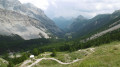
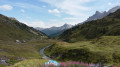
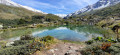
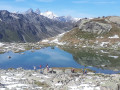
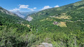
This 5-day route takes you from mountain hut to mountain hut along theGRP® Tour du Thabor route, offering fabulous high-mountain landscapes and panoramic views at altitudes often exceeding 2,500 metres. The ascent of Mont Thabor to nearly 3,200 metres gives you the feeling of being on top of the world, where you’ll experience the effects of high altitude.

Details

1498272
Creation:
Last update:
Last review:
  • Walking
    Activity: Walking
  • ↔
    Distance: 50.44 mi
  • ◔
    Average duration: 5 days 
  • ▲
    Difficulty: Difficult

  • ⚐
    Back to start: Yes
  • ↗
    Ascent: + 16,581 ft
  • ↘
    Descent: - 16,614 ft

  • ▲
    Highest point: 10,430 ft
  • ▼
    Lowest point: 5,213 ft

Photos

Stages of the route

This route needs several days, find the details below:

  1. S
  2. 2
  3. 3
  4. 4
  5. E

Notes

This route is only suitable for experienced and fit hikers. The recommended kit is that for high-mountain hiking, as the altitude is often above 2,500 metres and reaches 3,200 metres during the ascent of Mount Thabor.
There are no navigation issues, although theGRP® signposting could be improved.

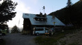
You’ll find water throughout the route. The mountain huts where we stayed were of a very high standard, and the hospitality was outstanding.

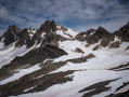
We completed this route in early August, when there were still plenty of snowfields. We experienced temperatures ranging from 5° to 30°.

Worth a visit

- Valmeiniers 1800.
- Le Col des Marches
- Lake Bissorte
- Col des Bataillères and Lac des Bataillères
- Le Cheval Blanc
- The Sainte-Marguerite Lakes: Lac Rond and Lac Long
- The Col de la Vallée Etroite
- Mont Thabor and its chapel
- Lake Peyron
- Le Grand Seru
- The Col des Méandes
- The Three Wise Men

Below is a list of what we packed in each of our rucksacks for our first trip – I hope you find it useful:

Hiking rucksack (mine was 70 litres and my wife’s was 50 litres) / Rucksack cover x1
Sleeping bag x1 / Sleeping mat (self-inflating or foam) x1
Hiking boots x1 / Hiking socks x2 / Sandals or flip-flops x1
Underwear x2
Relaxation shorts x1 / Relaxation T-shirts x1
Hiking trousers x1 / Long-sleeved hiking T-shirt(s) x1 and short-sleeved T-shirts x2
3-in-1 waterproof jacket x1 / Pouch x1
Woolly hat x1 / Gloves or mittens x1 / Cap or hat x1
Head torch x1 / Emergency blanket x2 / Water bottles x1 / Water pouches x1 / Knife + spoon x1 / Mobile phone x1 / Phone charger x1 / Trekking poles x1 / Pole tips x1 / Sunglasses
Personal toiletries: Toothbrush x1 / Towel x1 / Wipes (feminine hygiene)
Shared equipment:

Hiking tent x1
Adhesive tape x1 / Thread and needle x1 / Sewing needles x4 / Lighter x1 / Bin bags or plastic bags x2 / Spare batteries x1 / IGN map x1 / TOPO Guide / Map cover x1 / Compass x1 / First-aid kit x1 / Shoelaces x2 / Portable power bank x3 / Pen x2 / Notebook or paper x1 / Camera x1 / Washing powder x1 /
Mountaineering rope x1 / Carabiners x2
Toothpaste x1 / Toilet paper x2 / Soap (biodegradable) x1 / Sun cream / Lip balm x1 / Comb x1 / Nail clippers x1 / Insect repellent x1
Cash / Cheque book X1 / Credit card X1
- Les Granges de la Vallée étroite
- Le Col du Vallon
- Névache
- The Clarée Valley
- Lake Laramon
- Lake Clarée
- the Aiguille Noire
- Lake Grand Ban
- The Pas des Griffes

Always be cautious and plan ahead when you're outdoors. Visorando and the author of this route cannot be held responsible for any accidents occurring on this route.

Reviews and comments

5 / 5
Based on 2 reviews

Reliability of the description
5 / 5
Ease of following the route
5 / 5
Route interest
5 / 5
User 17891502

Hello,

I have a question: what was the temperature like at night? I’d like to know what comfortable temperature to set.

Thanks in advance!

Machine-translated

User 3757722

Hello,
Why are you going through Valmeinier when the IGN map shows that this is not the GRP route?
Thanks

Machine-translated

Edappere
Edappere

Overall rating : 5 / 5

Date of your route : Jul 22, 2024
Reliability of the description : ★★★★★ Very good
Ease of following the route : ★★★★★ Very good
Route interest : ★★★★★ Very good
Very busy route : Yes

A magnificent multi-day hike around Mont Thabor. We completed it in five days, as suggested on the website, which makes for quite substantial daily stages in terms of both distance and elevation gain and loss (an average of +1,000/-1,000 per day), but they are manageable provided you’re reasonably fit.
We didn’t stay in the mountain huts but camped nearby, which adds even more charm to the trek (and a bit of extra weight in the rucksack!).
The Thabor circuit is a fairly popular classic route; you’ll have no trouble finding the path throughout the journey. The valleys you pass through are stunning, as are the views, and the satisfaction of having ‘conquered a 3,000’ is the icing on the cake!

Machine-translated

Pjean34
Pjean34

Overall rating : 5 / 5

Date of your route : Aug 01, 2022
Reliability of the description : ★★★★★ Very good
Ease of following the route : ★★★★★ Very good
Route interest : ★★★★★ Very good
Very busy route : Yes

A lovely backpacking route, with some challenging stages, magnificent scenery and easy navigation. Well worth doing.

Machine-translated

Other walks in the area

For more walks, use our search engine .

The GPS track and description are the property of this route's author. Please do not copy them without permission.