From the Col de Chaussy to Fontanious

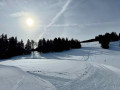
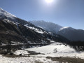
A sunny walk starting from the Col de Chaussy.
This is a south-facing route where you can enjoy plenty of sunshine even in the middle of winter.
The route is the start of the trail leading to the Grand Coin.

Details

n°46022
Creation:
Last update:
Last review:
  • Snowshoeing
    Activity: Snowshoeing
  • ↔
    Distance: 2.79 mi
  • ◔
    Duration according to the author: 3 hrs 
  • ▲
    Difficulty: Moderate

  • ⚐
    Back to start: Yes
  • ↗
    Ascent: + 2,126 ft
  • ↘
    Descent: - 2,126 ft

  • ▲
    Highest point: 7,159 ft
  • ▼
    Lowest point: 5,033 ft

Description of the walk

Park in the large car park at the pass.

(S/E) Set off along the path which starts immediately behind the chapel.
Head towards the signpost marked ‘Le Grand Coin 4h’.

(1) Take the path which winds its way up through a series of wide hairpin bends to the edge of the forest at l’Alpettaz. After half an hour’s walk, curiously enough, Le Grand Coin is now only 2 hours away.
The path enters the forest and crosses through it; note the gypsum outcrops as you pass.
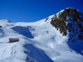
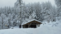
As you emerge from the forest, the path opens out onto a flat area, near two small wooden chalets.
After the clearing, you can either continue along the path at your own pace or tackle the slope head-on.
After the exertion of the latter option, you’ll emerge onto a flat area, the end of this walk.
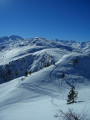
There’s a beautiful panoramic view of the Maurienne mountains: the Aiguilles d’Arves on one side, and the resort of Saint François Longchamp, just visible in the distance, on the other.

(2) Follow the ascent route back to the large car park at the pass (S/E).

Waypoints

  1. S/E : mi 0 - alt. 5,033 ft - Car park at the pass
  2. 1 : mi 0.62 - alt. 5,915 ft - Alpettaz Forest
  3. 2 : mi 1.4 - alt. 7,159 ft - Flat section
  4. S/E : mi 2.79 - alt. 5,033 ft - Car park at the pass

Notes

No water points, but there is a bar and restaurant at the start, open in season.
Sunglasses.

Worth a visit

Cross-country skiing is available in the Grand Coin Nordic area.
Marked snowshoe trails.

Reviews and comments

5 / 5
Based on 1 review

Reliability of the description
5 / 5
Ease of following the route
5 / 5
Route interest
5 / 5
mogambetta
mogambetta

Overall rating : 5 / 5

Date of your route : Aug 19, 2019
Reliability of the description : ★★★★★ Very good
Ease of following the route : ★★★★★ Very good
Route interest : ★★★★★ Very good

The Roc de la Lune is just a small hillock to the left of the pass of the same name. From the Col de l’Eschaud, there is a very beautiful route along a grassy ridge to the Col Jean, offering superb 360-degree views.

Machine-translated

jimmyduj
jimmyduj
• Edited:

Once we reached the Col de Chaussy, we ultimately decided to climb to the Croix de l’Armelaz, at 1,838 metres, to the west, rather than take the steep ascent to the east, as this offered a more interesting panoramic view, in my opinion

Machine-translated

Other walks in the area

For more walks, use our search engine .

The GPS track and description are the property of this route's author. Please do not copy them without permission.