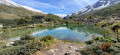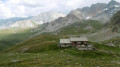
Circular walk from Valloire, with views of the Aiguille Noire, Mont Thabor and the Écrins

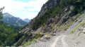
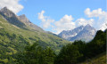
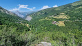
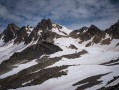
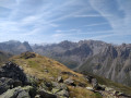
A lovely circular walk from Valloire that climbs through the hamlets overlooking the village with views of the Aiguille Noire, then along the ski runs to reach the pretty ridge separating the Valloire and Valmeinier valleys. After a small summit at 2,600 m offering a stunning view of Mont Thabor, the Aiguilles d’Arves and, behind them, the Galibier and the Écrins peaks (Meije, Râteau, Pelvoux, etc.), the descent takes you via the Pas des Griffes and the hamlets of Mérégers and Les Selles along a very pleasant, smooth trail to complete the circular route and return to Valloire.

Details

n°39043815
Creation:
Last update:
Last review:
  • Walking
    Activity: Walking
  • ↔
    Distance: 9.43 mi
  • ◔
    Average duration: 7h 50 
  • ▲
    Difficulty: Difficult

  • ⚐
    Back to start: Yes
  • ↗
    Ascent: + 4,042 ft
  • ↘
    Descent: - 4,039 ft

  • ▲
    Highest point: 8,576 ft
  • ▼
    Lowest point: 4,610 ft

Photos

Description of the walk

The route starts from Valloire, at the bottom of the Crêt de la Brive cable cars. Parking is available in the ski slope car parks.

(S/E) Pass under the cable cars and follow the signposted path towards Geneuil. You’ll arrive near a wayside shrine at l’Archaz.

(1) Turn right, heading south, then due east, and join theGRP® Tour du Mont Thabor (alternative route).

(2) Turn left and walk for about 400 m to Geneuil. Walk through the hamlet.

(3) Turn right towards La Turraz, then Montissot. Pass under the Montissot chairlift and reach the foot of the Grand Plateau ski lift (slope-side refreshment bar closed in summer).

(4) Head up to the left of the ski lift via the Gerboise run to reach the top of the Grand Plateau and admire the Écrins peaks coming into view to the south between the nearer peaks.

(5) From the top of the ski lift, turn right and follow the ridge southwards, separating the Valloire and Valmeinier valleys, to the summit at an elevation of 2,615 metres.

(6) Views over the valleys, the Aiguilles d’Arves, Mont Thabor and the peaks of the Écrins. Continue southwards and descend to the Pas des Griffes.

(7) Turn right onto theGRP®, heading towards the Valloire valley, following a path signposted ‘les Mérégers’. Further down, reach a junction at the Mont Jovet cross, situated at an elevation of 2,385 metres.

(8) Continue to the right, north-west, and reach a junction just before Les Mérégers (places to eat).

(9) First turn right then left, pass below the restaurant and take a small path leading to Les Selles.

(10) In the hamlet, follow the signposting on the right for “Montissot, Geneuil and Valloire”.

(11) Once in Pragautier, carry straight on, pass La Cléa, then go under the Montissot chairlift. Just before Geneuil, you’ll come to the junction you passed on the way there.

(2) Keep to the left and, taking the opposite route to the one you took on the way there, head towards Valloire and the car park for the Crêt de la Brive gondola lift (S/E).

Waypoints

  1. S/E : mi 0 - alt. 4,610 ft - Valloire, at the bottom of the cable car. Near the - Neuvachette (cours d'eau)
  2. 1 : mi 0.48 - alt. 5,069 ft - Oratory
  3. 2 : mi 0.92 - alt. 5,610 ft - Junction of the circular loop
  4. 3 : mi 1.16 - alt. 5,646 ft - Geneuil
  5. 4 : mi 2.54 - alt. 7,008 ft - Start at the Grand Plateau ski lift
  6. 5 : mi 3.49 - alt. 8,271 ft - Arrival at the Grand Plateau ski lift
  7. 6 : mi 4.48 - alt. 8,570 ft - Summit. Elevation 2,615
  8. 7 : mi 4.82 - alt. 8,376 ft - Pas des Griffes (2554m)
  9. 8 : mi 5.35 - alt. 7,835 ft - Mont Jovet Cross
  10. 9 : mi 6.4 - alt. 6,949 ft - Les Mérégers
  11. 10 : mi 6.81 - alt. 6,558 ft - Les Selles
  12. 11 : mi 7.74 - alt. 5,955 ft - Pragautier
  13. S/E : mi 9.43 - alt. 4,610 ft - Valloire, at the bottom of the cable car

Notes

The circular route follows easy hiking trails. Only the start and end are sheltered from the sun, so in summer it is best to set off early in the morning to avoid the heat and stay in the shade of the ridge for as long as possible. The path crosses numerous streams where you can cool off. In summer, the refreshment stands at the bottom of the trail are closed; only the Auberge des Mérégers (9) is open for food and drink.

Reviews and comments

5 / 5
Based on 2 reviews

Reliability of the description
5 / 5
Ease of following the route
5 / 5
Route interest
5 / 5
User 24553877
• Edited:

Overall rating : 5 / 5

Date of your route : Sep 28, 2026
Reliability of the description : ★★★★★ Very good
Ease of following the route : ★★★★★ Very good
Route interest : ★★★★★ Very good
Very busy route : No

I agree with the review dated 16 July 2025
The walk deserves its ‘Difficult’ rating, not for technical reasons (there are no technical sections) but because of the elevation gain, which begins right from the start and continues between points 4 and 5.
A very lovely ridge walk.
Magnificent autumn colours.
I didn’t come across a single soul (on a weekday in late September).

Machine-translated

le Badaud
le Badaud

Overall rating : 5 / 5

Date of your route : Jul 16, 2025
Reliability of the description : ★★★★★ Very good
Ease of following the route : ★★★★★ Very good
Route interest : ★★★★★ Very good
Very busy route : No

Superb hike with magnificent landscapes and a route that manages to avoid the resort's developments
(except between 4 and 5, but this is very short compared to the length of the circuit). The climb up the grassy slopes is pleasant and the route along the ridge is spectacular. The descent is very gentle.
one detail: at no. 9, the right/left turn has become a left/right turn to take the path towards Les Selles.
Thank you for this beautiful route.

Machine-translated

Other walks in the area

For more walks, use our search engine .

The GPS track and description are the property of this route's author. Please do not copy them without permission.