Circular Grand Perron des Encombres path via the ridge path

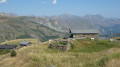
A beautiful and fairly short walk through the mountain pastures leading to the Grand Perron des Encombres, which dominates the area and offers a superb panoramic view of all the neighbouring mountain ranges: Écrins, Belledonne, Mont Blanc, etc.
Yellow markings and signposts.

Details

39684726
Creation:
Last update:
Last review:
  • Walking
    Activity: Walking
  • ↔
    Distance: 5.84 mi
  • ◔
    Average duration: 5h 10 
  • ▲
    Difficulty: Moderate

  • ⚐
    Back to start: Yes
  • ↗
    Ascent: + 2,838 ft
  • ↘
    Descent: - 2,831 ft

  • ▲
    Highest point: 9,262 ft
  • ▼
    Lowest point: 6,640 ft

Photos

Description of the walk

Park at the Saussaz car park.

(S/E) Turn right onto an old track and follow it to the first junction.

(1) Leave the old road and turn right towards the Col des Encombres.

(2) Turn left onto the ridge path to Perronnet.

(3) Carry on straight ahead to the Petit Col des Encombres.

(4) Carry on straight ahead to the next junction.

(5) Two options:
- You can turn right to climb steeper slopes.
- Turn left, heading south-west, to take a gentler, circular ascent. You’ll reach a junction at the Petit Perron.

(6) Turn left and begin the climb to the Grand Perron des Encombres.
Take care on the final climb, which is slippery and prone to slipping. Use the handrail for support.

(7) Turn round and head back to the Petit Col des Encombres.

(4) Turn right and head down, due south, through the mountain pastures to a junction.

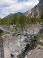
(8) Turn left, cross the Ruisseau de la Saussaz via small footbridges and continue to a junction.

(9) Turn left towards La Saussaz and head for the car park (S/E).

Waypoints

  1. S/E : mi 0 - alt. 6,841 ft - La Saussaz car park
  2. 1 : mi 0.2 - alt. 7,024 ft - La Combe
  3. 2 : mi 0.69 - alt. 7,635 ft - Col des Encombres (2336m)
  4. 3 : mi 1.26 - alt. 7,776 ft - Le Perronnet
  5. 4 : mi 1.72 - alt. 7,638 ft - Junction of the circular loop - Petit Col des Encombres
  6. 5 : mi 1.93 - alt. 7,844 ft - Crossroads
  7. 6 : mi 2.56 - alt. 8,448 ft - Le Petit Perron
  8. 7 : mi 3.11 - alt. 9,262 ft - Grand Perron des Encombres
  9. 8 : mi 5.38 - alt. 6,640 ft - Junction
  10. 9 : mi 5.63 - alt. 6,742 ft - Junction
  11. S/E : mi 5.84 - alt. 6,847 ft - La Saussaz car park

Notes

The path just below the Grand Perron is quite slippery (dust, loose stones). A handrail has been fitted to help you. Walking poles are also useful.
The access road between Charbutan and the car park is narrow; passing other cars can be difficult.
The summit can get very busy during the summer season.

Reviews and comments

5 / 5
Based on 2 reviews

Reliability of the description
5 / 5
Ease of following the route
5 / 5
Route interest
5 / 5
champet67
champet67

Overall rating : 5 / 5

Date of your route : Aug 11, 2025
Reliability of the description : ★★★★★ Very good
Ease of following the route : ★★★★★ Very good
Route interest : ★★★★★ Very good
Very busy route : Yes

A very beautiful hike with magnificent views of the surrounding peaks and, in the distance, Grande Casse, Barre des Ecrins, Glacier de l'Etendard, etc.
The last climb is quite steep, but the cable is a great help both on the way up and on the way down.
The orientation table is very good. There's a lovely picnic spot between the two Perrons.
It's a shame we didn't see any ibexes as there were too many people.
The first two times I climbed it about fifteen years ago, there were about thirty ibexes lying on the path!

Machine-translated

User 16595358

Overall rating : 5 / 5

Date of your route : Oct 16, 2023
Reliability of the description : ★★★★★ Very good
Ease of following the route : ★★★★★ Very good
Route interest : ★★★★★ Very good
Very busy route : Yes

Some really great information

Machine-translated

Other walks in the area

For more walks, use our search engine .

The GPS track and description are the property of this route's author. Please do not copy them without permission.