Lake Pramol, starting from Les Karellis

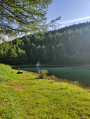
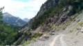
A fairly easy walk, despite a rather steep start. As the lake is accessible by car (via a good tarmac road), it can get quite busy, particularly with anglers.
You can return via the tarmac road; it’s not as scenic as going down through the forest, but it’s quicker and easier.

Details

n°2482185
Creation:
Last update:
Last review:
  • Walking
    Activity: Walking
  • ↔
    Distance: 2.58 mi
  • ◔
    Average duration: 1h 40 
  • ▲
    Difficulty: Easy

  • ⚐
    Back to start: Yes
  • ↗
    Ascent: + 577 ft
  • ↘
    Descent: - 564 ft

  • ▲
    Highest point: 5,761 ft
  • ▼
    Lowest point: 5,230 ft

Description of the walk

Park in the Vinouva chairlift car park.

(S/E) Take the road that leads to a path junction at the Ruisseau des Fontagnoux.

(1) Leave the road, cross the stream and head straight ahead onto the nature trail which zigzags beneath the chairlift. You’ll come to a series of spring water collection points. You’ll reach a place known as Le Plan du Truc.

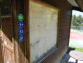
(2) Continue along the path marked with a Green Circle containing the number 5 and the words ‘Lac de Pramol’ underneath. You’ll reach Lac de Pramol almost on a level with the lake.

(3) Walk round the lake before setting off on the return journey:
- either head down via the road, as shown on the map,
- or take the same path as on the way there.
This will take you back to the car park at the Vinouva chairlift (S/E).

Waypoints

  1. S/E : mi 0 - alt. 5,230 ft - Car park next to the Vinouva chairlift
  2. 1 : mi 0.16 - alt. 5,312 ft - Junction of the circular loop
  3. 2 : mi 0.66 - alt. 5,663 ft - Crossroads after the springs
  4. 3 : mi 1.25 - alt. 5,722 ft - End of the nature trail
  5. S/E : mi 2.58 - alt. 5,230 ft - Car park next to the Vinouva chairlift

Notes

At the lake, there are plenty of places to picnic, and drinking water is available. You can also buy a ‘fishing permit’ there.
You are not allowed to swim in the lake

Worth a visit

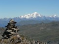
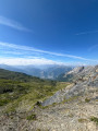
Enjoy the beautiful scenery around the lake.
Watch out for anglers.

Reviews and comments

4.3 / 5
Based on 2 reviews

Reliability of the description
4.5 / 5
Ease of following the route
4.5 / 5
Route interest
4 / 5
JPBOILLOT
JPBOILLOT

Overall rating : 4 / 5

Date of your route : Jul 29, 2025
Reliability of the description : ★★★★☆ Good
Ease of following the route : ★★★★☆ Good
Route interest : ★★★★☆ Good
Very busy route : Yes

The starting point of the trail could be marked more clearly.
It is a beautiful walk, accessible to all, although some sections in the forest are a little steep.
For the return to Les Karellis, a detour via the Col d'Albanne and the pony trail is quieter and more pleasant than the road, which is faster but also used by all kinds of vehicles travelling at high speed.

Machine-translated

Chupina
Chupina

Overall rating : 4.7 / 5

Date of your route : Aug 09, 2023
Reliability of the description : ★★★★★ Very good
Ease of following the route : ★★★★★ Very good
Route interest : ★★★★☆ Good
Very busy route : No

A very accessible walk with relaxation guaranteed around the lake.

Machine-translated

Other walks in the area

For more walks, use our search engine .

The GPS track and description are the property of this route's author. Please do not copy them without permission.