The ridges from Perron to Bréquin

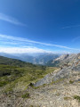
A ridge walk, partly off-trail, culminating at Mont Bréquin with a magnificent view over the Maurienne Valley and the surrounding Alps.

Details

8887
Creation:
Last update:
Last review:
  • Walking
    Activity: Walking
  • ↔
    Distance: 13.91 mi
  • ◔
    Duration according to the author: 7 hrs 
  • ▲
    Difficulty: Very difficult

  • ⚐
    Back to start: Yes
  • ↗
    Ascent: + 5,827 ft
  • ↘
    Descent: - 5,814 ft

  • ▲
    Highest point: 10,262 ft
  • ▼
    Lowest point: 5,810 ft

Photos

Description of the walk

Park your car near the cross in the hamlet known as ‘Les Râteaux’, situated above the village of Beaune.

(S/E) Take the path leading up towards the chalets visible above. Continue towards the Petit Col des Encombres and reach the chalets at La Léchère.

(1) Above the chalets, take the path (cattle track) climbing alongside the high-voltage power line. Pass the Saussaz chalets on your right and head left towards the high-voltage power line. Continue alongside this line until you reach the summit pylon.

(2) Take the path branching off to the right and running along the ridges (clearly visible). Pass over the Col des Encombres and continue to a path junction.

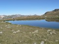
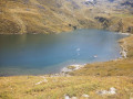
(3) Turn left to reach Lac de la Montagnette.

(4) Turn 90° to the right to reach the Collet Blanc. Follow the ridges due south towards Le Bréquin. They are fairly easy to traverse, with marked variations in terrain (scree, valleys, steep slopes).

(5) Reach the Col de Montfiot and continue to the left. Pass over the Col de Montfiot to go round the shoulder and reach the Col de la Grande Combe.

(6) Continue along the ridge to reach the Col de Pierre Blanche.

(7) Here, do not follow the signposted route, but continue along the ridges to climb Mont du Chat. Then descend to the Col de la Vallée Étroite.

(8) Begin the ascent of Mont Bréquin. The climb is made difficult by the choice of route. Cairns are supposed to mark a more frequently used route, but finding (very small) cairns amidst the vast scree field that is Mont Bréquin is by no means an easy task. You will therefore need to choose your own route for most of the way, whilst being wary of likely rockfalls.

(9) Descend via the same route to the Col de la Vallée Étroite.

(8) Turn left onto the track winding through the scree and, after a hairpin bend, reach a path junction.

(10) Head straight ahead to reach the Plateau de Bellecombe; cross the streams winding across the plateau to reach the junction at the Croix de Bellecombe.

(11) Ignore the paths to the right and left and head straight ahead across the mountain pasture to reach the Ruisseau de Champieu. Continue on to rejoin the path.

(12) Turn right onto the path to reach Les Râteaux and the car park (S/E).

Waypoints

  1. S/E : mi 0 - alt. 5,810 ft - Les Râteaux car park
  2. 1 : mi 0.52 - alt. 6,348 ft - La Léchère
  3. 2 : mi 1.59 - alt. 7,776 ft - Pylon on the ridge
  4. 3 : mi 2.95 - alt. 8,146 ft - Crossroads towards - Lac de la Montagnette (2500m)
  5. 4 : mi 3.39 - alt. 8,182 ft - Lake, source of the - Torrent des Encombres (rivière)
  6. 5 : mi 4.42 - alt. 8,707 ft - Col de Montfiot (2653m)
  7. 6 : mi 5.43 - alt. 8,724 ft - Col de la Grande Combe (2653m)
  8. 7 : mi 5.87 - alt. 8,701 ft - Col de Pierre Blanche (2636m)
  9. 8 : mi 6.92 - alt. 8,953 ft - Col de la Vallée Etroite (2730m - Maurienne)
  10. 9 : mi 7.74 - alt. 10,253 ft - Mont Bréquin
  11. 10 : mi 10.16 - alt. 7,677 ft - Hairpin junction
  12. 11 : mi 11.78 - alt. 7,119 ft - Croix de Bellecombe
  13. 12 : mi 12.93 - alt. 6,145 ft - Path junction
  14. S/E : mi 13.91 - alt. 5,810 ft - Les Râteaux car park

Notes

Drinking water source at the car park (between the car park and the track).

Reviews and comments

3.9 / 5
Based on 3 reviews

Reliability of the description
3.3 / 5
Ease of following the route
3.3 / 5
Route interest
5 / 5
User 30756392

Overall rating : 2.7 / 5

Date of your route : Aug 20, 2026
Reliability of the description : ★★☆☆☆ Disappointing
Ease of following the route : ★☆☆☆☆ Very disappointing
Route interest : ★★★★★ Very good
Very busy route : No

Hike completed on 20/08/26 in 10 hours 30 minutes, compared with the advertised 7 hours.
By way of comparison, I completed the Thabor hike – which was estimated to take 12 hours – in 7½ hours.
The first section of the ridge beneath the pylons is on private land; I’d recommend parking at the Saussaz car park to reach point no. 2 directly via the path.
The section between the Pointe du Collet Blanc and point 5 is great fun and very pleasant, with large boulders.
It is very difficult, if not dangerous, to try to follow the track on your phone at all costs between points 7 and 8, and also during the ascent of Mt Bréquin, as you risk ending up on very poor rock.
The ascent includes a short climbing section which is challenging but very impressive, and there’s no room for error as there’s a sheer drop below. Bear in mind that it’s even more daunting on the descent.

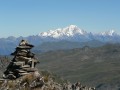
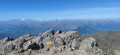
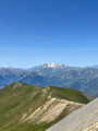
The view from the summit is magnificent; I could make out Mont Blanc, La Meije, Le Rateau and Le Thabor, which I’d climbed the day before.

On the way back, the section between points 11 and 12 is borderline madness – wide swerves across meadows with a 50° gradient. You need a lot of imagination to make out the path.
I climbed over I don’t know how many electric fences.

Machine-translated

Slonantes
Slonantes

Overall rating : 4.3 / 5

Date of your route : Oct 01, 2021
Reliability of the description : ★★★★☆ Good
Ease of following the route : ★★★★☆ Good
Route interest : ★★★★★ Very good
Very busy route : No

Undertaken in early autumn, it is a majestic place, but one with challenges that must be taken seriously after the final pass, right up to the ascent of Mont Bréquin. This final section is indeed tricky and demands time and energy that cannot be mustered in wet weather. The crossing through the scree slopes isn’t signposted, but small cairns have been erected – which I found easier to spot on the descent than on the ascent… You need to be wary of the terrain during the ascent; the rocks are very crumbly and unstable, and can come loose under your feet or when you try to grip them. I got a bit lost on the descent back into the valley as dusk was falling…In summary, this is best done early in the summer, in dry weather and preferably with a companion if you’re not particularly confident with navigation from the final pass.

Machine-translated

Other walks in the area

For more walks, use our search engine .

The GPS track and description are the property of this route's author. Please do not copy them without permission.