


Refine your search for walks in Méral
Méral walks


 Méral Route
 Tourist office
 6.80 mi
 +108 ft
 -115 ft
 3h 15
3h 15
 Easy
Easy
 Departure from Méral (Mayenne)
This family-friendly walk, lasting just over 3 hours, will take you on a tour of the village of Méral and its surroundings.
Route in Cossé-le-Vivien
9.62 mi
+233 ft
-256 ft
4h 40
 Moderate
Departure from Cossé-le-Vivien (Mayenne)
Moderate
Departure from Cossé-le-Vivien (Mayenne)
This lovely walk in Cossé-le-Vivien is all about water: you’ll discover the Cossé wetland as well as a small pond where you can stop for a pleasant break.
Courbeveille route
5.14 mi
+26 ft
-26 ft
2h 25
Easy
Departure from Courbeveille (Mayenne)
Discover the countryside of southern Mayenne and the area around the village of Courbeveille on this short walk lasting around 2½ hours.
Cosmes Route
4.89 mi
+174 ft
-144 ft
2h 25
Easy
Departure from Cosmes (Mayenne)
This short walk will introduce you to the Cosmes countryside. You’ll follow the old railway line and pass close to the Robert Tatin Museum – the perfect opportunity to discover this artist and his monumental work.
The Vau Follet to Le Pertre route
 Local authority
 5.40 mi
+217 ft
-217 ft
2h 40
Easy
Departure from Le Pertre (Ille-et-Vilaine)
5.40 mi
+217 ft
-217 ft
2h 40
Easy
Departure from Le Pertre (Ille-et-Vilaine)
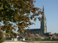
A welcoming destination on the edge of the Mayenne region and a true paradise for walkers, the village and countryside of Le Pertre offer stunning panoramic views: from the viewing platform behind the church, you can see 39 church spires.
Route du Bois de Clermont, Le Pertre
 7.66 mi
+390 ft
-374 ft
3h 50
Moderate
Departure from Le Pertre (Ille-et-Vilaine)
7.66 mi
+390 ft
-374 ft
3h 50
Moderate
Departure from Le Pertre (Ille-et-Vilaine)
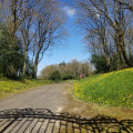
Horses reign supreme in Le Pertre: there are numerous stud farms specialising in draught, riding and racehorses, and the racecourse, situated at the foot of the village which has been perched on the hill since the 11th century, is emblematic of the area.
Le Pertre lies on the border between Maine and Brittany, so much so that the young children from Saint-Cyr-le-Gravelais in Maine walk along a pleasant path to get to the school in Le Pertre.
FFRP-certified.
Suitable for both walking and mountain biking.
La route de la Crossonière in Brielles
 10.18 mi
+331 ft
-308 ft
5h 00
Moderate
Departure from Brielles (Ille-et-Vilaine)
10.18 mi
+331 ft
-308 ft
5h 00
Moderate
Departure from Brielles (Ille-et-Vilaine)
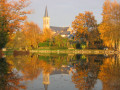
Although the high-speed rail line (LGV) runs through Brielles from east to west, the town, together with the neighbouring commune of Le Pertre, offers a network of beautiful trails.Suitable for both walking and mountain biking.
The Salé to Brielles route
7.11 mi
+131 ft
-105 ft
3h 25
Moderate
Departure from Brielles (Ille-et-Vilaine)
Centred around its church and the square surrounding it, the village of Brielles has largely retained the layout it had in 1810, the year the so-called ‘Napoleonic’ land register was drawn up.
Also worth mentioning in the commune is the breeding of Kobe cattle (a Japanese breed), whose meat is highly prized by gourmets.
This route can be tackled on foot or by mountain bike.
The Cinq Chemins route in Argentré-du-Plessis
3.57 mi
+164 ft
-164 ft
1h 45
Easy
Departure from Argentré-du-Plessis (Ille-et-Vilaine)
A short circular route through the countryside between Argentré-du-Plessis and Le Pertre.
The La Rincerie route
3.26 mi
+20 ft
-20 ft
1h 30
Easy
Departure from La Selle-Craonnaise (Mayenne)
A short, easy walk suitable for families around the La Rincerie lake. A pair of binoculars might be useful for exploring the birdwatching area (western part of the lake).
Eastern Craon Route
 4.88 mi
+128 ft
-125 ft
2h 20
Easy
Departure from Craon (Mayenne)
4.88 mi
+128 ft
-125 ft
2h 20
Easy
Departure from Craon (Mayenne)
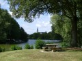
A short circular route that takes you along the paths through the Craon countryside. You’ll also follow the old railway line, now the Laval–Renazé Greenway.
At the Mûrier lake (the start and finish of the route), there are a few benches and picnic tables. There are also plenty of children’s play equipment and water play facilities (in July and August).
Around Montigné-le-Brillant
 Visorando Member4.30 mi
+203 ft
-233 ft
2h 10
Easy
Departure from Montigné-le-Brillant (Mayenne)
Visorando Member4.30 mi
+203 ft
-233 ft
2h 10
Easy
Departure from Montigné-le-Brillant (Mayenne)
A lovely walk through the countryside near Montigné. Beautiful, unobstructed scenery. Mainly small tarmac country roads and 1.5 km on a dirt track. The final section follows the D283 for 400 m. A shortcut is possible by returning via the Voie Verte, which is shaded and has a dirt and gravel surface: less tiring and, above all, no cars, though cyclists do pass through.
Route covering both villages, starting from Peuton
4.88 mi
+174 ft
-174 ft
2h 25
Easy
Departure from Peuton (Mayenne)
Pleasant circular route between the villages of Peuton and Marigné-Peuton in southern Mayenne. At the end of the route, on your return to Peuton, you’ll take the brand-new Sentier de la Carrière.
The Green World circular in Mondevert
 6.32 mi
+102 ft
-102 ft
3h 00
Moderate
Departure from Mondevert (Ille-et-Vilaine)
6.32 mi
+102 ft
-102 ft
3h 00
Moderate
Departure from Mondevert (Ille-et-Vilaine)
A circular route through the Mondevert countryside which also passes close to the Pertre Forest.
Moulin Neuf, Grotte de la Vierge and Jardin du Hill in Argentré-du-Plessis
4.30 mi
+171 ft
-177 ft
2h 10
Easy
Departure from Argentré-du-Plessis (Ille-et-Vilaine)
A short, refreshing walk in lush green surroundings – a little time for yourself or with the family, combining nature with a touch of history. Whatever the season, you’ll be treated to magnificent colours.
Circular Coupeau around the Vicoin
 5.30 mi
+184 ft
-167 ft
2h 35
Easy
Departure from Saint-Berthevin (Mayenne)
5.30 mi
+184 ft
-167 ft
2h 35
Easy
Departure from Saint-Berthevin (Mayenne)
A lovely, easy and picturesque walk around the Vicoin: marked route no. 3. There are many points of interest along the route, including a playground and a leisure centre. There is a dangerous section 500 m along the D500 between the marker (4) and the marker (5). The road can be busy at weekends. Avoid with children.
The Chemin des Loups in Argentré-du-Plessis
 8.93 mi
+282 ft
-279 ft
4h 20
Moderate
Departure from Argentré-du-Plessis (Ille-et-Vilaine)
8.93 mi
+282 ft
-279 ft
4h 20
Moderate
Departure from Argentré-du-Plessis (Ille-et-Vilaine)
Wolves were very common in Brittany until the 19th century. The Argentré-du-Plessis region was no exception. Although its refuge was the Pertre forest, which we will cross in its western part, its hunting ground extended over the entire municipality, as evidenced by the names of certain localities such as Louveaudière, Cul de Loup and even the Bois de Noirloup, which we will pass by. But you can hike in complete safety, as the wolf has been extinct in the region for over a century.
The Heron Trail in Argentré-du-Plessis
3.84 mi
+102 ft
-102 ft
1h 50
Easy
Departure from Argentré-du-Plessis (Ille-et-Vilaine)
This idyllic route (No. 79 in the Vitré Communauté walking guide), set in the heart of the Argentré-du-Plessis bocage, south of Vitré, connects the town’s two old mills (Neuf aux Moines) and their ponds over a distance of just over six kilometres.
Route de Plessis-Sévigné, Argentré-du-Plessis
 9.92 mi
+292 ft
-269 ft
4h 50
Moderate
Departure from Argentré-du-Plessis (Ille-et-Vilaine)
9.92 mi
+292 ft
-269 ft
4h 50
Moderate
Departure from Argentré-du-Plessis (Ille-et-Vilaine)
The village of Argentré-du-Plessis lived for five centuries in the shadow of the Château du Plessis. This family remained the owners of almost the entire village until the early 20th century, and Alain d’Argentré was mayor until 1983. You will pass close to the Château du Plessis during this walk.
Route certified by FFRandonnée.
Suitable for both walking and cycling.
Fouteau Mabon via the ridge
 3.41 mi
+210 ft
-282 ft
1h 45
Easy
Departure from Saint-Berthevin (Mayenne)
3.41 mi
+210 ft
-282 ft
1h 45
Easy
Departure from Saint-Berthevin (Mayenne)
A lovely walk through countryside and woodland in the immediate vicinity of Saint-Berthevin, with a slight climb, and not very busy. There are some rather picturesque stretches with beautiful flower-lined paths along the Vicoin. With a bit of luck, you might see the sulkies being trained at Fouteau Mabon.
(!) Take care when crossing the main road (7), as it can be very busy at weekends. Best avoided with children.
Around Genest-Saint-Isle
3.70 mi
+171 ft
-187 ft
1h 50
Easy
Departure from Le Genest-Saint-Isle (Mayenne)
An easy walk starting from Genest-Saint-Isle, with very little elevation gain. The paths are beautiful, and you may see deer. In rainy weather, two or three sections are flooded for a few metres, but you can get around this by walking along the edge of the adjacent field. A beautiful finish along a pretty little stream.
 Difficult