Country:
 City:
City:


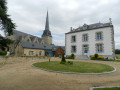
(S/E) Start from the church in Saint-Aignan-sur-Roë. With the church behind you, turn right onto Rue des Lavandières and follow it to the junction with the D110. Turn right onto the D110 and carry on straight ahead. The road curves sharply to the right and a track branches off to the left. Take this track and continue along it for a good 2 kilometres, ignoring any turn-offs to the right or left, until you reach the hamlet known as La Vigne. About 100 metres past the buildings, a stony track (Chemin de Rouillon) branches off to the right.
(1) Turn right onto this track and follow it for 1.5 km until you come out onto a small road, the D111. Cross the road (with care) and take the small road opposite, which veers slightly to the right. Follow this road, pass the hamlet of Les Avenries and you’ll come to a junction.
(2) Here, turn right onto the D230. Continue for just over 1 km, then turn left at the first junction after the hamlets of La Claie and La Basse Claie. Carry on straight ahead along this small road until you reach a junction at the hamlet of Les Barres. Turn right, then carry on straight ahead to reach a junction with the D110.
(3) Turn left onto the D110 (caution: this is a fairly busy road; vehicles travel at high speed). Follow the D110 for about 1 km, then, at the first junction, turn right (dead-end sign). Turn onto this small road, pass the hamlets known as La Tinallière and La Guilletière (on the right), then cross the small stream known as Le Chéran. Continue straight ahead and take a right-hand bend to reach the hamlet known as La Foultière. There, take the left-hand bend and continue straight ahead until you reach the junction with a larger road, the D11.
(4) Turn left onto the D11 (be careful, as vehicles travel at high speed), follow it for about 500 metres, then turn right onto the D598 towards La Rouaudière (signposted). You will then reach a crossroads at the hamlet of La Sevrie (on the left).
(5) Turn left towards La Sevrie and carry on straight ahead. You will then reach a T-junction. Turn left, continue for 150 metres until you reach another T-junction. There, turn right, then right again at the next junction to join a small tarmac road. Follow this road, which, after about 500 metres, takes a 90° bend to the left. At this bend, a country lane branches off straight ahead.
(6) Take the country lane and head towards the two small ponds 800 metres away. There, turn right between the two ponds, then continue straight on for 500 metres to reach a T-junction with the D598. Turn right and continue straight on to return to the crossroads at the hamlet of La Sevrie.
(5) This time, turn left and head towards the hamlet of Le Meslier. The small road continues as a track. Take this track (please note that part of the track is not shown on the map) and carry on straight ahead until you come out onto a tarmac road (D139).
(7) Turn right and follow the D139 for 600 metres to reach the village of Saint-Aignan-sur-Roë. Turn left just before the sign marking the entrance to the built-up area. Take this road, pass through the hamlet of La Touche, then 300 metres further on, at the left-hand bend, a track branches off to the right.
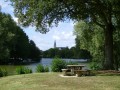
(8) Take this small track to reach the lake. Turn right, then follow the lake for 80 metres. There, a track branches off to the right; take this and continue straight on for just over 400 metres (please note: this track is not shown on the map). You will then come out onto another track. Turn left and head towards the ‘Stop’ sign.
(9) At the sign, turn right, then immediately left onto Rue Louis Letort; follow this road all the way to a ‘Stop’ sign at a junction. Cross the road (with care) then turn right. Head left and go round the football pitch to reach the small road leading to the Brunetière housing estate. There, turn right and continue for about 250 metres until you reach a junction with the D110. Cross the D110 (with care) and carry on straight ahead.
(10) At the next junction, turn right. After 50m, veer slightly to the left, then at the far end of the housing estate, turn left and take the small path leading to Rue des Vignobles (almost opposite the cemetery). Turn left and continue straight on to reach the church of Saint-Aignan-sur-Roë (S/E).


 Tourist office
 Easy
Easy 
 Visorando Member
 Local authority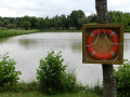
 Average