Eastern Craon Route

A short circular route that takes you along the paths through the Craon countryside. You’ll also follow the old railway line, now the Laval–Renazé Greenway.
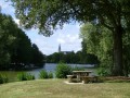
At the Mûrier lake (the start and finish of the route), there are a few benches and picnic tables. There are also plenty of children’s play equipment and water play facilities (in July and August).

Details

n°271532
Creation:
Last update:
Last review:
  • Walking
    Activity: Walking
  • ↔
    Distance: 4.88 mi
  • ◔
    Average duration: 2h 20 
  • ▲
    Difficulty: Easy

  • ⚐
    Back to start: Yes
  • ↗
    Ascent: + 128 ft
  • ↘
    Descent: - 125 ft

  • ▲
    Highest point: 259 ft
  • ▼
    Lowest point: 164 ft
  • ⚐ Country: France
  • ⚐ City: Craon (53400)
  • ⚑
    Start/End: N 47.84866° / W 0.943831°
  • ❏
    IGN map(s): Ref. 1420SB
  • Hour-by-hour weather

Photos

Description of the walk

Start from the car park at the Mûrier lake, on Rue Alain Gerbault.

(S) From the car park, head towards the lake and go round it by turning right. After passing the small copse, turn right at the children’s play area. Continue straight on along this path until you reach a roundabout on the D22.

(1) Cross the D22 and turn left. Carry on straight ahead along this road for about 650 metres.

(2) Turn right onto Avenue de l’Hippodrome (signposted ‘Hippodrome’). Continue for about 100 metres, then turn left at the first junction. Carry on straight ahead along this tarmac road for 800 metres until you reach the hamlet of Les Landes.

(3) When you reach the hamlet of Les Landes, a grassy path lined with trees leads straight ahead; take this path. After about 550 metres, this grassy path leads to a junction with the Voie Verte (a former railway line that has been converted into a cycle path).

(4) Turn left onto the Voie Verte and continue straight on until you reach the junction with the D22. Cross it (caution: very busy road; vehicles travel at high speed) and continue along the Voie Verte for 140 metres. After the large shed, a tree-lined path branches off to the left.

(5) Turn left onto this path, which joins a small tarmac road after about 300m. There, turn right again, continue for 150m and turn left onto the first tree-lined path. Follow this path for about 100m until you reach a T-junction with another path. Turn left and carry on straight ahead to join a small tarmac road leading to the junction with the D22.

(6) Turn right (Caution: very busy road; vehicles travel at high speed). Follow the D22 for 300 metres and turn right onto a small tarmac road. This road curves first to the left and then to the right. In this bend, a tree-lined path leads straight ahead; take this path. Continue along this tree-lined green path. After about 450m, you’ll come to a junction with a small tarmac road.

(7) Cross the small road and continue along the path opposite. Follow it for 1 km until you reach a small tarmac road at a place called Bouilli. Turn right, go for about 100 metres, then turn left onto a grassy path (not shown on the map). Follow it for about 300 metres until you reach the Mûrier lake. Make your way to the lakeside.

(8) Turn right to walk round the lake and return to the car park on Rue Alain Gerbault (E).

Waypoints

  1. S/E : mi 0 - alt. 164 ft - Car park on Rue Alain Gerbault
  2. 1 : mi 0.31 - alt. 174 ft - At the roundabout on the D22, cross over and then turn left
  3. 2 : mi 0.73 - alt. 259 ft - Avenue de l’Hippodrome, sign for ‘Hippodrome’
  4. 3 : mi 1.28 - alt. 223 ft - The hamlet of Les Landes – go straight on towards the path
  5. 4 : mi 1.63 - alt. 210 ft - Junction with the greenway, on the left.
  6. 5 : mi 2.28 - alt. 220 ft - Turn left after the hangar.
  7. 6 : mi 2.88 - alt. 243 ft - Turn right onto the D 22
  8. 7 : mi 3.54 - alt. 243 ft - Cross the small tarmac road.
  9. 8 : mi 4.5 - alt. 164 ft - Go round the lake to the right
  10. S/E : mi 4.88 - alt. 164 ft - Car park on Rue Alain Gerbault

Notes

Car parks on Rue Alain Gerbault and Rue Flandres, Dunkerque. Toilets near the car park on Rue Alain Gerbault.
Picnic tables and children’s play equipment at the Mûrier lake. In summer (July and August), there are water games and pedalos. The Mûrier campsite, also located on Rue Alain Gerbault, offers pitches and chalets. Ice cream is also available.

Worth a visit

You can stop off at a place called Le Pressoir: apples, apple juice, cider products and brandies are on sale. Cellar tours are available.
In the centre of Craon, you can also visit the château.

Reviews and comments

4.3 / 5
Based on 2 reviews

Reliability of the description
4.5 / 5
Ease of following the route
4 / 5
Route interest
4.5 / 5
User 20358345

Overall rating : 4 / 5

Date of your route : Sep 01, 2025
Reliability of the description : ★★★★☆ Good
Ease of following the route : ★★★★☆ Good
Route interest : ★★★★☆ Good
Very busy route : No

Pleasant circuit

Machine-translated

0678617387
0678617387

Overall rating : 5 / 5

Date of your route : Mar 30, 2021
Reliability of the description : ★★★★★ Very good
Ease of following the route : Not used / Not applicable
Route interest : ★★★★★ Very good
Very busy route : No

Please note that in wet weather, the final dirt track leading to the pond is impassable. You’ll need to head into the field on your right as soon as you set off along this track.

Machine-translated

Other walks in the area

For more walks, use our search engine .

The GPS track and description are the property of this route's author. Please do not copy them without permission.