Country:
 City:
City:


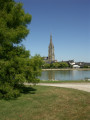
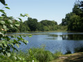
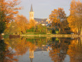
Start from the car park by the lake, Rue du Calvaire.
YellowPR® signposting supplemented by green arrows marked with the number 32. Signposted in an anti-clockwise direction.
(S/E) From the car park, head towards the football pitch and follow the road until you reach the departmental road. Cross it and continue straight on.
(1) At the end of the track, turn right, then immediately left, and follow the road to the hamlet of La Haye.
(2) As you leave the hamlet, take the path on the right, then turn left and carry on to L’Épine des Landes. First turn left then right to pass between the houses and continue along the small road.
(3) Cross the departmental road and carry on for 50 metres, then take the path on the right. Carry on until you reach the road, turn left towards the Fork in the road and take the road on the right; from the houses at Les Dodinières, the road turns into a track; rejoin the road by turning left.
(4) At the end of the track, cross over and carry on straight ahead. At the junction, turn right, carry on for 700 metres and turn left. After about 600 metres, turn right and carry on until you reach the road. Cross the road, carry on for 500 metres and turn towards the hamlet of La Saulnerie. Pass through it and take the track on the left.
(5) Turn right and carry on until you reach the road. Turn left, then right, and take the path leading off to the left.
(6) At La Basse Mellerais, turn right, then take the first left and carry on straight on until you reach Les Lardries.
(7) Pass through the hamlet and turn left. Carry on to the road and cross it to reach the opposite side. Follow the path straight on until you reach a pond on the left, then turn right.
(8) Cross the road to the opposite side and follow the path which runs behind a housing estate after 250 metres. Once you’ve passed the last house, rejoin the housing estate via a small path on the right.
(9) At the end of the path, turn left then right to return to the car park where you started. (S/E)



 Local authority
 Easy
Easy 
 Visorando Member