The Vau Follet to Le Pertre route

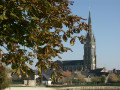
A welcoming destination on the edge of the Mayenne region and a true paradise for walkers, the village and countryside of Le Pertre offer stunning panoramic views: from the viewing platform behind the church, you can see 39 church spires.

Details

30322697
Creation:
Last update:
Last review:
  • Walking
    Activity: Walking
  • ↔
    Distance: 5.40 mi
  • ◔
    Average duration: 2h 40 
  • ▲
    Difficulty: Easy

  • ⚐
    Back to start: Yes
  • ↗
    Ascent: + 217 ft
  • ↘
    Descent: - 217 ft

  • ▲
    Highest point: 607 ft
  • ▼
    Lowest point: 459 ft
  • ⚐ Country: France
  • ⚐ City: Le Pertre (35370)
  • ⚑
    Start/End: N 48.034665° / W 1.039966°
  • ❏
    IGN map(s): Ref. 1418SB, 1419SB
  • Hour-by-hour weather

Photos

Description of the walk

Park in the car park by the lake, on Rue du Calvaire.

YellowPR® markings supplemented by green arrows bearing the number 33.

(S/E) From the car park, head towards the football pitch and follow the road (Rue de la Reinerie).

(1) Pass Rue des Châtaigners on your left – you’ll take this on the way back – and carry on straight ahead to join the departmental road. Cross it carefully and continue straight on until you reach the D29.

(2) Turn right, then take the first path on the left about a hundred metres further on. Follow it to the hamlet of La Haye. Go past this hamlet and take the path branching off to the right. You’ll come to a fork in the road.

(3) Head to the right and carry on until you reach the road, which you’ll need to cross to take the track opposite until the next fork.

(4) Turn left at the edge of the forest, then, at the end of the track, turn left again and rejoin the road.

(5) Head to the right, then, after about 400 m, turn left onto a dirt track. Continue to a junction at a place called l’Épine des Landes.

(6) Turn right and carry on straight ahead to reach Vau Follet and the D29.

(7) Cross the road with care, carry on straight ahead, then turn left at the hamlet known as l’Être Croix. Follow the track until you come out onto the D33, cross it and turn left for a few dozen metres.

(8) Turn right. Continue along the road, then take the first dirt track on the left and follow it until you reach a housing estate.

(9) Turn left.

(1) Turn right to return to the starting car park (S/E).

Waypoints

  1. S/E : mi 0 - alt. 568 ft - Car park at the lake
  2. 1 : mi 0.26 - alt. 594 ft - Junction of the circular loop
  3. 2 : mi 0.69 - alt. 558 ft - D29
  4. 3 : mi 1.24 - alt. 476 ft - Junction; turn right
  5. 4 : mi 2.09 - alt. 571 ft - Turn left at the fork
  6. 5 : mi 2.71 - alt. 571 ft - Road junction, on the right
  7. 6 : mi 3.21 - alt. 518 ft - L'Épine des Landes
  8. 7 : mi 3.59 - alt. 531 ft - Crossing the D29
  9. 8 : mi 4.15 - alt. 600 ft - Crossing the D33
  10. 9 : mi 4.94 - alt. 571 ft - Housing estate, on the left
  11. S/E : mi 5.4 - alt. 568 ft - Car park at the lake

Notes

Trail certified by FFRandonnée.
Marked in an anti-clockwise direction.
Suitable for both walking and cycling.

Car park, picnic table, drinking water point, toilets and swimming area near the starting point.

Worth a visit

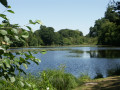
(S/E) The village lake.

Always be cautious and plan ahead when you're outdoors. Visorando and the author of this route cannot be held responsible for any accidents occurring on this route.

The GR® and PR® markings are the intellectual property of the Fédération Française de Randonnée Pédestre.

Reviews and comments

5 / 5
Based on 2 reviews

Reliability of the description
5 / 5
Ease of following the route
5 / 5
Route interest
5 / 5
Chantal bardoux
Chantal bardoux

A really lovely, easy route with some lovely sights to discover and, above all, very well signposted. That makes the route much easier. Well done!

Machine-translated

jl53
jl53

Overall rating : 5 / 5

Date of your route : Nov 13, 2023
Reliability of the description : ★★★★★ Very good
Ease of following the route : ★★★★★ Very good
Route interest : ★★★★★ Very good
Very busy route : No

Lots of medlar trees!

Machine-translated

HIRONDELLE72
HIRONDELLE72

Overall rating : 5 / 5

Date of your route : Aug 20, 2023
Reliability of the description : ★★★★★ Very good
Ease of following the route : ★★★★★ Very good
Route interest : ★★★★★ Very good
Very busy route : Yes

Done in the morning before it gets too hot –
Some lovely, well-shaded paths and stunning views –
An easy route to follow, whether using the app or the signposts...

Machine-translated

Other walks in the area

For more walks, use our search engine .

The GPS track and description are the property of this route's author. Please do not copy them without permission.