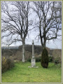
Fouteau Mabon via the ridge

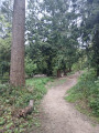
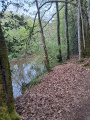
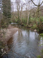
A lovely walk through countryside and woodland in the immediate vicinity of Saint-Berthevin, with a slight climb, and not very busy. There are some rather picturesque stretches with beautiful flower-lined paths along the Vicoin. With a bit of luck, you might see the sulkies being trained at Fouteau Mabon.

(!) Take care when crossing the main road (7), as it can be very busy at weekends. Best avoided with children.

Details

72927614
Creation:
Last update:
Last review:
  • Walking
    Activity: Walking
  • ↔
    Distance: 3.41 mi
  • ◔
    Average duration: 1h 45 
  • ▲
    Difficulty: Easy

  • ⚐
    Back to start: Yes
  • ↗
    Ascent: + 210 ft
  • ↘
    Descent: - 282 ft

  • ▲
    Highest point: 551 ft
  • ▼
    Lowest point: 377 ft

Photos

Description of the walk

Park in the car park on Rue du Haut Gouet at the eastern entrance to Saint-Berthevin, just after the small bridge over the Voie Verte when coming from Laval.

(S/E) Cross the Voie Verte at the Stop sign and immediately turn right onto the small path alongside the stream.

(1) At the fork in the road at the start of the descent, turn left and follow the path which climbs slightly. At the top of a fairly steep little hill, turn right and follow the path which runs along the ridge, ignoring the paths branching off to the right.

(2) At the junction (with a wayside cross on the right), head left, skirting the field and then the pond. At the T-junction after the pond, take the path on the right and then head straight down.

(3) Look out for the return path on your right and continue straight ahead.

(4) At the bottom of the slope, take the forest track on the left and continue for about 300 metres.

(5) Ignore the track on the right and carry on straight ahead along the track, which climbs gently.

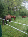
(6) At the bottom of the valley, head up to the right (a rather muddy stretch for 100 m). At the junction with Allée du Rocher, leave the paddocks on your right and follow the road to the left leading to Fouteau Mabon.

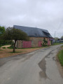
(7) Turn right to follow the D500 for 400 m; this road is fairly quiet outside rush-hour times, butdo take care on this stretch. Take thefirst right onto the Clos l’Œil forest track, marked by a red and white signpost.

(8) At the junction, keep to the right and rejoin the outbound route. 

(5) Take the forest track on the left, heading in the opposite direction to the outward journey. At the Fork in the road (blue caravan), ignore the path on the left and continue straight up the hill. 

(3) Halfway up the slope, turn left onto the small path that crosses the verge and descends towards the Vicoin. Follow it until it joins a track, which you’ll take to the left as far as the old mill.

(9) Cross the three small bridges and immediately take the bridge on the right. Then follow the path on the left which climbs back up and leads back to the original junction.

(1) Continue straight ahead to the car park (S/E).

Waypoints

  1. S/E : mi 0 - alt. 505 ft - Haut Gouet car park
  2. 1 : mi 0.14 - alt. 469 ft - Fork
  3. 2 : mi 0.38 - alt. 492 ft - Calvary
  4. 3 : mi 0.67 - alt. 420 ft - Common junction for outbound and return routes
  5. 4 : mi 0.75 - alt. 404 ft - Forest track
  6. 5 : mi 0.96 - alt. 436 ft - Junction of the circular loop
  7. 6 : mi 1.3 - alt. 531 ft - Valley floor
  8. 7 : mi 1.61 - alt. 541 ft - Fouteau Mabon
  9. 8 : mi 2.24 - alt. 413 ft - Three-way junction, on the right
  10. 9 : mi 3.01 - alt. 407 ft - Small bridges
  11. S/E : mi 3.41 - alt. 459 ft - Haut Gouet car park

Reviews and comments

4.4 / 5
Based on 3 reviews

Reliability of the description
4.7 / 5
Ease of following the route
4.7 / 5
Route interest
4 / 5
josephdel
josephdel

Thanks for letting me know
I did it again myself on Saturday. There weren't many cars (four), but you have to be careful. It's best to stop when a car approaches. It seems that drivers (who generally give you plenty of space) appreciate it.
Best regards

Machine-translated

DenisGJ
DenisGJ

Overall rating : 4.7 / 5

Date of your route : Aug 03, 2025
Reliability of the description : ★★★★★ Very good
Ease of following the route : ★★★★★ Very good
Route interest : ★★★★☆ Good
Very busy route : Yes

Lots of people at the start (close to the greenway and Coupeau site + Sunday morning with joggers and mountain bikers) but then very quiet and pleasant. Same comment as the other people about the section on the departmental road.

Machine-translated

josephdel
josephdel

Hello
I completely agree with you, particularly when it comes to children: whilst this local road is fairly quiet during the week, it gets very busy at the weekend. I had an unpleasant experience there myself one Saturday. I now avoid going on Saturdays.
Thank you for your feedback

Machine-translated

Moilouipaul49
Moilouipaul49

Overall rating : 4 / 5

Date of your route : May 10, 2025
Reliability of the description : ★★★★☆ Good
Ease of following the route : ★★★★☆ Good
Route interest : ★★★★☆ Good
Very busy route : No

A very enjoyable and varied walk.
One major downside is the section along the county road, which is extremely dangerous. The road was quite busy for a Saturday afternoon. Vehicles were travelling at high speed. The verges were very narrow.
With children, this section is impossible to navigate.
Safety risks downplayed by Visorando in the route description.

Machine-translated

MID53
MID53

Overall rating : 4.7 / 5

Date of your route : Apr 28, 2025
Reliability of the description : ★★★★★ Very good
Ease of following the route : ★★★★★ Very good
Route interest : ★★★★☆ Good
Very busy route : Yes

A nice route, but I had to change it and head back via the cycle path because it was still too muddy for my Loulou

Machine-translated

Other walks in the area

For more walks, use our search engine .

The GPS track and description are the property of this route's author. Please do not copy them without permission.