Around Montigné-le-Brillant

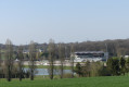
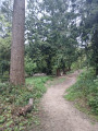
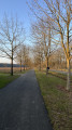
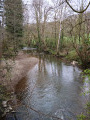
A lovely walk through the countryside near Montigné. Beautiful, unobstructed scenery. Mainly small tarmac country roads and 1.5 km on a dirt track. The final section follows the D283 for 400 m. A shortcut is possible by returning via the Voie Verte, which is shaded and has a dirt and gravel surface: less tiring and, above all, no cars, though cyclists do pass through.

Details

106367579
Creation:
Last update:
Last review:
  • Walking
    Activity: Walking
  • ↔
    Distance: 4.30 mi
  • ◔
    Average duration: 2h 10 
  • ▲
    Difficulty: Easy

  • ⚐
    Back to start: Yes
  • ↗
    Ascent: + 203 ft
  • ↘
    Descent: - 233 ft

  • ▲
    Highest point: 331 ft
  • ▼
    Lowest point: 180 ft

Description of the walk

Park in the spacious car park at the junction with the Voie Verte. Take care not to obstruct the bus stop.

(S/E) Opposite the old station, turn right onto the road. Keep right at the bend to follow the D283.

(1) Turn right and pass under the Voie Verte. Leave the Fellerie buildings on your right and continue straight on to reach the junction by the chapel.

(2) Turn right to go round the chapel and follow the road uphill.

(3) Leave the road by taking the path on the left: signposted towards PN13. Join the Voie Verte again.

(4) Cross the Greenway and carry on straight through the countryside until you reach a four-way junction.

(5) Turn left. Ignore the first road on the right, then a second on the left, and continue to a third junction.

(6) Head right, leaving La Goupillère on your right. Cross the bridge over the Galoi and carry on straight ahead until you reach the junction with the D283: the wayside cross.

(7) Turn left and return to the junction you passed on the way out.

(1) Carry on straight ahead to return to the car park (S/E).

Waypoints

  1. S/E : mi 0 - alt. 210 ft - Voie Verte junction.
  2. 1 : mi 0.15 - alt. 194 ft - Junction on the circular loop
  3. 2 : mi 1.09 - alt. 269 ft - Chapel
  4. 3 : mi 1.42 - alt. 289 ft - Path on the left
  5. 4 : mi 1.84 - alt. 230 ft - PN13 – Greenway
  6. 5 : mi 2.61 - alt. 331 ft - Crossroads
  7. 6 : mi 3.09 - alt. 292 ft - Crossroads
  8. 7 : mi 3.9 - alt. 223 ft - Calvaire - D283
  9. S/E : mi 4.3 - alt. 210 ft - Voie Verte junction

Notes

There is a bakery and a grocery shop as you head back up towards the village from the start.

D283: not very busy but watch out for cars. Take great care with children; keep dogs on a lead.

(4) A shortcut is possible, returning directly to the start by taking the Voie Verte to the left.

Other walks in the area

For more walks, use our search engine .

The GPS track and description are the property of this route's author. Please do not copy them without permission.