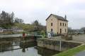
Route covering both villages, starting from Peuton

Pleasant circular route between the villages of Peuton and Marigné-Peuton in southern Mayenne. At the end of the route, on your return to Peuton, you’ll take the brand-new Sentier de la Carrière.

Details

n°19018143
Creation:
Last update:
Last review:
  • Walking
    Activity: Walking
  • ↔
    Distance: 4.88 mi
  • ◔
    Average duration: 2h 25 
  • ▲
    Difficulty: Easy

  • ⚐
    Back to start: Yes
  • ↗
    Ascent: + 174 ft
  • ↘
    Descent: - 174 ft

  • ▲
    Highest point: 295 ft
  • ▼
    Lowest point: 200 ft
  • ⚐ Country: France
  • ⚐ City: Peuton (53360)
  • ⚑
    Start/End: N 47.885737° / W 0.815715°
  • ❏
    IGN map(s): Ref. 1419SB, 1420SB
  • Hour-by-hour weather

Description of the walk

Start from the car park at the Peuton communal lake.

(S/E) Head towards the covered hall, then turn slightly to the right to go round the western lake on the left-hand side. Walk along the lake’s edge, then turn left onto the path that runs under the trees. Follow this path all the way to the end, ignoring a new path on the right-hand side which you will take on the way back. When you reach the road, turn left onto it. Walk a little over 200 m, passing the hamlet of La Pommeraie on your right. Shortly afterwards, a path branches off to the right.

(1) Turn right onto this tree-lined path, then continue straight on until you come out onto a small road. There, turn left, walk 150 m and, at the next junction, turn right at La Petite Tramière.

(2) Carry on straight ahead along this road until you reach the village of Marigné-Peuton.

(3) After passing the village entrance sign, turn left onto the first street (Chemin du Pré Hardouin), then after 100 metres turn right onto Allée des Chênes and continue for about 75 metres. There, a footpath branches off to the left between two houses. Turn left onto the footpath leading to the Marigné-Peuton lake.

(4) Turn left or right to walk round the lake. Follow the same route in the opposite direction until you reach the tree-lined path leading to the Peuton lakes. On this path, another track branches off to the left (signposted amongst the trees).

(5) Turn left onto this path and follow it to join the new Sentier de la Carrière, which runs alongside the Hière. Follow the stream, cross it, then head back towards the lakes and turn left onto the small path. This leads to Impasse du Roquet. Turn left, walk a few metres; a path branches off to the right after the third house.

(6) Turn right, follow the path to the road. At the next junction, turn right, walk for about a hundred metres, then turn left onto a footpath. Follow this path, which forms a large circular loop of about 1.2 km, passing near the Maison Neuve, and leads to a farm (landmark: wayside cross).

(7) At the wayside cross, turn right and you’ll reach the Route de Saint-Gault (D128). There, turn right to reach the car park by the lakes (S/E).


Waypoints

  1. S/E : mi 0 - alt. 210 ft - Car park at the lakes
  2. 1 : mi 0.47 - alt. 226 ft - Path after La Pommeraie
  3. 2 : mi 0.76 - alt. 289 ft - La Petite Tramière
  4. 3 : mi 1.2 - alt. 259 ft - Chemin du Pré Hardouin
  5. 4 : mi 1.35 - alt. 246 ft - Marigné-Peuton lake
  6. 5 : mi 2.93 - alt. 207 ft - Junction: Sentier de la Carrière
  7. 6 : mi 3.65 - alt. 243 ft - Turn right into the housing estate
  8. 7 : mi 4.65 - alt. 217 ft - Calvary
  9. S/E : mi 4.88 - alt. 210 ft - Car park at the lakes

Notes

Parking spaces are available at the lakes. The large shelter between the two lakes is a good place to take a break or have a picnic out of the elements.
You can also follow this route starting from the Marigné-Peuton lake.

NB: The route is very wet in winter, so please dress appropriately.

Reviews and comments

4.2 / 5
Based on 2 reviews

Reliability of the description
5 / 5
Ease of following the route
3.5 / 5
Route interest
4 / 5
Jocelyne bouvet
Jocelyne bouvet

Overall rating : 4.7 / 5

Date of your route : Apr 11, 2022
Reliability of the description : ★★★★★ Very good
Ease of following the route : ★★★★★ Very good
Route interest : ★★★★☆ Good
Very busy route : No

A lovely walk to explore two villages – it’s a shame to have to retrace your steps.

Machine-translated

MID53
MID53

Overall rating : 3 / 5

Date of your route : Apr 04, 2022
Reliability of the description : Not used / Not applicable
Ease of following the route : ★★☆☆☆ Disappointing
Route interest : ★★★★☆ Good
Very busy route : No

The route is reasonably well signposted, especially at the start
Otherwise, it’s a nice route, though perhaps a bit too much tarmac in the middle

Machine-translated

Other walks in the area

For more walks, use our search engine .

The GPS track and description are the property of this route's author. Please do not copy them without permission.