


Refine your search for walks in Méailles
Méailles walks
 The village of Peyresq
 Visorando Member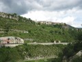
 10.25 mi
 +2,674 ft
 -2,582 ft
 7h 00
7h 00
 Difficult
 Departure from Thorame-Haute (Alpes-de-Haute-Provence)
A journey on the Train des Pignes. An acrobatic river crossing and the magnificent village of Peyresq with its sweeping views.
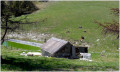
The foresters’ cottages at Le Pasquier at the start of the trail from Peyresq
 10.44 mi
+2,684 ft
-2,690 ft
7h 10
10.44 mi
+2,684 ft
-2,690 ft
7h 10
 Average
Departure from Thorame-Haute (Alpes-de-Haute-Provence)
Average
Departure from Thorame-Haute (Alpes-de-Haute-Provence)
Located between the Mercantour National Park and the Verdon Nature Park.
A route of moderate difficulty; on the return leg to Plan de Rieu, you can retrace your steps to Peyresq via the path taken on the way out, which offers a more comfortable hike.
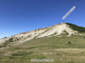
Puy de Rent
 10.25 mi
+3,301 ft
-3,274 ft
7h 35
Difficult
Departure from Allons (Alpes-de-Haute-Provence)
10.25 mi
+3,301 ft
-3,274 ft
7h 35
Difficult
Departure from Allons (Alpes-de-Haute-Provence)
A magnificent hike with no great technical difficulty, apart from the 1,000 m elevation gain and a distance of over 17 km. The ascent is gradual through a magnificent larch forest. At the summit, a 360° panorama awaits you. Breathtaking views at an altitude of nearly 2,000 metres over the Mercantour: the Grand Coyer, the Mole, the Pic de Chamatte, the Cheval Blanc, the Montagne de Cordeil and the Estrop in the distance, to name the most important. In spring, the flora is in full bloom.
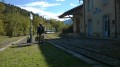
From Allons station to Fugeret station
 8.90 mi
+1,975 ft
-2,349 ft
5h 50
Average
Departure from Allons (Alpes-de-Haute-Provence)
8.90 mi
+1,975 ft
-2,349 ft
5h 50
Average
Departure from Allons (Alpes-de-Haute-Provence)
This allows you to use the ‘Train des Pignes’ as a means of exploring the area whilst hiking, by changing valleys. The route runs partly through former farmland and partly through mixed woodland (with remarkable trees during the descent towards Fugeret).
Three sections, three landscapes:1/ from the station to the village of Allons,2/ from the village to La Basse d’Annot,3/ from the ridge to Fugeret station.
Coulomp Waterfall
 9.91 mi
+3,238 ft
-3,238 ft
8 hrs
9.91 mi
+3,238 ft
-3,238 ft
8 hrs
 Very difficult
Departure from Castellet-lès-Sausses (Alpes-de-Haute-Provence)
Very difficult
Departure from Castellet-lès-Sausses (Alpes-de-Haute-Provence)
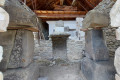
A lovely walk to the waterfall and the Source du Coulomp, with the option to visit the Aurent museum, which houses everything the descendants of the former inhabitants found in the ruins when they revived the hamlet. To reach the waterfall, you need to walk along the bed of the Coulomp for 1 km and cross it seven times, which can be dangerous if the flow is too strong.The archaeological remains of the Argenton Mausoleum bear witness to the presence of the Romans in the region.
Circular Mourre Frey, Tête de Travers and La Mélina loop, starting from the Col de Fa
 13.56 mi
+5,023 ft
-5,023 ft
7 hrs
Very difficult
Departure from Castellet-lès-Sausses (Alpes-de-Haute-Provence)
13.56 mi
+5,023 ft
-5,023 ft
7 hrs
Very difficult
Departure from Castellet-lès-Sausses (Alpes-de-Haute-Provence)
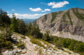
A long and beautiful circular route in the Alpes de Haute Provence, taking you along a magnificent ridge path to Aurent, perhaps one of the most beautiful remote little hamlets in France. Sturdy walking boots and walking poles are essential.
Annot, land of chestnut trees and sandstone
 8.54 mi
+2,457 ft
-2,477 ft
6h 05
Average
Departure from Annot (Alpes-de-Haute-Provence)
8.54 mi
+2,457 ft
-2,477 ft
6h 05
Average
Departure from Annot (Alpes-de-Haute-Provence)
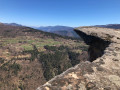
A very distinctive and unique forest.Rock formations that defy the laws of balance, dizzying cliffs and centuries-old chestnut trees. A hike that is a feast for the eyes.
The Annot Sandstone
 3.58 mi
+1,394 ft
-1,378 ft
2h 50
Average
Departure from Annot (Alpes-de-Haute-Provence)
3.58 mi
+1,394 ft
-1,378 ft
2h 50
Average
Departure from Annot (Alpes-de-Haute-Provence)
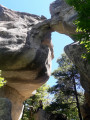
A very pretty, magical and interactive hike under oak trees, hundred-year-old chestnut trees and among huge sandstone boulders.
Most of the walk is in the cool forest.
The Grès d'Annot are world famous and are a listed and protected site.
Vérimande - Colle Basse d'Annot
8.00 mi
+2,316 ft
-2,257 ft
5h 40
Average
Departure from Annot (Alpes-de-Haute-Provence)
Discover the trails of the Colle Basse d'Annot on this route, which offers stunning views of the Baou and the Grès d'Annot. After a rewarding climb, you’ll follow the Vaïre at the end of the walk, with the chance to take a refreshing dip.
The Baou d'Annot
2.68 mi
+1,020 ft
-1,007 ft
2h 05
 Easy
Departure from Annot (Alpes-de-Haute-Provence)
Easy
Departure from Annot (Alpes-de-Haute-Provence)
A short and lovely walk with a magical view of the village, oak and chestnut trees amidst sandstone boulders. Much of the route is through the cool forest.
The Combe Renard circular route starting from Annot
2.67 mi
+922 ft
-912 ft
2h 00
Easy
Departure from Annot (Alpes-de-Haute-Provence)
Follow the paths of La Colle Basse d’Annot to reach the Combe Renard Spring.
An easy hike featuring a steep climb at the start, followed by a flat forest path before beginning the descent.
(!) In winter, this section is very shaded and patches of ice may be present.
Ondres
4.52 mi
+906 ft
-902 ft
2h 50
Easy
Departure from Thorame-Haute (Alpes-de-Haute-Provence)
Ascent to and visit to Ondres, a small picturesque village belonging to Thorame-Haute.
Mont Saint-Honorat via Daluis
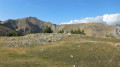 10.85 mi
+4,370 ft
-4,350 ft
8h 50
10.85 mi
+4,370 ft
-4,350 ft
8h 50
 Extremely difficult
Departure from Daluis (Alpes-Maritimes)
Extremely difficult
Departure from Daluis (Alpes-Maritimes)
Warning: very dangerous route – avoid unless you have mountaineering equipment.
The Gorges de St-Pierre and the Tour de la Femme Couchée
 10.97 mi
+4,285 ft
-4,285 ft
8h 45
Difficult
Departure from Beauvezer (Alpes-de-Haute-Provence)
10.97 mi
+4,285 ft
-4,285 ft
8h 45
Difficult
Departure from Beauvezer (Alpes-de-Haute-Provence)
Very varied landscapes between canyons, forests and ridges.
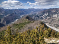
Gueydan Bridge – Entrevaux via the summit of La Lette
 10.68 mi
+3,665 ft
-3,845 ft
8h 05
Difficult
Departure from Saint-Benoît (Alpes-de-Haute-Provence) (Alpes-de-Haute-Provence)
10.68 mi
+3,665 ft
-3,845 ft
8h 05
Difficult
Departure from Saint-Benoît (Alpes-de-Haute-Provence) (Alpes-de-Haute-Provence)
A beautiful, challenging route that keeps you on the ridgelines. The C-shaped configuration of the Var means that throughout this ascent you can admire the river’s banks on both the north and south sides. At the end of the hike, wander through the narrow streets lined with old walls in this magnificent village.
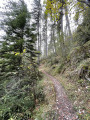
Issole Forest Circular Route
 6.79 mi
+994 ft
-1,010 ft
4h 00
Average
Departure from Saint-André-les-Alpes (Alpes-de-Haute-Provence)
6.79 mi
+994 ft
-1,010 ft
4h 00
Average
Departure from Saint-André-les-Alpes (Alpes-de-Haute-Provence)
A lovely walk through the Issole State Forest, planted with magnificent pine trees.Throughout the walk, the gradient is gentle, on a path that’s very easy on the joints and which occasionally alternates with a forest track; both are always very well signposted.
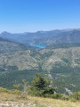
The Pic de Chamatte, starting from Vergons
 8.95 mi
+2,815 ft
-2,815 ft
6h 35
Difficult
Departure from Vergons (Alpes-de-Haute-Provence)
8.95 mi
+2,815 ft
-2,815 ft
6h 35
Difficult
Departure from Vergons (Alpes-de-Haute-Provence)
A very lovely walk leading to the Pic de Chamatte at an altitude of 1,879 metres. This walk may prove challenging due to the elevation gain for inexperienced walkers. However, there are no technical sections. Only the descent requires a sense of direction. The path, although marked on the map, is barely visible in places. From the summit, a magnificent 360° view awaits you, taking in the Mercantour, the Verdon massifs and Lac du Castillon.
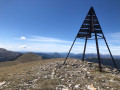
The summit of La Bernarde as seen from the village of Ubraye
 11.29 mi
+3,294 ft
-3,317 ft
8h 05
Difficult
Departure from Ubraye (Alpes-de-Haute-Provence)
11.29 mi
+3,294 ft
-3,317 ft
8h 05
Difficult
Departure from Ubraye (Alpes-de-Haute-Provence)
The ascent is gradual and straightforward. The highlight of the climb is reaching the ridges, followed by the Sommet de la Bernarde and its exceptional panoramic views of the Alpes de Hautes-Provence.
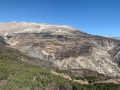
Tour of the Grotte du Chat valley
 8.06 mi
+3,002 ft
-3,005 ft
6h 20
Average
Departure from Daluis (Alpes-Maritimes)
8.06 mi
+3,002 ft
-3,005 ft
6h 20
Average
Departure from Daluis (Alpes-Maritimes)
A pleasant circular route through a quiet valley passing by the Grotte du Chat, a geological curiosity comprising a vast network of galleries, though access is restricted and not unrestricted. The circular route also takes us through the countryside of Le Bez, a vast meadow ideal for a rest in the sun before descending via the other side of the valley where the cave is located.
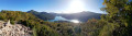
The Barre du Pidanoux starting from Saint-Julien-du-Verdon
 4.30 mi
+1,017 ft
-1,017 ft
2h 50
Average
Departure from Saint-Julien-du-Verdon (Alpes-de-Haute-Provence)
4.30 mi
+1,017 ft
-1,017 ft
2h 50
Average
Departure from Saint-Julien-du-Verdon (Alpes-de-Haute-Provence)
The Barre du Pidanoux hike overlooks Lake Castillon and the village of Saint-Julien-du-Verdon. It offers exceptional panoramic views.
Note: The entire hike is marked with yellow lines.
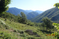
Saint-Jean du Désert as seen from Le Plan
 8.57 mi
+2,195 ft
-2,188 ft
5h 50
Average
Departure from Entrevaux (Alpes-de-Haute-Provence)
8.57 mi
+2,195 ft
-2,188 ft
5h 50
Average
Departure from Entrevaux (Alpes-de-Haute-Provence)
A lovely, mostly shaded walk, following theGR® 4 andGRP® trails of the Grande Traversée des Préalpes.
The Lignin Lakes circular tour
11.21 mi
+2,306 ft
-2,320 ft
7h 10
Difficult
Departure from Colmars (Alpes-de-Haute-Provence)
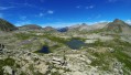
A superb circular walk offering views of a charming little valley, then, after a short but steep climb, the plateau home to the Lignin Lakes. View the lakes and descend via a very beautiful path that crosses the plateau and passes close to La Lance, where you can see some superb pools and waterfalls. Return to the starting point. No particular difficulties apart from the length of the route, provided there is no snow on the ground.
Towards the Lignin Lakes
 11.05 mi
+2,667 ft
-2,664 ft
7h 25
Difficult
Departure from Colmars (Alpes-de-Haute-Provence)
11.05 mi
+2,667 ft
-2,664 ft
7h 25
Difficult
Departure from Colmars (Alpes-de-Haute-Provence)
A beautiful hike starting at the Pont de la Serre by the Lance pools and leading to the Lignin Lakes through woods and alpine pastures.
Circular Boules and Chalufy Huts Loop
 9.14 mi
+3,104 ft
-3,084 ft
6h 55
Difficult
Departure from Thorame-Basse (Alpes-de-Haute-Provence)
9.14 mi
+3,104 ft
-3,084 ft
6h 55
Difficult
Departure from Thorame-Basse (Alpes-de-Haute-Provence)
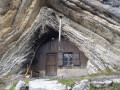
What a surprise to come across this cave-like hut nestled in a small valley – it makes you want to see more! And so it continues throughout this walk, taking in mountain passes, mountain pastures and the charming village of La Valette, typical of these low-lying Alpine valleys.
Three Crosses Loop in Villars-Colmars
 3.64 mi
+1,332 ft
-1,325 ft
2h 50
Average
Departure from Villars-Colmars (Alpes-de-Haute-Provence)
3.64 mi
+1,332 ft
-1,325 ft
2h 50
Average
Departure from Villars-Colmars (Alpes-de-Haute-Provence)
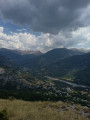
Loop starting from Villars-Colmars, taking part of the Tour du Haut-Verdon. Possible difficulties during the climb: the gradient is a little steep for beginners and there are a few sections on slate rubble.
Cheval Blanc summit
 11.22 mi
+3,986 ft
-3,960 ft
8h 40
Difficult
Departure from Thorame-Basse (Alpes-de-Haute-Provence)
11.22 mi
+3,986 ft
-3,960 ft
8h 40
Difficult
Departure from Thorame-Basse (Alpes-de-Haute-Provence)
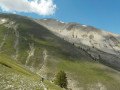
A lovely walk to a magnificent, barren peak rising to an altitude of nearly 2,350 metres. The climb remains challenging due to the elevation gain, but the view on arrival is truly extraordinary, with a 360° panorama. The mountain is also known as the ‘cursed mountain’ due to the two plane crashes that occurred on 27 and 30 January 1948 (see information below).
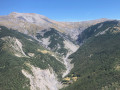
La Pointe de la Figuilière
 5.81 mi
+2,106 ft
-2,116 ft
4h 30
Average
Departure from Saint-Martin-d'Entraunes (Alpes-Maritimes)
5.81 mi
+2,106 ft
-2,116 ft
4h 30
Average
Departure from Saint-Martin-d'Entraunes (Alpes-Maritimes)
A varied route, alternating between wooded sections and views of the Saint-Martin-d’Entraunes valley. The Pointe de la Figuilière, a stone’s throw from the Aiguilles de Pelens, offers an exceptional 360° panorama.
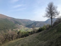
The unmarked trails of the wooded ridges of the Haut-Estéron
 6.35 mi
+1,657 ft
-1,670 ft
4h 20
Average
Departure from Val-de-Chalvagne (Alpes-de-Haute-Provence)
6.35 mi
+1,657 ft
-1,670 ft
4h 20
Average
Departure from Val-de-Chalvagne (Alpes-de-Haute-Provence)
Discover a beautiful forest near Castellet Saint-Cassien. Following the ridges along unmarked paths offers a delightful way to explore this stunning Haut-Estéron National Forest.