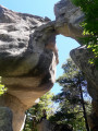
Coulomp Waterfall

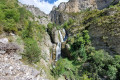
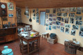
A lovely walk to the waterfall and the Source du Coulomp, with the option to visit the Aurent museum, which houses everything the descendants of the former inhabitants found in the ruins when they revived the hamlet. To reach the waterfall, you need to walk along the bed of the Coulomp for 1 km and cross it seven times, which can be dangerous if the flow is too strong.
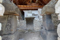
The archaeological remains of the Argenton Mausoleum bear witness to the presence of the Romans in the region.

Details

25157112
Creation:
Last update:
Last review:
  • Walking
    Activity: Walking
  • ↔
    Distance: 9.91 mi
  • ◔
    Duration according to the author: 8 hrs 
  • ▲
    Difficulty: Very difficult

  • ⚐
    Back to start: Yes
  • ↗
    Ascent: + 3,238 ft
  • ↘
    Descent: - 3,238 ft

  • ▲
    Highest point: 4,718 ft
  • ▼
    Lowest point: 3,281 ft

Photos

Description of the walk

Leave the D2202 (formerly the N202) at Enriez and take the D660. Pass through Castellet-lès-Sausses and continue along the narrow road, which ends as a track at the Col du Fa. The signpost is situated below, facing Argenton. There is ample parking, including shaded spaces near the shepherd’s hut.

Please take care to follow the route description from the Aurent Museum. If in doubt, do not take the circular loop. Turn left, heading due south, to reach the footbridge directly, then follow the route description for the return journey.

(S/E) Follow the path uphill for 1.4 km, heading due north, until you reach the “Chemin d’Aurent” signpost.

(1) Continue along the path which descends to the suspension bridge crossing the Ruisseau de Grave Plane.

(2) Cross the bridge and follow the path uphill to the hamlet of Aurent, which is only inhabited in summer; signs point towards the museum. You can visit it on request; it houses objects, photographs and tools from days gone by, collected by the residents of Aurent up until 1936.

(3) At the last house, take the path heading north-west to reach the left bank of the Coulomp and arrive at a fork in the path.

(4) Follow the cairns, keeping the Coulomp on your left, until you reach the path that turns 90° to the right and climbs steeply; a rope marks the bend.

(5) Do not take this path, but continue straight on along the river to the first ford.
Please note: do not proceed with the rest of the walk until you have read the route description.

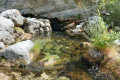
(6) Wear waterproof footwear as, over a distance of about 1 km, you will need to cross the river seven times and wade through water that is knee-deep or deeper in places, depending on the flow. The stones may be slippery, so take great care to avoid falls. Follow the river upstream to a Fork in the road. The waterfall can be seen high up on the right.

(7) From here on, you will no longer be walking in the water, so dry shoes will be more useful, especially as the slope becomes steep. Follow the path between the two streams up to the promontory, where there is a breathtaking view of the 70-metre-high Coulomp Waterfall.

(8) Continue climbing to reach the Source du Coulomp, France’ssecond-largest resurgence. The water, at 8°C, flows through the Grotte du Chamois from the Lignin plateau.

(9) The return journey follows the cavers’ path, initially uphill with a few exposed sections; handrails, the safety of which can no longer be guaranteed, are still in place, followed by a steep descent to the junction from the outward journey.

(5) Turn left and follow the outbound path in the opposite direction as far as the first fork.

(4) Turn right towards the footbridge, where you can stop for a snack in the shade.

(10) Cross the bridge and head up the right bank, with some slightly exposed sections at the start, until you reach Le Villard.

(11) At the boundary marker, leave the path and head uphill towards the glass-fronted building housing the archaeological remains of the Argenton Mausoleum. Free entry.

(12) Head south-west along the level path to reach Argenton. Refreshments and farm-fresh cheese on sale.

(13) Continue south and descend through the chestnut grove to Le Tardoun.

(14) Cross the bridge and head back up the opposite side through the beech forest to the Col du Fam (S/E).


Waypoints

  1. S/E : mi 0 - alt. 4,350 ft - Col du Fam or - Col du Fa (1320 m)
  2. 1 : mi 0.82 - alt. 4,459 ft - Aurent Trail
  3. 2 : mi 2.51 - alt. 3,904 ft - Suspension bridge
  4. 3 : mi 2.66 - alt. 3,953 ft - Aurent Museum
  5. 4 : mi 2.84 - alt. 3,868 ft - Junction used for both the outward and return journeys
  6. 5 : mi 3.23 - alt. 3,904 ft - Junction of the circular loop
  7. 6 : mi 3.4 - alt. 3,967 ft - 1st ford
  8. 7 : mi 3.67 - alt. 4,026 ft - Fork in the road
  9. 8 : mi 3.76 - alt. 4,140 ft - Promontory
  10. 9 : mi 3.92 - alt. 4,446 ft - Source du Coulomp, near the - Grotte des Chamois (Castellet-lès-Sausses)
  11. 10 : mi 5.2 - alt. 3,796 ft - Footbridge
  12. 11 : mi 7.2 - alt. 4,127 ft - Le Villard signpost
  13. 12 : mi 7.34 - alt. 4,268 ft - Archaeological remains
  14. 13 : mi 7.72 - alt. 4,327 ft - Argenton
  15. 14 : mi 8.71 - alt. 3,284 ft - Le Tardoun - Coulomp (rivière)
  16. S/E : mi 9.91 - alt. 4,350 ft - Col du Fam

Notes

You can top up your water supplies at the fountains in Aurent and at the Source du Coulomp.
Bring a pair of shoes suitable for walking in water.
Sturdy footwear and walking poles are recommended.
Free mountain hut in Aurent.
Refreshment stand in Argenton.

Worth a visit

Information boards on the Chemin d’Aurent and on the wall of the refuge.
The hamlet and museum at Aurent.
Coulomp Waterfall and Spring.
Argenton mausoleum.

Reviews and comments

5 / 5
Based on 2 reviews

Reliability of the description
5 / 5
Ease of following the route
5 / 5
Route interest
5 / 5
Crisdarkwolf
Crisdarkwolf

Overall rating : 5 / 5

Date of your route : Aug 07, 2023
Reliability of the description : ★★★★★ Very good
Ease of following the route : ★★★★★ Very good
Route interest : ★★★★★ Very good
Very busy route : No

A breathtaking hike.
Just a heads-up: this hike requires a minimum level of fitness and a fair bit of hiking experience – above all, 100 per cent mental toughness. Not suitable for children. I crossed the river five times when it was running very high and had to contend with its sheer force – hence the need for mental toughness. I also walked alongside the river with my feet in the water, including a few long stretches barefoot in the freezing water – which also took real mental strength. From the viewpoint overlooking the waterfall (seen from a distance, of course), I made my way over the rocks to reach a spectacular view of the waterfall, with magnificent cascades all the way down to its base. Please note that for this part, I avoided the signposted path, then rejoined it by climbing up the ravine on the side of the waterfall. A magical, challenging and magnificent adventure.

Machine-translated

LAURENTGRI
LAURENTGRI

Overall rating : 5 / 5

Date of your route : Nov 21, 2022
Reliability of the description : ★★★★★ Very good
Ease of following the route : ★★★★★ Very good
Route interest : ★★★★★ Very good
Very busy route : No

We went on a hike on 11 November; at that time of year, the river, the waterfalls and the cave were in the shade!

Machine-translated

Other walks in the area

For more walks, use our search engine .

The GPS track and description are the property of this route's author. Please do not copy them without permission.