Ondres

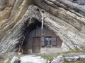
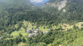
Ascent to and visit to Ondres, a small picturesque village belonging to Thorame-Haute.

Details

3419307
Creation:
Last update:
Last review:
  • Walking
    Activity: Walking
  • ↔
    Distance: 4.52 mi
  • ◔
    Average duration: 2h 50 
  • ▲
    Difficulty: Easy

  • ⚐
    Back to start: Yes
  • ↗
    Ascent: + 906 ft
  • ↘
    Descent: - 902 ft

  • ▲
    Highest point: 4,491 ft
  • ▼
    Lowest point: 3,586 ft

Description of the walk

Park at the side of the D908, near the recycling bins.

(S/E) Walk alongside the road, taking the wide stony path which leads 100 m further on to the wooden bridge crossing the Verdon.

(1) Cross the road carefully and go over the bridge to reach a track on the other side of the Verdon. Pass another track on your right, cross the Riou d’Ondres and arrive at a junction.

(2) Continue to the right. Keep left at the next junction. You’ll climb slightly and be rewarded with a lovely view of the Verdon valley. You’ll reach another junction.

(3) Turn right towards Ondres.

(4) Completely deserted at the start of the 20th century, the village was restored from the 1950s onwards by holidaymakers who fell in love with the site. The village has neither mains water nor electricity. In summer there may be around a hundred people, whereas in the past the village was home to up to 250 people.

(5) When you reach the last house, turn round and follow the route back in the opposite direction to return to the starting point (S/E).

Waypoints

  1. S/E : mi 0 - alt. 3,586 ft - Parking at the side of the road
  2. 1 : mi 0.12 - alt. 3,589 ft - Cross the road. Bridge over the - Verdon (rivière)
  3. 2 : mi 0.51 - alt. 3,655 ft - Crossroads at the end of the circular loop
  4. 3 : mi 2 - alt. 4,364 ft - Junction of the circular loop. Crossroads of tracks
  5. 4 : mi 2.18 - alt. 4,462 ft - Ondres
  6. 5 : mi 2.26 - alt. 4,491 ft - Last house in the village
  7. S/E : mi 4.52 - alt. 3,589 ft - Parking at the side of the road

Reviews and comments

4.7 / 5
Based on 3 reviews

Reliability of the description
5 / 5
Ease of following the route
4.7 / 5
Route interest
4.3 / 5
Lolli83
Lolli83

Overall rating : 4.7 / 5

Date of your route : Jun 21, 2026
Reliability of the description : ★★★★★ Very good
Ease of following the route : ★★★★★ Very good
Route interest : ★★★★☆ Good
Very busy route : No

A lovely find – we’re going for a walk to the abandoned hamlet. It’s quite charming.
A few locals live there, mainly in the summer as there’s no electricity or running water.
The highlight of the walk: the interior of the church, which is stunning for its architecture and colours.

Machine-translated

PATDIDOU
PATDIDOU

Overall rating : 5 / 5

Date of your route : Apr 17, 2026
Reliability of the description : ★★★★★ Very good
Ease of following the route : ★★★★★ Very good
Route interest : ★★★★★ Very good
Very busy route : No

A very pleasant walk with no major difficulties

Machine-translated

ThomP21
ThomP21

Overall rating : 4.3 / 5

Date of your route : Aug 11, 2025
Reliability of the description : ★★★★★ Very good
Ease of following the route : ★★★★☆ Good
Route interest : ★★★★☆ Good
Very busy route : No

A very pleasant walk, culminating in the discovery of an authentic little village.

Machine-translated

Other walks in the area

For more walks, use our search engine .

The GPS track and description are the property of this route's author. Please do not copy them without permission.