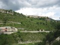
The village of Peyresq

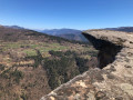
A journey on the Train des Pignes. An acrobatic river crossing and the magnificent village of Peyresq with its sweeping views.

Details

n°864
Creation:
Last update:
Last review:
  • Walking
    Activity: Walking
  • ↔
    Distance: 10.25 mi
  • ◔
    Average duration: 7h 00 
  • ▲
    Difficulty: Difficult

  • ⚐
    Back to start: No
  • ↗
    Ascent: + 2,674 ft
  • ↘
    Descent: - 2,582 ft

  • ▲
    Highest point: 5,115 ft
  • ▼
    Lowest point: 3,002 ft

Photos

Description of the walk

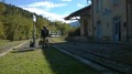
Park at Méailles, north of Annot, and walk down to the station to catch the train to the Peyresq stop. (Train timetable ¶ Practical information).

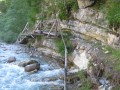
(S) Follow the Vaïre torrent, with its footbridges and chains attached to the rock faces, as far as the ruins of the Moulin du Ray.

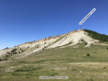
(1) The track then leaves the banks of the stream and climbs to the right up to Peyresq.

(2) Head back down via Colle Saint-Michel, passing through Les Coulets.

(3) Follow theGR® route of the Great Pre-Alps Crossing as far as Méailles (E).

Waypoints

  1. S : mi 0 - alt. 3,333 ft - Walk alongside the Vaïre (river) - Gare de Peyresc
  2. 1 : mi 1.06 - alt. 3,593 ft - Moulin du Ray. The track leaves the - Vaïre (rivière)
  3. 2 : mi 2.69 - alt. 5,003 ft - Peyresq
  4. 3 : mi 6.19 - alt. 4,692 ft - Col de la Colle-Saint-Michel
  5. E : mi 10.25 - alt. 3,412 ft - Méailles - Gare de Méailles

Notes

It is recommended that you know how to read a map and use a compass. The terrain, which can be difficult in places, requires good footwear with lugged soles.

Train des Pignes timetable

Always be cautious and plan ahead when you're outdoors. Visorando and the author of this route cannot be held responsible for any accidents occurring on this route.

The GR® and PR® markings are the intellectual property of the Fédération Française de Randonnée Pédestre.

Reviews and comments

4.3 / 5
Based on 2 reviews

Reliability of the description
4 / 5
Ease of following the route
4 / 5
Route interest
5 / 5
User 18802737

Overall rating : 4.3 / 5

Date of your route : Aug 19, 2026
Reliability of the description : ★★★★☆ Good
Ease of following the route : ★★★★☆ Good
Route interest : ★★★★★ Very good
Very busy route : No

A pleasant discovery.

Machine-translated

User 18802737

Overall rating : 4.3 / 5

Date of your route : Aug 24, 2026
Reliability of the description : ★★★★☆ Good
Ease of following the route : ★★★★☆ Good
Route interest : ★★★★★ Very good
Very busy route : No

A wonderful walk. It’s just the walk back that lacks a bit of charm (but that’s just my opinion)

Machine-translated

Other walks in the area

For more walks, use our search engine .

The GPS track and description are the property of this route's author. Please do not copy them without permission.