Country:

 City:
City:


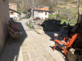
(S/E) From the car park in the village of Ubraye, go down the 25-step staircase and turn right onto the grassy area to reach the tarmac road known as the Montée de Saint-Martin, situated below the village (do not take the second section of the stairs, which has unusually large steps). Once at the road, turn left to reach the nearby junction and the start of the path.
(1) At the road junction, you’ll see a yellow signpost marked ‘Le Touyet 1h30’. Head towards Le Touyet and the two buildings a few metres away. Walk round the back of the building on the right to reach the footpath, the start of which is somewhat hidden by vegetation.
(2) At this point, the path leads to the D310 road via about ten stone steps. Turn left and walk along the road for about thirty metres. At the hairpin bend, leave the road and take the stony path opposite, which climbs straight away.
(3) The end of the path marks the entrance to the hamlet of Le Touyet. For a short round trip, turn left into the lane that passes by the fountain – where benches have been placed for walkers to rest – then continue towards the church.
(4) Saint-Pons Church in the hamlet of Le Touyet. Recently restored and beautifully decorated, it’s well worth a visit. Retrace your steps.
(3) Turn left at the wayside shrine to rejoin the tarmac road. Continue along this tarmac section to the next hamlet, where there is a water point on the right.
(5) Look out for the yellow signpost marked “Le Touyet altitude 1259 m”, then turn right towards Castellanne. Carry on, staying on this stony track suitable for vehicles.
(6) At this bend in the road, ignore the yellow signpost and turn right to continue along the ascending track.
The path is marked both on and off the track with cairns.
(7) Two cairns are present. Leave the stony track and turn right between these two cairns, which mark the start of the path. Continue the ascent towards the ridge, following the clearly visible path.
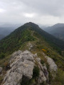
(8) Turn right at the Crête de Bernarde. This is straightforward; follow the cairn markings along a path or across grassy ground. An easy walk of about twenty minutes. The summit of La Bernarde is still not visible; it will only come into view further on.
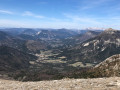
(9) Reach the summit of La Bernarde, at an altitude of 1,941 m, marked by a geodetic point (a metal triangle on a stand) and offering a magnificent 360° panorama. Turn back. Return to the path and cairns you left shortly before to head towards the south-west of the ridge.
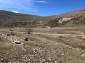
(8) Turn left. You’ll be looking down on the Vauplane snow stadium, at an altitude of 1,600 m. Do not go as far as the fork you passed on the way up, but descend by sight towards the two resort buildings below. Leave the track and turn off to cross the fields to the left of the two buildings. Cross the open meadow towards the ski lift situated furthest to the east of the resort.
Red and white markings
(10) To the left of the ski lift, there is a solitary wooden post, the top of which is painted white and red. Standing 1 m high, it serves as a marker forthe GR®4. Turn left and continue following the slope; several posts mark theGR®4, which runs above the ravine.
(11) Cross the River Bernarde and continue along the path.
(12) At this junction of paths, carry on straight ahead to quickly rejoin the bend in the track you took earlier.
(6). Carry on straight ahead, following the route in the opposite direction to the way out.
(5) As you pass through the hamlet, there is a popular drinking fountain on the left. Continue along the tarmac section; there is a fountain in the hamlet of Le Touyet. Continue towards the village of Ubraye, following the reverse route of the outward journey.
(1) In the village, you can take the stone staircase on the right – it has high steps, so please take care. Return to the Ubraye car park (S/E).


 .:.
.:. Visorando Member
 Moderate
 Easy
Easy