Circular Boules and Chalufy Huts Loop

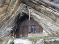
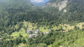
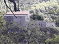
What a surprise to come across this cave-like hut nestled in a small valley – it makes you want to see more! And so it continues throughout this walk, taking in mountain passes, mountain pastures and the charming village of La Valette, typical of these low-lying Alpine valleys.

Details

64441517
Creation:
Last update:
Last review:
  • Walking
    Activity: Walking
  • ↔
    Distance: 9.14 mi
  • ◔
    Average duration: 6h 55 
  • ▲
    Difficulty: Difficult

  • ⚐
    Back to start: Yes
  • ↗
    Ascent: + 3,104 ft
  • ↘
    Descent: - 3,084 ft

  • ▲
    Highest point: 6,670 ft
  • ▼
    Lowest point: 4,173 ft

Photos

Description of the walk

At Thorame-Basse, leave the RD2 and take the RD72 towards La Valette. When you reach the end of the road, do not drive up into the village but park immediately after crossing the Pont de l’Issole.

(S/E) From the car park, look for the track heading due north, following the Issole upstream towards the Refuge de Boules. You’ll come to a ford.

(1) Cross the Issole as best you can and continue along the track through the forest, keeping a close eye on the direction towards Boules until you reach the next junction.

(2) Turn right and continue along the track to the next junction.

(3) Leave the track, turn right onto the footpath, cross a stream, then climb up to the picturesque Cabane de Boules.

(4) Continue along the path which climbs up the mountainside to the Barre de Boules.

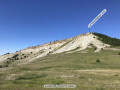
(5) At this junction, turn left for a round trip to the Col de Vachière or Col de Chalufy.

(6) Return to the junction at the Barre de Boules.

(5) Carry on straight ahead, cross a ravine and climb up to the Col de Colle Meyère. Head for the Cabane de Colle Méyère.

(7) Follow the path down to the Cabane de Chalufy.

(8) Continue along the path which descends, then runs along the hillside to an inconspicuous crossroads.

(9) Do not continue straight on, as this path leads to the Cabane des Abéourons; instead, take the path on the right, descend, then climb back up. Stay alert and follow the cairns or the yellow markings carefully. If, at times, you find yourself on a tractor track, it doesn’t matter, as it also leads to the Col de la Plaine de Jassaud.

(10) Then turn right onto the GRP® marked in yellow and red, which descends through the Ravin de Raichas, sometimes as a footpath and sometimes as a track. Pass through a scree slope, then further down, when the village of La Valette comes into view, look out for a crossroads.

(11) Leave the GRP® and take the small, level path on the right, marked with the GRP®’s Yellow Cross and Red Cross. Follow the path as it leads into the village. Walk past the chapel, then head down the tarmac road until you reach a crossroads.

(12) Leave the road and turn right onto the GRP® path which leads down to the car park (S/E).

Waypoints

  1. S/E : mi 0 - alt. 4,173 ft - Pont de l’Issolle car park
  2. 1 : mi 0.38 - alt. 4,275 ft - Ford across the - Issole (rivière) - Affluent du Verdon
  3. 2 : mi 0.62 - alt. 4,301 ft - Crossroads
  4. 3 : mi 1.34 - alt. 4,619 ft - Junction
  5. 4 : mi 2.45 - alt. 5,522 ft - Boules Hut
  6. 5 : mi 3.88 - alt. 6,516 ft - La Barre de Boules junction
  7. 6 : mi 4.21 - alt. 6,670 ft - Col de Vachière - Col de Chalufy (2034m)
  8. 7 : mi 5.1 - alt. 6,519 ft - Colle Meyère hut
  9. 8 : mi 5.79 - alt. 6,106 ft - Cabane de Chalufy
  10. 9 : mi 6.58 - alt. 5,948 ft - Junction at the Cabane des Abéourons
  11. 10 : mi 7.02 - alt. 6,316 ft - Col de la Plaine de Jassaud
  12. 11 : mi 8.84 - alt. 4,334 ft - Crossroads
  13. 12 : mi 9.06 - alt. 4,245 ft - Crossroads
  14. S/E : mi 9.14 - alt. 4,193 ft - Pont de l’Issolle car park

Notes

  • Water: bring your own; otherwise, there is an intermittent spring on the path about a quarter of an hour past the Cabane de Boules. Alternatively, water is also available at the Cabane de Chalufy and in the village of La Valette.
  • The Cabane de Boules is available to walkers.
  • Crossing the ford (1) can be problematic if the Issole is in flood, and there is no bridge to cross to the other bank.
  • Please respect the privacy of the shepherds when approaching the shepherds’ huts.
  • The sheep farming activity along this walk requires you to behave appropriately towards the flocks.
  • From the start (S/E) to the Col de la Plaine de Jassaud (10), follow the yellow PR® markings. From (10) to (11), follow the yellow and red GRP® markings.

Worth a visit

Always be cautious and plan ahead when you're outdoors. Visorando and the author of this route cannot be held responsible for any accidents occurring on this route.

The GR® and PR® markings are the intellectual property of the Fédération Française de Randonnée Pédestre.

Reviews and comments

5 / 5
Based on 2 reviews

Reliability of the description
5 / 5
Ease of following the route
5 / 5
Route interest
5 / 5
User 28627878

Overall rating : 5 / 5

Date of your route : Jun 08, 2026
Reliability of the description : ★★★★★ Very good
Ease of following the route : ★★★★★ Very good
Route interest : ★★★★★ Very good
Very busy route : No

A wonderful hike – best done before the herds arrive in the mountain pastures so as not to disturb them. We did it in early June, and everything was perfect: the weather, the scenery, the abundance of flowers...

Machine-translated

User 13099635
• Edited:

Overall rating : 5 / 5

Date of your route : Nov 12, 2025
Reliability of the description : ★★★★★ Very good
Ease of following the route : ★★★★★ Very good
Route interest : ★★★★★ Very good
Very busy route : No

Magnificent larch trees and an amazing refuge!!!!

Machine-translated

User 2286072

We’re interested in this walk, but we haven’t done it yet. Thank you for all these lovely walks to discover.

Machine-translated

Other walks in the area

For more walks, use our search engine .

The GPS track and description are the property of this route's author. Please do not copy them without permission.