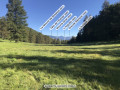
The foresters’ cottages at Le Pasquier at the start of the trail from Peyresq

Located between the Mercantour National Park and the Verdon Nature Park.
A route of moderate difficulty; on the return leg to Plan de Rieu, you can retrace your steps to Peyresq via the path taken on the way out, which offers a more comfortable hike.

Details

3548652
Creation:
Last update:
Last review:
  • Walking
    Activity: Walking
  • ↔
    Distance: 10.44 mi
  • ◔
    Average duration: 7h 10 
  • ▲
    Difficulty: Moderate

  • ⚐
    Back to start: Yes
  • ↗
    Ascent: + 2,684 ft
  • ↘
    Descent: - 2,690 ft

  • ▲
    Highest point: 6,923 ft
  • ▼
    Lowest point: 5,003 ft

Photos

Description of the walk

Take the D32 road towards the village of Peyresq, which overlooks the Vaïre valley. Park at the entrance to the village on the right.

(S/E) Set off along the road to the Oratory of the Virgin, then climb the embankment at the ‘Rocher de Saint-Restitut’ signpost. Follow theGR® de Pays Tour du Haut Verdon trail, marked in red and yellow, on a pleasant climb through the north-facing pine forest. You’ll reach a clearing on a flat stretch, with a shepherd’s cottage further up.

(1) Continue until you reach a Y-junction at the Pré de Thorame signpost.

(2) Leave theGRP® here. Turn right onto thePR® path, marked in yellow. Head northwards through the forest to reach a hairpin bend.

(3) Turn right to climb back up onto the ridge, still through the higher undergrowth. Reach the highest point and continue along the almost flatPR® path to reach the Plan du Rieu signpost as you emerge from the woods.

(4) Turn left towards the Cabane de Congerman along a pleasant, open path offering a stunning 360° view. You’ll reach the Cabane Vieille.

(5) Continue downhill towards the Serre ravine and cross it – this is straightforward. Head back up the opposite side into the woods and, via a gentle slope, reach the Pasquier Forest Huts.

(6) Follow the same route in the opposite direction to return to the junction marked by the Plan du Rieu signpost.

(4) Take the path opposite, leaving the route you took on the way there to your right, and pass beneath the Barres du Courradour.
Caution: this section features steep, scree-covered terrain.
Head towards the edge of the woodland.

(7) Continue your return journey through the woods to the village of Peyresq and the car park (S/E).


Waypoints

  1. S/E : mi 0 - alt. 5,016 ft - Entrance to Peyresq
  2. 1 : mi 1.25 - alt. 5,738 ft - Flat clearing
  3. 2 : mi 1.58 - alt. 5,833 ft - Signpost at Pré de Thorame
  4. 3 : mi 2.12 - alt. 6,253 ft - Hairpin bend
  5. 4 : mi 3.73 - alt. 6,752 ft - Map of Le Rieu
  6. 5 : mi 4.38 - alt. 6,732 ft - La Cabane Vieille
  7. 6 : mi 5.86 - alt. 6,923 ft - Pasquier Forest Huts
  8. 7 : mi 9.04 - alt. 6,375 ft - Scree
  9. S/E : mi 10.44 - alt. 5,013 ft - Entrance to Peyresq

Notes

There are no water sources along the route.
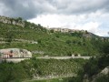
Peyresq means ‘land of stones’; it has a superb little Romanesque church.

Worth a visit

(2) Directly in front of you, through a gap in the trees, lies the summit of Grande Séolane.
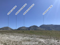
(Between 3 and 4) Enjoy the beautiful views through the gaps in the trees of several peaks: Petit and Grand Coyer, Sommet du Carton, Grande Séolane and Les Trois Evêchés.
(Between 4 and S/E) This return route is less pleasant than the outward one.

Always be cautious and plan ahead when you're outdoors. Visorando and the author of this route cannot be held responsible for any accidents occurring on this route.

The GR® and PR® markings are the intellectual property of the Fédération Française de Randonnée Pédestre.

Reviews and comments

4.6 / 5
Based on 3 reviews

Reliability of the description
4.3 / 5
Ease of following the route
4.7 / 5
Route interest
4.7 / 5
JPCanet
JPCanet

Hello,
Have you checked out ‘Pieroblanc’s’ suggestion to head back via the summit of Le Courradour?
Is there a path? Directly from point 4? After the summit, which route should we take??
Thanks!
JPCanet

Machine-translated

Espedaillac
Espedaillac

Keep up the good work on the trails – it’s brilliant

Machine-translated

Chriscross
Chriscross

Overall rating : 5 / 5

Date of your route : Sep 19, 2022
Reliability of the description : ★★★★★ Very good
Ease of following the route : ★★★★★ Very good
Route interest : ★★★★★ Very good
Very busy route : No

A lovely hike with an overnight stay in the shepherd’s hut, with a little fire in the stove – very cosy in the slightly chilly weather.
A little tip for the following day if you’re doing a two-day hike: head up to the Lignin Lakes (about 45 mins)
Important information: there are small streams after point 5 and also near the hut, where a spring emerges.

Machine-translated

Espedaillac
Espedaillac

It’s absolutely stunning in winter – it’s a whole new experience, especially if the sun’s out. That said, do take care and make sure you’ve got the right kit. Enjoy the rest of your walk

Machine-translated

EstelleBuraud
EstelleBuraud

Overall rating : 4.7 / 5

Date of your route : Feb 07, 2022
Reliability of the description : ★★★★☆ Good
Ease of following the route : ★★★★★ Very good
Route interest : ★★★★★ Very good
Very busy route : No

A lovely hike we did in winter (early February), taking us through various forests and then across open countryside (a variety of landscapes!). At this time of year, we encountered snow from an altitude of 1,800 metres, but had no trouble finding the path and the various junctions using the IGN map and the numerous markings on trees and small wooden posts.
It took us 5 hours from the start of the walk to the hut (from point 1 to point 6), including a picnic break, a stop to watch wildlife and several tricky icy sections (particularly at the Ravin du Serre after point 5).
We didn’t come across any other walkers, which makes for a truly wild hike
We recommend this walk

Machine-translated

pieroblanc
pieroblanc

Overall rating : 4 / 5

Date of your route : Jul 12, 2021
Reliability of the description : ★★★★☆ Good
Ease of following the route : ★★★★☆ Good
Route interest : ★★★★☆ Good
Very busy route : No

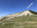
A variation involving climbing to the summit of Le Courradour on the way back is more interesting than the route via the scree slope.
The ‘chimney’ leading to the summit is very easy, making it possible to complete a circular route.
As there’s already a return route to the forest lodge, it’s well worth going via this summit on the way back.

Machine-translated

Other walks in the area

For more walks, use our search engine .

The GPS track and description are the property of this route's author. Please do not copy them without permission.