From Allons station to Fugeret station

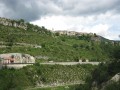
This allows you to use the ‘Train des Pignes’ as a means of exploring the area whilst hiking, by changing valleys. The route passes partly through former farmland and mixed woodland (with remarkable trees during the descent towards Le Fugeret).

Three sections, three landscapes:
1/ from the station to the village of Allons,
2/ from the village to Basse d’Annot,
3/ from the ridge to Fugeret station.

Details

165018
Creation:
Last update:
Last review:
  • Walking
    Activity: Walking
  • ↔
    Distance: 8.90 mi
  • ◔
    Average duration: 5h 50 
  • ▲
    Difficulty: Moderate

  • ⚐
    Back to start: No
  • ↗
    Ascent: + 1,975 ft
  • ↘
    Descent: - 2,349 ft

  • ▲
    Highest point: 4,928 ft
  • ▼
    Lowest point: 2,733 ft
  • ⚐ Country: France
  • ⚐
    Areas: Alps, Pelat
  • ⚐ City: Allons (04170)
  • ⚑
    Start: N 44.008207° / E 6.561199°
  • ⚑
    End: N 44.001131° / E 6.645817°
  • ❏
    IGN map(s): Ref. 3541OT
  • Hour-by-hour weather

Photos

Description of the walk

First section: from the station to the village of Allons

(S) Start from Allons station: on the banks of the Verdon, do not cross the bridge; turn left, following the yellow and red markings ofthe GR® de Pays (GRPA: Grande Traversée des Préalpes), and follow the tarmac road through the gorges for a while.

(1) Leave the road and take theGRPA® to the left as the valley widens. Walk past the Saint-Domnin chapel, which is situated slightly above the road. In the middle of farmland, turn left to climb up through the fields along a stony farm track (the path is clearly marked).
When you come to an almost level path at the top of the fields, turn right (a farm is visible a little further on) and follow it to the hamlet of La Moutière, which you pass through.

(2) Then follow the small tarmac road downwards for about 300 metres. Leave the road and turn left. This junction is not very clearly signposted at present: if you miss it, it is easy to find your way back to the Ravin de Douane by taking the next track (an obvious track at a right angle on your left, 400 metres further on).

(3) Turn right onto the path, which remains almost level all the way to the village of Allons (an old track). At the entrance to the village, there is a welcoming bench near a wayside shrine by the first house.

Part Two: from the village of Allons to La Basse d’Annot.

(4) Walk down through the village, past the church and then past the “La Mar Salaou” fountain, and leave the village on the left: cross the bridge and follow the track to the left up to the second bridge.

(5) Cross it and follow the track to the right, ignoring the yellow-markedPR® path which branches off to the left; follow the yellow and red GTPA markers.

(6) 250 metres further on, don’t miss the junction. Leave the track (cairn) and take the path on the left, which climbs up into the Champons ravine. You’ll come to another junction with the yellowPR® path (signpost for Les Peyrières).

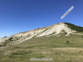
(7) Continue to the right on theGRP® trail, which gradually becomes more wooded after passing through sections of marl and stony outcrops. The slope gradually steepens until you reach the Col de la Basse d’Annot.

Part Three: from the ridge to Fugeret station

(8) Head for the next pass, which is very close by, by following the forest track to the left immediately after crossing over to the other side of the slope. (Alternative route available, see “Practical information”). In both cases, you will arrive at La Basse d’Allons (an information board marking a junction).

(9) Take the path on the right (yellowPR® markings), which starts right at the sign. After a descent down a grassy slope, a series of steep hairpin bends through the forest will lead you to the Roncharel spring.

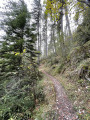
(10) Follow the yellowPR® path to the left and ignore the road leading off to the right from the spring. All that remains is to follow thePR® path to the village of Le Fugeret – a fairly long but straightforward walk. There are some beautiful ancient trees along the way. You’ll reach Le Fugeret.

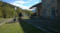
(11) Cross the bridge. Just after the bridge, turn right; the station is at the other end of the village. Walk through the main square (café, town hall, etc.) then leave the main road at a bend to the right. Continue straight on along Avenue de la Gare and walk through a small estate of new detached houses. You’ll soon be walking alongside the railway line and will arrive at the station (E).

Don’t forget to wave to the train driver!

Waypoints

  1. S : mi 0 - alt. 3,130 ft - Starting point: Allons railway station - Verdon (rivière)
  2. 1 : mi 1.32 - alt. 3,307 ft - Chapelle Saint Domnin junction, turn left
  3. 2 : mi 1.83 - alt. 3,488 ft - The hamlet of La Moutière
  4. 3 : mi 2.41 - alt. 3,497 ft - Ravin de Douane: turn right
  5. 4 : mi 3.43 - alt. 3,606 ft - Village of Allons, wayside shrine
  6. 5 : mi 3.82 - alt. 3,533 ft - Bridge: follow the track to the right
  7. 6 : mi 4 - alt. 3,596 ft - At the fork, take the FTPA path on the left
  8. 7 : mi 4.55 - alt. 3,789 ft - At the Les Peyrières signpost, turn right
  9. 8 : mi 5.77 - alt. 4,898 ft - Basse d’Annot
  10. 9 : mi 6.25 - alt. 4,928 ft - Tourist information sign; take the path down to the right
  11. 10 : mi 6.61 - alt. 4,409 ft - Roncharel spring: follow the PR signpost to the left
  12. 11 : mi 8.47 - alt. 2,756 ft - The village of Fugeret. Bridge over the - Vaïre (rivière)
  13. E : mi 8.9 - alt. 2,753 ft - Le Fugeret station

Notes

Water points in the village of Allons, at the Roncharel spring and in the village of Fugeret (as well as a bar-restaurant).
Standard walking gear, sturdy shoes, map, etc.

Alternative route to La Basse d’Allons.
(8) Follow the ridge to the left via the Colle d’Annot (10 mins) instead of taking the forest road.

Worth a visit

This walk was undertaken by travelling by train to the starting point; the return journey was also by train, from Digne.
Provided you set off on the morning train, there is plenty of time for a leisurely walk. Do check the timetables, particularly for the return journey, and bear them in mind whilst allowing for a margin of error…
Full details of this narrow-gauge tourist train can be found via the following link: Train des Pignes

You can, of course, drive to the starting point, but you’ll still need to arrange some sort of shuttle, as this route isn’t circular and doesn’t return to the starting point via the trail.

Nevertheless, the journey on the “Train des Pignes” is a tourist attraction in its own right – it would be a shame to miss it!

If you decide to give it a go, bear in mind that the two stops, Allons-Argens and Le Fugeret, are not full-fledged stations, but simply stops; you’ll need to ask the conductor to stop there on the outward journey and wave to the driver to request a stop on the return journey.

Always be cautious and plan ahead when you're outdoors. Visorando and the author of this route cannot be held responsible for any accidents occurring on this route.

The GR® and PR® markings are the intellectual property of the Fédération Française de Randonnée Pédestre.

Reviews and comments

4 / 5
Based on 3 reviews

Reliability of the description
3.7 / 5
Ease of following the route
3.7 / 5
Route interest
4.7 / 5
pmwilson
pmwilson

Overall rating : 3.7 / 5

Date of your route : Aug 27, 2019
Reliability of the description : ★★★☆☆ Average
Ease of following the route : ★★★☆☆ Average
Route interest : ★★★★★ Very good
Very busy route : No

I’ve done this walk twice. Unfortunately, despite having downloaded the .gpx file, I couldn’t find the track between 9 and 10 – a stretch through thick scrub. With a GPS, it’s possible to find the track – though it’s tricky! – but I wouldn’t recommend doing the walk without a good Garmin or similar device.
Otherwise, it’s a very good walk.

Machine-translated

JOKAJI
JOKAJI

Overall rating : 4.7 / 5

Date of your route : May 06, 2019
Reliability of the description : ★★★★★ Very good
Ease of following the route : ★★★★★ Very good
Route interest : ★★★★☆ Good

In paragraph 9, the term ‘steep hairpin bends’ is a euphemism: you start off on a scree slope, then the path winds its way vaguely; we even lost sight of the markings for a while, but we managed to reach the spring all the same. As a previous user said: a GPS is useful – that’s true. As for us, we had Iphigénie on our iPhone.
After the spring: be careful not to follow the stream for too long – the correct path branches off to the left and you risk missing the markings

Machine-translated

marcmoine
marcmoine

Unfortunately, we weren’t able to go on this walk because the Train des Pignes wasn’t running (the line is undergoing works)

Machine-translated

bibi
bibi ★

Thank you for your feedback. If you have any further information you’d like to share with us, we’d be happy to add it to the description to help future walkers find their way.
Kind regards

Machine-translated

pmwilson
pmwilson

Overall rating : 3.7 / 5

Date of your route : Aug 11, 2017
Reliability of the description : ★★★☆☆ Average
Ease of following the route : ★★★☆☆ Average
Route interest : ★★★★★ Very good

I really enjoyed this walk. The train journey was particularly special.
I’d strongly recommend using a GPS device as the path on one side of the mountain was very difficult to follow.

Machine-translated

Other walks in the area

For more walks, use our search engine .

The GPS track and description are the property of this route's author. Please do not copy them without permission.