


Refine your search for walks in Lunas (Hérault)
Lunas (Hérault) walks


 Campredon and Fontenilles, starting from the Bousquet d’Orb
 Visorando Member
 2.97 mi
 +741 ft
 -741 ft
 2h 00
2h 00
 Easy
Easy
 Departure from Le Bousquet-d'Orb (Hérault)
A circular route, following fairly wide paths, with a lovely view of the Bousquet d’Orb.
Laval de Nize Circular
3.77 mi
+827 ft
-827 ft
2h 25
Easy
Departure from Lunas (Hérault) (Hérault)
A lovely walk through the upper cantons: along the Ruisseau de Nize, then up through the boxwood trees towards the hamlet of Briandes and back via the postman’s path.
Crossing the Orb and Mare valleys
13.44 mi
+1,280 ft
-2,083 ft
7h 20
 Difficult
Departure from Dio-et-Valquières (Hérault)
Difficult
Departure from Dio-et-Valquières (Hérault)
This route runs entirely within the Haut-Languedoc Regional Nature Park. Setting off from Dio, you look out over the Orb valley before rejoining the river at Lamalou-les-Bains after crossing its tributary, the Mare, via the Pont du Diable. At the foot of the Monts d’Orb, you can see the Montagne de l’Espinouse and the cliffs of the Caroux Plateau. The views of Dio Castle, the walk through purple-coloured rock formations and a visit to the medieval village of Boussagues make this walk a delight.
Mont Sénégra
 3.79 mi
+709 ft
-728 ft
2h 20
Easy
Departure from La Tour-sur-Orb (Hérault)
3.79 mi
+709 ft
-728 ft
2h 20
Easy
Departure from La Tour-sur-Orb (Hérault)
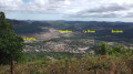
A beautiful walk through a former mining site, among chestnut trees and terraced vineyards, overlooking a magnificent landscape.
Route of the Saint-Amans and Notre-Dame-de-Nize chapels
 11.85 mi
+1,680 ft
-1,686 ft
6h 55
Difficult
Departure from Lodève (Hérault)
11.85 mi
+1,680 ft
-1,686 ft
6h 55
Difficult
Departure from Lodève (Hérault)
From Col de la Baraque to Chapelle de Saint-Amans via the ridges, then to Chapelle de Notre-Dame-de-Nize via a chestnut grove.
Along the banks of the Orb, starting from La Tour
 3.21 mi
+177 ft
-190 ft
1h 40
Easy
Departure from La Tour-sur-Orb (Hérault)
3.21 mi
+177 ft
-190 ft
1h 40
Easy
Departure from La Tour-sur-Orb (Hérault)
An easy walk along the banks of the Orb between La Tour-sur-Orb and Le Mas Blanc.
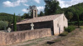
La Tour-sur-Orb and Boubals via the Brousson Chapel
 3.63 mi
+344 ft
-344 ft
2h 00
Easy
Departure from La Tour-sur-Orb (Hérault)
3.63 mi
+344 ft
-344 ft
2h 00
Easy
Departure from La Tour-sur-Orb (Hérault)
A lovely walk through vineyards and holm oak woods.
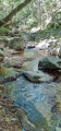
The Espaze arboretum
 7.60 mi
+1,480 ft
-1,480 ft
4h 45
7.60 mi
+1,480 ft
-1,480 ft
4h 45
 Moderate
Departure from Camplong (Hérault)
Moderate
Departure from Camplong (Hérault)
In a remote and uncrowded area, you will pass through valleys and ridges in the heart of the Monts-d'Orb national forest, renowned for its plantations of Laricio pines native to Corsica.
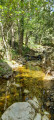
Circular walk from Camplong to La Découverte on the left bank of the mining basin
 5.73 mi
+876 ft
-873 ft
3h 25
Moderate
Departure from Camplong (Hérault)
5.73 mi
+876 ft
-873 ft
3h 25
Moderate
Departure from Camplong (Hérault)
A circular walk along good paths, taking in the impressive mining faces of the coalfield, followed by a visit to the small, restored Saint-Sauveur Chapel and its rural setting.
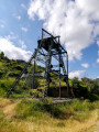
Puits Durand and Chapelle Saint-Sauveur at the start of Camplong
 3.31 mi
+600 ft
-600 ft
2h 05
Easy
Departure from Camplong (Hérault)
3.31 mi
+600 ft
-600 ft
2h 05
Easy
Departure from Camplong (Hérault)
Walk around the former mining site of Camplong, where you will find the Durand Pit headframe and, at the top of the hill, in the middle of a chestnut forest, the restored 12th-century Saint-Sauveur Chapel, which overlooks Camplong, Saint-Étienne-d'Estréchoux and Graissessac. The circular dry stone wall a few dozen metres from the sanctuary is an old cemetery.
Saint-Amans Chapel from Villecun
10.72 mi
+1,575 ft
-1,594 ft
6h 20
Moderate
Departure from Olmet-et-Villecun (Hérault)
A beautiful hike with 360° views on very good paths. The ridge section is exposed to the wind.
Villecun route via the Col de la Défriché and Lavalette
9.80 mi
+1,312 ft
-1,306 ft
5h 40
Moderate
Departure from Olmet-et-Villecun (Hérault)
A pleasant walk, starting with unobstructed views of the highest peaks, then shaded after Lavalette. A short stretch of tarmac at the start and halfway along the route.
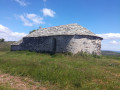
From Brenas to the Saint-Amans Chapel
 8.30 mi
+1,240 ft
-1,270 ft
4h 55
Moderate
Departure from Brenas (Hérault)
8.30 mi
+1,240 ft
-1,270 ft
4h 55
Moderate
Departure from Brenas (Hérault)
This hike takes you from Brenas to the Saint-Amans Chapel via a fairly easy and varied route.
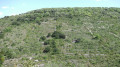
La Serre from Boussagues
 4.76 mi
+571 ft
-584 ft
2h 40
Easy
Departure from La Tour-sur-Orb (Hérault)
4.76 mi
+571 ft
-584 ft
2h 40
Easy
Departure from La Tour-sur-Orb (Hérault)
A walk through the hills above the medieval village of Boussagues, amongst the vineyards and ancient terraced fields, which can be extended with a visit to the village.
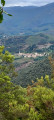
Estréchoux circular loop
 9.15 mi
+1,260 ft
-1,260 ft
5h 20
Moderate
Departure from Graissessac (Hérault)
9.15 mi
+1,260 ft
-1,260 ft
5h 20
Moderate
Departure from Graissessac (Hérault)
A very pretty, unmarked hike, taking paths and trails that sometimes run along the hillside and reveal varied landscapes, including the remains of mining activity, in the hinterland of western Hérault.
There are a series of ascents and descents, but they do not require significant physical effort. It is a complete change of scenery for hikers looking for diversity.
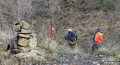
Circular route along the right bank of the Cledou above Graissessac
 6.94 mi
+1,030 ft
-1,030 ft
4h 05
Moderate
Departure from Graissessac (Hérault)
6.94 mi
+1,030 ft
-1,030 ft
4h 05
Moderate
Departure from Graissessac (Hérault)
From the Graissessac Mining Museum via the Castan district, climb up alongside the old mining spoil heaps towards the Chapelle Saint-Laurent and Les Nières, then return via the Pommier mine, the arboretum, the Saint-Simon mine and the Chemin du Papin.
Upper Orb Valley – From Avène to Rieussec via Peyreguille
 7.91 mi
+1,923 ft
-1,923 ft
5h 20
Moderate
Departure from Avène (Hérault)
7.91 mi
+1,923 ft
-1,923 ft
5h 20
Moderate
Departure from Avène (Hérault)
Avène is not just a cosmetics brand; it is also a thriving spa village in the upper cantons of the Hérault. Influenced by both the ocean and the Mediterranean, the Monts-d’Orb present striking contrasts from one slope to the other. From the Orb valley to the dry Rieussec valley via Peyreguille, the route—lovely and wooded, and therefore often shaded—alternates between south- and north-facing slopes. No fewer than six passes and four valleys are strung together in this way. Added to this is a well-preserved heritage (mill, Saint-André Chapel, etc.).
The summit of Peyreguille as seen from the hamlet of Le Coural in Avène
2.48 mi
+774 ft
-774 ft
1h 50
Moderate
Departure from Avène (Hérault)
A short walk taking you up Mont Peyreguille, where the mobile phone mast is located, from the hamlet of Le Coural, situated a few kilometres above Avène. The walk offers views of mid-mountain landscapes; the first section is fairly shaded by the forest canopy.
Five summits in the Devois
 6.67 mi
+2,320 ft
-2,316 ft
5h 05
Difficult
Departure from Graissessac (Hérault)
6.67 mi
+2,320 ft
-2,316 ft
5h 05
Difficult
Departure from Graissessac (Hérault)
This circuit is very elegant and very sporty, going around the valley formed by the Provères stream. For most of the route, you will enjoy distant views in almost every direction.
At the end of the route, the gorges formed by the Bouissescure stream are very wild and have exuberant vegetation.
The Avène Spa-Goer’s Getaway
2.42 mi
+312 ft
-325 ft
1h 25
Easy
Departure from Avène (Hérault)
This is a short circular loop through the pine forest, perfect for unwinding after the showers, baths, compresses and mist treatments.
During the climbs and descents – which are quite substantial – gaps in the pine forest offer glimpses, in the distance, of the spa complex and the surrounding hills.
The local road from Lieude to Causse de Carlencas
 5.12 mi
+719 ft
-715 ft
3h 00
Moderate
Departure from Mérifons (Hérault)
5.12 mi
+719 ft
-715 ft
3h 00
Moderate
Departure from Mérifons (Hérault)
Having found traces of this local road No. 13 on the 1827 land registry, I went in search of it. It starts at La Lieude and climbs up through the Las Moles valley.
This hike is reserved for experienced hikers who are familiar with the terrain and enjoy getting off the beaten track.
The path is not always easy to follow in the ruffes (red earth).
Return via Mas Bousquet and Mas Valos le Vieux and Valos le Bas.
No markings - GPS very useful.
Chapelle Notre-Dame de Roubignac on the way to Château de Lauzières
 4.76 mi
+787 ft
-774 ft
2h 50
Easy
Departure from Octon (Hérault)
4.76 mi
+787 ft
-774 ft
2h 50
Easy
Departure from Octon (Hérault)
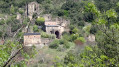
Starting from Octon, this beautiful walk takes you to the ruins of Château de Lauzières and the 12th-century Romanesque chapel of Roubignac.
Chapelle Notre-Dame de Roubignac via the dolmens at Octon
 6.52 mi
+932 ft
-932 ft
3h 50
Moderate
Departure from Octon (Hérault)
6.52 mi
+932 ft
-932 ft
3h 50
Moderate
Departure from Octon (Hérault)
A short but very pretty hike in the Octon hills, offering views of Lake Salagou at the start. The destination is the small Romanesque chapel of Notre-Dame de Roubignac (7), but there are other places of interest along the way, such as the dolmen and the ruins of Octon Castle, visible from the other side of the valley.
From the Orb to the Escandorgue via Tibet
 10.46 mi
+1,670 ft
-1,644 ft
6h 15
Moderate
Departure from Roqueredonde (Hérault)
10.46 mi
+1,670 ft
-1,644 ft
6h 15
Moderate
Departure from Roqueredonde (Hérault)
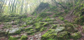
This hike starts in Roqueredonde and takes you to the Orb river and the Tibetan Buddhist temple Lerab Ling, where you can take a short meditation break. The route then enters the Escandorgue National Forest, where the charm of the forest paths contrasts with the chaotic dolomitic landscape of the Causse. Finally, the route follows ancient paths worn by passing flocks of sheep.
Cirque de Labeil and its cave
 8.35 mi
+2,365 ft
-2,388 ft
5h 55
Difficult
Departure from Lauroux (Hérault)
8.35 mi
+2,365 ft
-2,388 ft
5h 55
Difficult
Departure from Lauroux (Hérault)
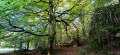
In a limestone circus setting, this circuit climbs to the foot of the cliffs, offering views of the Lodève countryside. After a refreshing stop in the hamlet of Labeil and its converted cave, it continues on the plateau, enters a dark forest, then crosses the limestone plateau amid a chaotic rock formation.
Les Corniches de Lauroux
 8.32 mi
+2,297 ft
-2,270 ft
5h 50
Moderate
Departure from Lauroux (Hérault)
8.32 mi
+2,297 ft
-2,270 ft
5h 50
Moderate
Departure from Lauroux (Hérault)
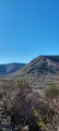
A beautiful walk, without major difficulty and well marked, that takes you through scrubland and forests, cliffs and limestone plateaus.
Montagne de la Boutine and the Saint-Fulcran Chapel
 4.36 mi
+643 ft
-643 ft
2h 35
Easy
Departure from Mérifons (Hérault)
4.36 mi
+643 ft
-643 ft
2h 35
Easy
Departure from Mérifons (Hérault)
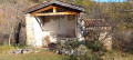
This easy walk takes you to the Chapel of Saint-Fulcran, where tradition holds that Saint-Fulcran – Bishop of Lodève from 949 to 1006 – was born in the vicinity. You then climb along an old path to Mas de Pradels. The return journey takes you to the Montagne de la Boutine, from where you descend via a winding track.
The Causse de Boussagues
 9.52 mi
+1,506 ft
-1,490 ft
5h 40
Moderate
Departure from Villemagne-l'Argentière (Hérault)
9.52 mi
+1,506 ft
-1,490 ft
5h 40
Moderate
Departure from Villemagne-l'Argentière (Hérault)
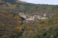
A lovely walk through rolling countryside, among vineyards and cherry trees, accessible to most people.
Plateau and forests above Labeil
 8.58 mi
+1,181 ft
-1,181 ft
5h 00
Moderate
Departure from Lauroux (Hérault)
8.58 mi
+1,181 ft
-1,181 ft
5h 00
Moderate
Departure from Lauroux (Hérault)
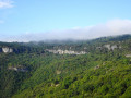
The hike combines sections of well-known routes (Haute Vallée de la Lergue, Corniches de Lauroux, Forêt de l'Escandorgue) with unmarked paths. A GPS is highly recommended. In clear weather, the views are superb, overlooking the Cirque de Labeil. There is a wide variety of landscapes and environments.
The Jure Stream
 5.73 mi
+1,060 ft
-1,060 ft
3h 35
Moderate
Departure from Ceilhes-et-Rocozels (Hérault)
5.73 mi
+1,060 ft
-1,060 ft
3h 35
Moderate
Departure from Ceilhes-et-Rocozels (Hérault)
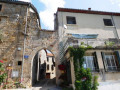
From Ceilhes-et-Rocozels, in Haut-Languedoc, near the ‘border’ with Aveyron, here’s an opportunity to head for the hills, in the Monts d’Orb State Forest, towards the Rocher du Canari on the edge of the Tesserièyres Plateau. The Ruisseau de Jure will then serve as your guide back to the village, which lies on the banks of the Orb, a coastal river regulated by the Avène Reservoir.
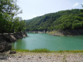
The Avène Reservoir
 6.86 mi
+1,043 ft
-1,043 ft
4h 05
Moderate
Departure from Ceilhes-et-Rocozels (Hérault)
6.86 mi
+1,043 ft
-1,043 ft
4h 05
Moderate
Departure from Ceilhes-et-Rocozels (Hérault)
Here is a brief overview of the Avène Reservoir, starting from Ceilhes-et-Rocozels, first climbing up Mont Redon, south of the village. After the Rouvignac chapel and the holiday lodges, the route approaches the left bank of the Orb, which feeds the Bouloc lake, developed for outdoor leisure activities (water sports, camping).
⚠️ 11/05/2026:In winter and spring, and after heavy rain, when the reservoir is full, the walk may be impassable between points 8 and 10. It is possible to avoid walking along the banks by following the route shown on the IGN map between points 7 and 10.