Country:

 City:
City:



Start from the car park at the Puits Durand holiday residence, at the far end of the village, on the left after the cemetery.
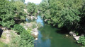
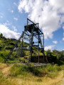
(S/E) Head up to the left, crossing the bridge over the Ruisseau l’Espaze, then follow the wide track to the Puits Durand headframe.
(1) Continue uphill to the third hairpin bend from the headframe, which is also a junction.
(2) Continue due north along the track until you reach another fork 100 m further on (Col des Padènes – not signposted on the ground).
(3) Continue straight on due north until you reach the fence of the solar panel farm.
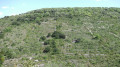
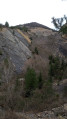
(4) Follow the fence, then leave it to continue climbing along the track. Pass a few reforestation tracks on the right. The track curves left towards the west, running parallel to the majestic face of La Découverte. Follow the track all the way along the face until you reach a bend to the right. Look out for a sign for “la cabane du berger”.
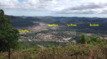
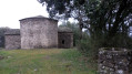
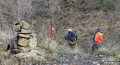
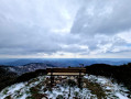
(5) Follow this path, which branches off to the left, passes a stone shelter and ends, about a hundred metres further on, at an impressive viewpoint overlooking the coal faces opposite.
(6) Retrace your steps back to the track.
(5) Continue along it to the left for about 80 metres, until you reach the next hairpin bend at a fork in the track.
(7) Ignore the path that climbs sharply to the right in a hairpin bend towards the Col de la Pause. Turn left onto the track that begins to descend in wide hairpin bends towards the valley. Descend, taking your time on the tight bends which reveal impressive views of the mining faces. You’ll arrive at a junction of tracks with a spring.
(8) Continue descending to the left until you reach the low point marking the end of the former open-cast mining area. The track then climbs steadily back up to the track junction you passed on the way out.
(3) Continue to the right, in the opposite direction to the outward journey, to reach, 100 m further on, the other junction you passed on the way out.
(2) This time, take the track on the right, towards the mast, leaving a track on the left. After the mast, you’ll come to a three-way junction, in front of a concrete transformer.
(9) Take the track on the right to quickly reach another junction of much narrower paths.
(10) Take the paved slanting street opposite, which climbs quite steeply up to the Chapelle Saint-Sauveur.
(11) Return along the same path to the previous junction.
(10) This time, take the descending path on the right, which is marked in red and yellow (GR® de Pays).
(12) Follow the signposted path, which descends steeply through the trees, crosses the main track twice and joins the track leading into Camplong. You’ll emerge at the corner of the grocery shop and the café.
(13) Turn left, heading due north, onto the tarmac road (D23E3) which runs through the village to the cemetery, then turn left onto Chemin du Mineur, continuing to the car park (S/E).

 Visorando Member

 Easy
Easy 
 Difficult