Upper Orb Valley – From Avène to Rieussec via Peyreguille

Avène is not just a cosmetics brand; it is also a thriving spa village in the upper cantons of the Hérault. Influenced by both the ocean and the Mediterranean, the Monts-d’Orb present striking contrasts from one slope to the other. From the Orb valley to the dry Rieussec valley via Peyreguille, the route—lovely and wooded, and therefore often shaded—alternates between south- and north-facing slopes. No fewer than six passes and four valleys are strung together in this way. Added to this is a well-preserved heritage (mill, Saint-André Chapel, etc.).

Details

28822707
Creation:
Last update:
Last review:
  • Walking
    Activity: Walking
  • ↔
    Distance: 7.91 mi
  • ◔
    Average duration: 5h 20 
  • ▲
    Difficulty: Moderate

  • ⚐
    Back to start: Yes
  • ↗
    Ascent: + 1,923 ft
  • ↘
    Descent: - 1,923 ft

  • ▲
    Highest point: 2,300 ft
  • ▼
    Lowest point: 1,161 ft

Photos

Description of the walk

The route starts from the well-equipped car park at Les Bains d’Avène, on the left of the D8 when approaching from the south, after the bridge over the Orb.

(S/E) Cross the road and head right towards the avenue of plane trees below the spa to reach the Source Saint-Odile.

(1) Just next to the spring, on the right, cross the Orb via the footbridge. You will then enter the beautiful Thermal Park. Follow a gravel path to the right which takes you back to the D8 at the exit of a car park. Cross the road here and take the footpath directly opposite which climbs towards Beau Désert and leads onto a track.

(2) Here, you have two options:
- follow this track to a junction further down at elevation 424.
- follow the route description and look for the start of an ascending path on the right. Follow it along the ridge of the hill, through beautiful vegetation.
At the junction, take the track on the right, which winds pleasantly along a balcony-like path amidst the pine trees.
You can see the Moulin de la Salesse on the banks of the Orb below, which you will visit at the end of the route. At the next junction, take the track to the right until the first bend, where a path climbing to the left leads to a small pass where theGR®71and aGRP® meet.

(3) From this pass, a short detour to the right to the Vierge viewpoint is possible (breathtaking view of the village of Avène).

(4) Return to the crossroads.

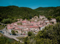
(3) Begin the climb up Peyreguille, following theGR® markings. Don’t hesitate to stop every now and then to turn round and admire the unfolding landscape. At the 593m mark, take the track to the left for 50m to continue the ascent along a path, leading to a track at a fork. At the far left of the bend, there is a rather unique view looking down over the Avène thermal baths and the village.

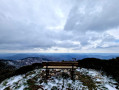
(5) Take a return trip along the track to the left to reach the summit of Peyreguille and its orientation table, which is partially obscured by vegetation.

(6) Return to the fork.

(5) Then continue left, still on theGR®, along the descending track to the Col de Peyreguille at an elevation of 626 metres. Continue straight ahead on the GR®. The path descends through an oak forest, crossing the Route du Coural à Serviès (D163E2) for the first time.

(7) At this point, there are two options:
- follow this road to the right as a shortcut to reach the Col de la Mousquièyre directly and avoid Le Coural.
- follow the route description and continue along theGR® down to the pleasant hamlet of Le Coural.
TheGR® joins the D163E2 for a second time at the entrance to Le Coural.

(8) After a possible visit to the hamlet, return to this spot, follow theGR® for a few metres, leave theGR® and look for a discreet path that branches off straight ahead, heading uphill.
This old Chemin du Coural to La Chapelle Saint-André is poorly maintained and overgrown in places (a pair of secateurs might come in handy); it also joins the D163E2 near the cross at the Col de la Mousquièyre.

(9) Follow the road for 100 m after the pass and continue along a path on the right, descending towards the Rieussec valley. You’ll arrive at the charming Chapelle Saint-André de Rieussec and its adjoining cemetery.

(10) Cross the D163 (Route de Serviès) and head towards the dry stream bed. Follow it to the right, downstream, for about 100 m until you reach the edge of a field with beehives. Enter the field and immediately spot a path on the left leading above the beehives. Follow this well-built old track, which leads to Saint-André and climbs gently up to a small pass flanked by a ruin.

(11) Continue along the path on the shaded slope through the beech trees. You will come out onto the Route de Serviès.

(12) Cross the road and immediately turn right onto the bed of the Rieu Sec, which forms a proper gravel path here. Follow the bed of La Grave (another name for the Rieu Sec) downstream until you come to a path rising to the right (blue markings). Pass a small pass and reach a minor road (D8E13) running alongside the Avenette. Follow this charming stream to the right until you cross the Avène bridge over the Orb.

(13) Turn right and cross the Orb again via the causeway. Cross the car park and follow the path alongside a water channel leading to the renovated Moulin de la Salesse (information boards).

(14) Turn sharply left to head back towards the village, following the Orb. Take the metal footbridge and follow the pavement on the right. On leaving the village, cross the road and follow the lovely footpath that links the spa resort and the Bains d'Avène car park (S/E).

Waypoints

  1. S/E : mi 0 - alt. 1,175 ft - Bains d'Avène car park
  2. 1 : mi 0.18 - alt. 1,165 ft - Sainte-Odile Spring
  3. 2 : mi 0.39 - alt. 1,227 ft - Beau Désert
  4. 3 : mi 1.43 - alt. 1,362 ft - Pass. Junction of the GR and GRP. Return to viewpoint
  5. 4 : mi 1.5 - alt. 1,325 ft - Panorama of the Virgin
  6. 5 : mi 2.35 - alt. 2,208 ft - Junction – Access to a viewpoint
  7. 6 : mi 2.5 - alt. 2,300 ft - Orientation table
  8. 7 : mi 3.43 - alt. 1,667 ft - Road from Le Coural to Serviès (D163E2)
  9. 8 : mi 3.55 - alt. 1,535 ft - Le Coural
  10. 9 : mi 3.86 - alt. 1,821 ft - Croix - Col de la Mousquièyre
  11. 10 : mi 4.14 - alt. 1,572 ft - Saint-André Chapel in Rieussec
  12. 11 : mi 4.76 - alt. 1,818 ft - Pass - Ruins
  13. 12 : mi 5.29 - alt. 1,437 ft - Route de Serviès
  14. 13 : mi 6.51 - alt. 1,207 ft - Avène Bridge - Orb (fleuve)
  15. 14 : mi 6.9 - alt. 1,198 ft - Salesse Mill
  16. S/E : mi 7.91 - alt. 1,175 ft - Bains d'Avène car park

Notes

Drinking water and shops in Avène.
Drinking water at Le Coural.
Pruning shears may come in handy between Le Coural (8) and the Col de la Mousquièyre (9).
The Saint-André Chapel is usually closed, but a large entrance porch can serve as shelter if needed.

Worth a visit

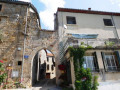
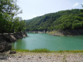
Places to see along the route: the modern thermal baths, the historic Sainte-Odile thermal spring, the magnificent Thermal Park, the panoramic views of Avène and the Monts d’Orb, the summit of Peyreguille, the forests of conifers and deciduous trees of various species, the hamlet of Le Coural in its valley, the Romanesque Chapel of Saint-André de Rieussec (11th century), the curious dry riverbed of the Rieu Sec (also known as La Grave), the small valley of the Avénette, the village of Avène nestled around its church, the restored Salesse Mill (18th–19th centuries) and its supply channel (béal), the banks of the Orb...

Always be cautious and plan ahead when you're outdoors. Visorando and the author of this route cannot be held responsible for any accidents occurring on this route.

The GR® and PR® markings are the intellectual property of the Fédération Française de Randonnée Pédestre.

Reviews and comments

3.8 / 5
Based on 8 reviews

Reliability of the description
3.8 / 5
Ease of following the route
3.3 / 5
Route interest
4.3 / 5
Synthric
Synthric

Overall rating : 2.7 / 5

Date of your route : Aug 12, 2025
Reliability of the description : ★★★☆☆ Average
Ease of following the route : ★★☆☆☆ Disappointing
Route interest : ★★★☆☆ Average
Very busy route : No

Hiking, but I would describe it as difficult due to the difficulty in following the route.
The first part is relatively accessible. There is a nice steep climb up to the relay antenna.
At point 8, surprise: a sign indicating the wrong direction stops you in your tracks. You then have to decide whether to continue along the road, turn back or, as the path is still visible, brave the forbidden. I chose the latter option and managed to reach point 9, but the brambles had taken over the area. You're guaranteed to arrive covered in scratches.
Then, woe betide anyone whose mobile phone battery runs out, as the markings gradually disappear and only the route on your phone prevents you from getting lost in the forest.
The descent at point 12 is a little technical.
In summary, there were some nice passages and landscapes, but overall I was left with mixed feelings about this hike.

Machine-translated

User 12612471

Overall rating : 2.7 / 5

Date of your route : Jul 07, 2025
Reliability of the description : ★★★☆☆ Average
Ease of following the route : ★★☆☆☆ Disappointing
Route interest : ★★★☆☆ Average
Very busy route : No

We have rarely had such a difficult hike! Even with GPS tracking (essential here, as there are very few signposts), we had a lot of trouble finding the indicated junctions. Some sections had become impassable due to brambles, particularly section 8. We couldn't find the path at this point and had to go back down to the hamlet, then retrace our steps to section 7. We also got lost towards the end, unable to find the path indicated at the beehives, and ended up following the course of the Rieu Sec stream. Although some of the passages through the undergrowth are very pleasant and beautiful, we found this hike really difficult to follow and do not particularly recommend it. If you decide to go on an adventure anyway, a GPS tracker is absolutely essential and a pair of secateurs would be very useful to avoid ending up with your legs in tatters!

Machine-translated

cbernadou
cbernadou

Overall rating : 4.3 / 5

Date of your route : May 18, 2025
Reliability of the description : ★★★★☆ Good
Ease of following the route : ★★★★☆ Good
Route interest : ★★★★★ Very good
Very busy route : No

A fairly strenuous route for us: 5½ hours’ walking and a 650-metre elevation gain over roughly 15 km; the southern section of the route has been partially cleared of undergrowth, but otherwise, at this time of year, there are plenty of different flowers and the route is mostly shaded

Machine-translated

Lydie CARBOU
Lydie CARBOU

Overall rating : 4.3 / 5

Date of your route : May 05, 2025
Reliability of the description : ★★★★★ Very good
Ease of following the route : ★★★★☆ Good
Route interest : ★★★★☆ Good
Very busy route : No

Good descriptions and route marking. Not very busy at the start of the season; the paths were still quite overgrown with branches and brambles. The panoramic views are lovely, and the sections through the woodland are very pleasant. A lovely backcountry route!

Machine-translated

sabinelagardeval
sabinelagardeval

Overall rating : 3.7 / 5

Date of your route : Dec 28, 2023
Reliability of the description : ★★★☆☆ Average
Ease of following the route : ★★★☆☆ Average
Route interest : ★★★★★ Very good
Very busy route : No

A lovely walk, but be warned: a GPS is ESSENTIAL, as there are no landmarks in the forest. We got slightly lost on the way down; best done in summer as it’s very shady.

Machine-translated

Ben Languedoc
Ben Languedoc

I’ve updated the description regarding the field with the beehives. You actually need to walk a few metres into the field. Thank you for your comment.

Machine-translated

lagardie
lagardie

Overall rating : 3.7 / 5

Date of your route : Oct 02, 2023
Reliability of the description : ★★★☆☆ Average
Ease of following the route : ★★★☆☆ Average
Route interest : ★★★★★ Very good
Very busy route : No

The route to the beehives was fine, provided you kept your phone to hand. After that, we lost our way and had to return via the road.

Machine-translated

Ben Languedoc
Ben Languedoc

Thank you for your comment and for your pruning efforts! If everyone helps to maintain the path—which is likely to be centuries old—from the hamlet of Coural to Saint-André Chapel, it will not disappear.

Machine-translated

7oise
7oise
• Edited:

Overall rating : 5 / 5

Date of your route : Jun 12, 2023
Reliability of the description : ★★★★★ Very good
Ease of following the route : ★★★★★ Very good
Route interest : ★★★★★ Very good
Very busy route : No

A lovely walk where we really appreciated the open spaces in the forest, given the heat. Some stunning views. Thank you for recommending we bring secateurs at this point (7); we had to cut through the vegetation to get past, but it was much nicer than taking the road.

Machine-translated

Ben Languedoc
Ben Languedoc

Thank you for your comment. Indeed, the forest is ever-present in the Avène area, making it a cool haven during the summer months.
To begin with, when you find yourself in the middle of the lovely lawn in the Thermal Park, head for the long car park that separates the D8 from the park. Once in this one-way car park, turn right towards the exit onto the D8. It is at the exit of this car park that you will find the footpath leading up to Beau Désert.

Machine-translated

casinoguy
casinoguy

Overall rating : 3.7 / 5

Date of your route : May 08, 2023
Reliability of the description : ★★★★☆ Good
Ease of following the route : ★★★☆☆ Average
Route interest : ★★★★☆ Good
Very busy route : No

A walk mostly in the shade through the woodland, but the route from Avène isn't very well signposted

Machine-translated

Other walks in the area

For more walks, use our search engine .

The GPS track and description are the property of this route's author. Please do not copy them without permission.