Refine your search for walks in Lozzi
Lozzi walks


 Circular Monte Cinto
 Visorando Member
 11.06 mi
 +5,827 ft
 -5,810 ft
 10h 10
 Difficult
 Departure from Lozzi (Haute-Corse)
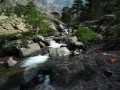
This circular will take you to the highest point in Corsica.
It is a difficult hike, but it offers unrivalled views of the surrounding area.
Corsica Stage 3: Albertacce to Col de Vergio
 9.60 mi
+2,533 ft
-735 ft
6h 35
9.60 mi
+2,533 ft
-735 ft
6h 35
 Moderate
Departure from Albertacce (Haute-Corse)
Moderate
Departure from Albertacce (Haute-Corse)
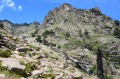
This third stage takes us to the Col de Vergio, the highest point of the day, which marks the start of the descent to Porto.
We will pass by the beautiful Radule waterfall and its pools, which are perfect for swimming.
Viru-Golo loop starting from Albertacce
 4.97 mi
+738 ft
-745 ft
2h 55
Difficult
Departure from Albertacce (Haute-Corse)
4.97 mi
+738 ft
-745 ft
2h 55
Difficult
Departure from Albertacce (Haute-Corse)
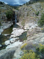
Loop starting from the Genoese bridge at Albertacce, first following the Viru, a tributary of the Golo, to the Moulin de Muricciolu, then a pretty balcony path above the Golo to the footbridge over the Golo.
Monte Albanu – Tour des Cinque Frati
 8.41 mi
+3,031 ft
-3,110 ft
6h 30
Difficult
Departure from Albertacce (Haute-Corse)
8.41 mi
+3,031 ft
-3,110 ft
6h 30
Difficult
Departure from Albertacce (Haute-Corse)
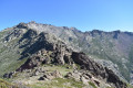
A unique hike in the Niolu region, featuring a little-known summit offering a sublime view of the Paglia Orba.
Afterwards, you’ll have just one desire: to climb to the summit of this Corsican gem.
Les Bergeries de Ballone
 5.70 mi
+1,178 ft
-1,178 ft
3h 40
Moderate
Departure from Albertacce (Haute-Corse)
5.70 mi
+1,178 ft
-1,178 ft
3h 40
Moderate
Departure from Albertacce (Haute-Corse)
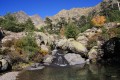
A short climb to the Bergeries de Ballone, nestled in a superb mountain setting. A short hike, taking half a day.
Scala di Santa Regina to Corscia, from Funtana Vignente
 5.93 mi
+1,847 ft
-1,844 ft
4h 20
Moderate
Departure from Corscia (Haute-Corse)
5.93 mi
+1,847 ft
-1,844 ft
4h 20
Moderate
Departure from Corscia (Haute-Corse)
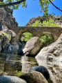
This walk follows the ancient transhumance trail that linked Aléria to Galéria. This path, which winds its way above the Fiume Golu (Golo), takes us in the footsteps of the goatherds who, moving from the mountain pastures to the coast, led their herds to graze far from the harsh winters of the peaks or the scorching heat of the plains. There are several ‘scala’ sections along the route, including the legendary climb from the pretty Accia Bridge, which spans the Ruda stream, before reaching Corscia.
Refuge A Sega – Corte
 Tourist office7.71 mi
+1,171 ft
-3,501 ft
4h 35
Moderate
Departure from Corte (Haute-Corse)
Tourist office7.71 mi
+1,171 ft
-3,501 ft
4h 35
Moderate
Departure from Corte (Haute-Corse)
The second stage of the “Circular Tour of Two Vallées” takes you into one of Corsica’s wildest and best-preserved valleys: the Tavignanu Valley.
From the A Sega mountain hut, situated on the banks of the Tavignanu, the path follows the river and descends gradually through a dense forest where Laricifolius pines and holm oaks grow side by side. Along the way, you’ll enjoy numerous viewpoints over the steep-sided gorges and pools of crystal-clear water that dot the river. Halfway along the route, you can stop for a break at the Rossulinu Footbridge before continuing on the less steep but equally spectacular section of the trail, which will gently lead you towards Corte.
The transhumance trail of the ancient Scala di Santa Regina
6.81 mi
+2,073 ft
-2,096 ft
4h 55
Moderate
Departure from Corscia (Haute-Corse)
A magical hike along the Scala di Santa Regina, in the heart of Corsica, on the D84 linking Ponte Castirla to Calacuccia. This is a fairly well-preserved transhumance trail featuring stone walls and numerous stone steps to help you navigate the few challenging sections of the route. The view over the Scala Santa Regina valley, where the Golo river winds its way through, is spectacular.
Corsica Stage 2: Refuge de A Sega to Albertacce
 7.82 mi
+1,768 ft
-2,795 ft
5h 10
Moderate
Departure from Corte (Haute-Corse)
7.82 mi
+1,768 ft
-2,795 ft
5h 10
Moderate
Departure from Corte (Haute-Corse)
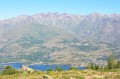
Second day of the hike between Corte and Porto.
The trail begins by climbing up to Bocca Arinella, where we discover our destination: after Lake Calacuccia, the village of Albertacce.
From the Tighiettu Refuge to Castellu di Vergio
 Association / Club / Walk leader
 9.04 mi
+2,703 ft
-3,648 ft
6h 30
Difficult
Departure from Albertacce (Haute-Corse)
9.04 mi
+2,703 ft
-3,648 ft
6h 30
Difficult
Departure from Albertacce (Haute-Corse)
Fifth stage ofthe GR®20, pushing on to the Col de Vergio, we are doing two 6-hour stages rather than one 4-hour and one 8-hour stage, and we will be using the accommodation at the Col de Vergio.
Monte Cinto
 7.51 mi
+4,944 ft
-4,918 ft
10 hrs
7.51 mi
+4,944 ft
-4,918 ft
10 hrs
 Very difficult
Departure from Haute-Corse
Very difficult
Departure from Haute-Corse
The highest peak in Corsica (2,706 metres) can be reached from the Haut-Asco resort after a difficult climb over rocky terrain reminiscent of the volcanic origins of Monte Cinto. However, from Pointe des Eboulis, continuing on to the highest point, you are rewarded with a spectacular view and a sumptuous panorama. An early start is necessary to avoid the clouds that can cling to the summit.
From the Asco Stagnu refuge to the Tighiettu refuge
 3.89 mi
+3,484 ft
-2,638 ft
6 hrs
3.89 mi
+3,484 ft
-2,638 ft
6 hrs
 Extremely difficult
Departure from Haute-Corse
Extremely difficult
Departure from Haute-Corse
Fourth stage ofthe GR®20with the Cirque de la Solitude pass. A place that leaves no one indifferent.
Please note: the facilities for descending and ascending the Cirque de la Solitude have been removed, making this a very challenging route.
Lake Nino from Poppaghia
 6.36 mi
+2,392 ft
-2,362 ft
5h 00
Difficult
Departure from Albertacce (Haute-Corse)
6.36 mi
+2,392 ft
-2,362 ft
5h 00
Difficult
Departure from Albertacce (Haute-Corse)
Please note: a hiker reported in August 2026 that access to the lake is prohibited due to forest fires. Check before setting off.
A climb to a high-altitude lake, set in beautiful mountain scenery. A varied route that starts in a pine forest, continues through rocky terrain and ends amidst pastures. This hike offers an alternative to the much busierGR®®20route, which starts from the Col de Vergio.
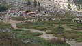
The Cappelaccia and Alzo sheepfolds as seen from the Frasseta Bridge
 6.61 mi
+2,641 ft
-2,644 ft
5h 20
Moderate
Departure from Corte (Haute-Corse)
6.61 mi
+2,641 ft
-2,644 ft
5h 20
Moderate
Departure from Corte (Haute-Corse)
You’ll be delighted by the unique view of the Cappelaccia sheepfolds. We are now at the highest point of the vast Alzo plateau and can enjoy a magnificent panoramic view stretching from Rotondo to Cinto, via Punta Artica and Paglia Orba. A large sign and red markings show us the way forward.
From Frasseta to the sheepfolds at E Grotelle
7.61 mi
+1,985 ft
-1,985 ft
5h 15
Moderate
Departure from Corte (Haute-Corse)
The E Grotelle Path
The only access route to the upper Restonica valley, this walk takes you to the famous sheepfolds of E Grotelle.
Following the storms last November, extensive damage has made the upper Restonica valley inaccessible by car from the Tagone Bridge (which was swept away by the flood).
Access to the E Grotelle sheepfolds is now via this walking route from La Frasseta (this is the same starting point as for the route leading to the Cappellaccia sheepfolds).
This trail can be taken either for a moderate-difficulty hike leading to the Grotelle sheepfolds, or to reach the start of the hike to the Melu and Capitellu lakes (which is now considered a challenging route). This trail runs along the upper Restonica valley and leads to the Grotelle sheepfolds.
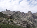
The Cirque des Waterfalls in the Restonica
 12.65 mi
+4,446 ft
-4,449 ft
8 hrs
Very difficult
Departure from Corte (Haute-Corse)
12.65 mi
+4,446 ft
-4,449 ft
8 hrs
Very difficult
Departure from Corte (Haute-Corse)
A more challenging hike than the one to Lac de Melo, as it takes you through the steep-sided valley of the Ruisseau de Rinoso and up to over 2,100 m on theGR® 20, before descending via Lac de Melo.
Only attempt this in good weather as, if it rains on the large slabs at around 2,000 m, it can be slippery.
20/05/2024: The Restonica Valley is no longer accessible by car! The start point is now at the final stop served by the shuttle bus (Pont de Frasseta).
Lakes Mélo and Capitello in Restonica
 11.46 mi
+3,783 ft
-3,783 ft
8h 35
Very difficult
Departure from Corte (Haute-Corse)
11.46 mi
+3,783 ft
-3,783 ft
8h 35
Very difficult
Departure from Corte (Haute-Corse)
A magnificent and unmissable hike.
Caution: the passage of ladders and cables before Lac Melo and the descent of this section may prove difficult for those not accustomed to using this equipment and also to stony paths.
20/05/2024: Hike modified. The Restonica valley is no longer accessible by car! The start is now at the last stop served by the shuttle bus(Pont de Frasseta). See practical information.
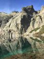
From Frasseta to the Melu and Capitellu lakes via Grotelle
 11.32 mi
+3,678 ft
-3,678 ft
8h 25
Very difficult
Departure from Corte (Haute-Corse)
11.32 mi
+3,678 ft
-3,678 ft
8h 25
Very difficult
Departure from Corte (Haute-Corse)
U chjassu di i lavi
The beautiful lakes of Melu and Capitellu are still accessible. It is now a challenging hike. Take on the challenge and your efforts will be rewarded!
The former starting point for this hike, from the Grotelle sheepfolds, is no longer accessible by vehicle due to the significant damage caused by storms Ciaran and Domingos. The starting point is now at the Frasseta bridge.
From Lake Melo to the Brèche de Capitello
 12.47 mi
+4,265 ft
-4,239 ft
9h 25
Very difficult
Departure from Corte (Haute-Corse)
12.47 mi
+4,265 ft
-4,239 ft
9h 25
Very difficult
Departure from Corte (Haute-Corse)
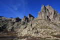
This is a very beautiful hike that allows you to discover the two lakes of Melo and Capitello with a view of the Brèche de Capitello. The view from the breach allows you to discover both sides of the massif.
20/05/2024: The Restonica Valley is no longer accessible by car! The starting point is now at the last stop served by the shuttle bus( Pont de Frasseta) . See practical information.
A circular route via Bocca di Guagnarola and Bocca di Cuccavera from Le Fer à Cheval
12.98 mi
+4,403 ft
-4,413 ft
9h 50
Very difficult
Departure from Albertacce (Haute-Corse)
A magnificent, physically demanding circular route passing by the Radule sheepfold (with its nearby waterfalls), heading towards the Cittulu Mountain Hut but branching off towards the Bocca di Guagnarola. A long descent to the Puscaghja Mountain Hut. Return via the Bocca Saltu and the Mare à Mare Nord, climbing back up to the Vergio Pass. It is possible to complete the route over two days, staying at the Puscaghja mountain hut.
From the Col de Vergio to the Manganu Refuge
 9.39 mi
+2,123 ft
-1,450 ft
6h 10
Moderate
Departure from Albertacce (Haute-Corse)
9.39 mi
+2,123 ft
-1,450 ft
6h 10
Moderate
Departure from Albertacce (Haute-Corse)
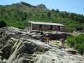
The sixth stage of ourGR®20. We pass by the beautiful Lake Nino. It is a long hike in terms of distance, but the elevation gain is easier than on previous days.
Lake Oriente and the Timozzu sheepfolds
 5.88 mi
+3,527 ft
-3,501 ft
5h 45
Difficult
Departure from Corte (Haute-Corse)
5.88 mi
+3,527 ft
-3,501 ft
5h 45
Difficult
Departure from Corte (Haute-Corse)
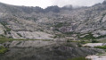
A challenging hike to one of Corsica’s most beautiful lakes, at an altitude of over 2,000 metres.
Please note: read the latest review dated August 2024.
Corsica Stage 5: Col de Vergio to Evisa
 7.12 mi
+597 ft
-2,470 ft
3h 50
Moderate
Departure from Albertacce (Haute-Corse)
7.12 mi
+597 ft
-2,470 ft
3h 50
Moderate
Departure from Albertacce (Haute-Corse)
After our break at the Col de Vergio, we head back towards the sea.
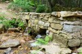
During this stage, we will cross the beautiful Aîtone forest with its swimming pools and paved paths in some places.
From Col de Vergio to Lac Nino
 11.29 mi
+3,064 ft
-3,064 ft
7h 50
Moderate
Departure from Albertacce (Haute-Corse)
11.29 mi
+3,064 ft
-3,064 ft
7h 50
Moderate
Departure from Albertacce (Haute-Corse)
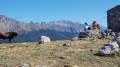
A very beautiful hike that allows you to walk along the ridges and discover Lake Nino in a beautiful valley surrounded by stone mountains.
Col de Vergio - Albertacce
 9.49 mi
+699 ft
-2,510 ft
5h 00
Moderate
Departure from Albertacce (Haute-Corse)
9.49 mi
+699 ft
-2,510 ft
5h 00
Moderate
Departure from Albertacce (Haute-Corse)
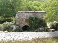
A quick detour via theGR®20allows you to discover the superb sheepfolds at Radule.
Ciuttulu di Mori refuge
9.58 mi
+2,444 ft
-2,421 ft
6h 30
Moderate
Departure from Albertacce (Haute-Corse)
View of the Gulf of Porto from the ridge, Paglia Orba mountain (the most beautiful in Corsica), Capu Tafunatu and its hole below the summit.
A beautiful hike on theGR®20.
The Riviseccu Sheepfolds (Rivisecco)
 5.58 mi
+1,814 ft
-1,798 ft
4h 10
Moderate
Departure from Corte (Haute-Corse)
5.58 mi
+1,814 ft
-1,798 ft
4h 10
Moderate
Departure from Corte (Haute-Corse)
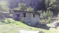
These sheepfolds, which are in very good condition, mark the end of a forest area. The group of sheepfolds forms a small hamlet of several well-restored huts. The surroundings are magnificent, with large rock formations and the Riviseccu stream.
Shaded throughout, the route follows an old forest track that climbs gradually through a forest where beech trees are omnipresent, in contrast to the Laricio pine trees along the stream.
Lake Nino via Bocca San Pedru
 10.99 mi
+2,631 ft
-2,608 ft
7h 20
Difficult
Departure from Albertacce (Haute-Corse)
10.99 mi
+2,631 ft
-2,608 ft
7h 20
Difficult
Departure from Albertacce (Haute-Corse)
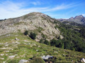
A legendary place in Corsica: Lake Nino and its pozzines.
You have a magnificent view of the Cintu massif, the Gulf of Cargèse, and if you are lucky, you will encounter beautiful wild horses.