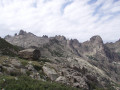
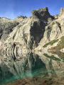
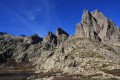
The Cirque des Waterfalls in the Restonica

A more challenging hike than the one to Lac de Melo, as it takes you through the steep-sided valley of the Ruisseau de Rinoso and up to over 2,100 m on theGR® 20, before descending via Lac de Melo.
Only attempt this in good weather as, if it rains on the large slabs at around 2,000 m, it can be slippery.

20/05/2024: The Restonica Valley is no longer accessible by car! The start point is now at the final stop served by the shuttle bus (Pont de Frasseta).

Details

4871372
Creation:
Last update:
Last review:
  • Walking
    Activity: Walking
  • ↔
    Distance: 12.65 mi
  • ◔
    Duration according to the author: 8 hrs 
  • ▲
    Difficulty: Very difficult

  • ⚐
    Back to start: Yes
  • ↗
    Ascent: + 4,446 ft
  • ↘
    Descent: - 4,449 ft

  • ▲
    Highest point: 7,126 ft
  • ▼
    Lowest point: 3,012 ft

Photos

Description of the walk

The starting point is at the Frasseta Bridge car park, accessible only by shuttle bus.

(S/E) The start of the trail, marked in red, winds its way up through the pine trees to reach a signpost.

(1) Turn off onto the path on the left (towards Grotelle), and continue to the Lamaghjosu Bridge, which spans the Restonica.

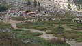
(2) Do not take the bridge, but carry on climbing. It is another 2 km to E Grotelle and its sheepfolds.

(3) Follow this to begin the classic route to Lac de Melo.

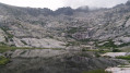
(4) After a few minutes, and just over a kilometre, turn left to head towards the Rinoso Stream, whose deep gorge can be seen about 200 to 300 metres higher up (see photo).
The route runs just along the left bank of this stream: you’ll need to climb about 300 m to reach a plateau at the entrance to the cirque.

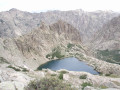
(5) From there, the slope levels out. Follow the stream until you approach Lake Rinoso. Risk of snowfields on the north face if it is very early in the season.

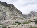
(6) Climb up the large granite slab roughly parallel to the outlet of Lac de Rinoso: that is to say, generally in a south-westerly direction, keeping parallel to the various small streams cutting across the slab.

Avoid venturing onto this very large slab if it is raining: water may be running off it from all directions. There are just under a hundred metres left to climb to reach theGR®20on the section between Manganu and Petra Piana, across some beautiful, short-grassed meadows that invite you to relax.

(7) Head back down following theGR®20, heading west, then south-west.

(8) Near Bocca a Soglia, leave theGR®20and follow the path on the right down to Lac de Melo.

(9) Take the path on the left: be careful, as there are ladders to climb down. Return to the junction where you started.

(4) Follow the path back the way you came to the car park (S/E).

Notes: as VisoRando has pointed out, since the road is closed, this considerably lengthens the walk.
Between control point 1899 m and the landmark (7), you are off the path and must climb, if possible, onto the huge granite slab.
“Do not attempt this section in the event of rain, even light rain, as there may be a layer of water a few centimetres deep at the foot of the slab, which could prevent you from gaining a firm footing. Do not attempt this section in fog or snow.
Thishike is for experienced walkers only.

Waypoints

  1. S/E : mi 0 - alt. 3,015 ft - Grotelle car park
  2. 1 : mi 0.41 - alt. 3,346 ft - Signpost: Turn-off towards Grotelle
  3. 2 : mi 2.98 - alt. 4,163 ft - Grottelle Bridge
  4. 3 : mi 3.73 - alt. 4,511 ft - Grottelle sheepfold car park
  5. 4 : mi 4.39 - alt. 4,997 ft - Junction of the circular loop
  6. 5 : mi 4.94 - alt. 5,912 ft - Base of the Cirque des Cascades
  7. 6 : mi 5.79 - alt. 6,837 ft - Little Lake of Rinoso
  8. 7 : mi 5.95 - alt. 7,126 ft - Arrival at the GR20
  9. 8 : mi 6.71 - alt. 6,693 ft - To the right - Bocca a Soglia
  10. 9 : mi 7.73 - alt. 5,636 ft - Starting point for both routes - Lake Melo
  11. S/E : mi 12.65 - alt. 3,012 ft - Grotelle car park

Notes

From 1 May 2024, we recommend taking the shuttle bus from Corte to reach the trailhead in the Restonica Valley. (Regarding the shuttle bus: check the details with the Tourist Office)
Shuttle bus stop: Frasseta

The north-facing aspect of the Rinoso valley makes this a challenging hike, especially if there is still snow around Lake Rinoso. So it’s best to go after mid-June.

I often talk about swimming, but you really have to be keen for this, as at this altitude the water is cold – particularly on the two occasions I went there when the weather was rather overcast.
Please note: this is a fairly difficult high-mountain route, recommended only for experienced walkers.

(9) If you want to avoid the ladders, take the path on the right, which also leads to (4).

Remember to take water with you.
Please note, you may find yourself alone for much of the day and in a remote area.
A spectacular setting that offers a nice change from just visiting Lac de Melo.
Set off early in the morning so you can drive up, as once the car park is full, you’ll have to complete the journey by shuttle bus.
A circular walk in a wild, uncrowded area, except for the final stretch which takes you past Lac de Melo.

Worth a visit

Lake Capitello.

Always be cautious and plan ahead when you're outdoors. Visorando and the author of this route cannot be held responsible for any accidents occurring on this route.

The GR® and PR® markings are the intellectual property of the Fédération Française de Randonnée Pédestre.

Reviews and comments

3.9 / 5
Based on 3 reviews

Reliability of the description
3.7 / 5
Ease of following the route
3 / 5
Route interest
5 / 5
Risk
Risk
• Edited:

Overall rating : 4 / 5

Date of your route : Oct 02, 2022
Reliability of the description : ★★★★☆ Good
Ease of following the route : ★★★☆☆ Average
Route interest : ★★★★★ Very good
Very busy route : No

Hello,

Thank you for suggesting this route, which clearly helps to avoid the ‘crowds’ on the classic route!
As mentioned in some of the comments, I ended up doing just under 11 km but with a significant elevation gain (over 1,400 m) (though as I got a bit lost, that might have played a part...).

I followed the suggested circular route (Lake Rinoso – Lake Melo):
- The first section was fairly straightforward up to Lake Rinoso (apart from perhaps the section just before point 2, which isn’t easy to spot) – that didn’t stop me getting lost, but I’ve only got myself to blame ;
- To reach the GR 20 from the large Rinoso Lake, I couldn’t find a way across the large slab. I preferred to follow the route marked on ‘OpenStreetRandonné’, which involves climbing – or rather, scrambling – up to the summit at the far end of Grand Lac de Rinoso (for experienced walkers, you clearly have to scramble most of the way and there are no signposts, so you have to rely on your instincts…). Once at the summit, you need to follow the ridge line to rejoin the GR 20 at the Col de Rinoso, and after that it’s an easy walk to the end of the route.

The effort is more than rewarded by those stolen moments at Lake Rinoso, feeling as though you’re alone in the world with a (2) lake all to yourself!
Thank you very much!

Machine-translated

marila13
marila13
• Edited:

Overall rating : 3.7 / 5

Date of your route : Jun 03, 2022
Reliability of the description : ★★★☆☆ Average
Ease of following the route : ★★★☆☆ Average
Route interest : ★★★★★ Very good
Very busy route : No

Please note that the walking time and distance are underestimated. We’re experienced walkers and, even though we did the circular route in the opposite direction to that indicated (the scenery was magnificent either way) – heading up first to Lake Mélo and then down via Lake Ronoso and the large rock slabs – it took us 7 hours in total (with just a three-quarter-hour break for a picnic) and our Garmin GPS recorded 11 km with 950 m of elevation gain.
The walk is absolutely stunning but should only be attempted if you’re a confident walker; there’s a high risk of falling, whether on the sections where you’re moving from boulder to boulder (the GR20 section), the snowfields you have to cross, or the slabs, which are slippery, especially on the descent.

Machine-translated

Sabwilly
Sabwilly
• Edited:

Overall rating : 4 / 5

Date of your route : Jul 23, 2021
Reliability of the description : ★★★★☆ Good
Ease of following the route : ★★★☆☆ Average
Route interest : ★★★★★ Very good
Very busy route : No

A magnificent hike. The Rinosu Lakes are well worth a visit, but you have to work for them!
We followed the cairns to Lac du Petit Rinosu. It’s a little-used path; we met a couple who’d done the whole route, coming back down via Lac de Melo. We couldn’t find the path leading back up from Lac du Rinosu to the GR20. It’s no longer signposted at all. We decided to head back down the same way (over 7 hours there and back, covering 11 km). Generally speaking, the cairns are visible all the way along.
We met the couple again on the way back towards the Grotelle sheepfold (an 8-hour hike and 13 km).
So we were a long way off the 4 hours 40 minutes and 8 km. Mind you, we were with our 11-year-old son, which might explain the time but not the distance.
Nevertheless, it’s a superb hike, offering a change from the extremely busy Melo and Capitello route.

Machine-translated

Other walks in the area

For more walks, use our search engine .

The GPS track and description are the property of this route's author. Please do not copy them without permission.