From Tuani to Corte via Forca di A Lancia and Punta di Zurmulu

U chjassu di u Finellu (The Finello Trail)

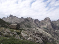
A challenging hike that takes you along the ridges, following the watershed between the Restonica and the Tavignanu rivers, via Punta di u Finellu, to the summit overlooking the town of Corte known as Zurmulu.
The route starts in the Restonica valley, at Tuani, and finishes in Corte.

Details

n°44478666
Creation:
Last update:
Last review:
  • Walking
    Activity: Walking
  • ↔
    Distance: 7.01 mi
  • ◔
    Average duration: 6h 25 
  • ▲
    Difficulty: Difficult

  • ⚐
    Back to start: No
  • ↗
    Ascent: + 3,638 ft
  • ↘
    Descent: - 4,403 ft

  • ▲
    Highest point: 5,141 ft
  • ▼
    Lowest point: 1,365 ft

Photos

Description of the walk

Take the shuttle bus from Corte to reach the start of the trail in the Restonica Valley. The starting point is near the Tuani campsite, 6 km into the Restonica Valley – starting altitude: 650 m. (Regarding the shuttle bus: check the details with the Tourist Office).

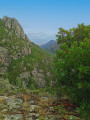
(S) From Tuani, take the path that climbs uphill. This path, following an old track, winds its way along the northern slopes of the Restonica. Continue to the ridge.

(1) Take the path on the right towards Corte. To the left, the path leads to the sheepfolds at Cappellaccia. You’ll reach the foot of Punta a u Finellu.

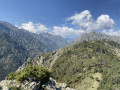
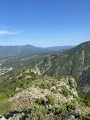
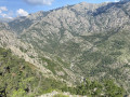
(2) Continue along the path. Following this ridge route, you’ll reach a viewpoint overlooking both valleys.

(3) Keep going in the same direction and, once you reach the end of the ridge, a very easy climb will take you to the summit of Zurmulu.

(4) The panoramic view over Corte and the surrounding area is exceptional. On a clear day, you can also see the sea (towards the eastern plain). On descending from the small summit, retrace your steps a few metres back to the pass to take the path that leads down towards the pine trees, in the direction of the Tavignanu valley, and reach Corte at a place called Baliri (E).

Continuing along the heritage trail for a further 5 minutes, you’ll reach the Pont Vieux, situated near the entrance to the Restonica Valley.

Waypoints

  1. S : mi 0 - alt. 2,156 ft - Tuani - Restonica
  2. 1 : mi 2.04 - alt. 5,118 ft - Ridge – junction
  3. 2 : mi 2.74 - alt. 4,856 ft - Punta a u Finellu
  4. 3 : mi 5.1 - alt. 3,228 ft - View over the two valleys
  5. 4 : mi 5.59 - alt. 3,071 ft - Punta di Zurmulu
  6. E : mi 7.01 - alt. 1,365 ft - Baliri – Corte - Tavignano (fleuve)

Notes

This route is long, so make sure you bring water, a good snack and something to keep you warm in case it’s a bit windy on the ridges. Don’t forget your camera (or mobile phone) as the views are exceptional!

Worth a visit

You’ll be able to see several peaks in the distance, including Monte Rotondu, Lombarducciu and Paglia Orba...

Reviews and comments

4 / 5
Based on 2 reviews

Reliability of the description
4 / 5
Ease of following the route
3.5 / 5
Route interest
4.5 / 5
Gare aux chemins
Gare aux chemins

Overall rating : 3.3 / 5

Date of your route : Sep 10, 2024
Reliability of the description : ★★★☆☆ Average
Ease of following the route : ★★☆☆☆ Disappointing
Route interest : ★★★★★ Very good
Very busy route : No

A magnificent route along the ridges
But be careful once you’re on the ridges:
- the yellow markings often disappear, leading you down the wrong path
- Cairns sometimes make up for poor signposting, but can also be misleading when there are no markings
- the path is sometimes vague
- at times, these are nothing more than animal tracks, which are extremely steep: my GPS showed gradients of 70 per cent
- there are several sections where you have to climb down

Machine-translated

Laurent Roux
Laurent Roux

Overall rating : 4.7 / 5

Date of your route : Jun 01, 2024
Reliability of the description : ★★★★★ Very good
Ease of following the route : ★★★★★ Very good
Route interest : ★★★★☆ Good
Very busy route : No

A very beautiful but challenging hike. There’s a significant amount of ascent and descent. Once on the ridge, there are stunning views and wild scenery. However, be aware that there are some exposed sections and plenty of rocks.

Machine-translated

Other walks in the area

For more walks, use our search engine .

The GPS track and description are the property of this route's author. Please do not copy them without permission.