GR® 20 – Stage 06: from Castellu di Vergio to Manganu via Capu a u Tozzu

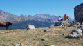
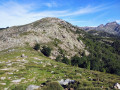
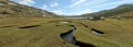
Stage 6 ofthe GR® 20 between Castellu di Vergio and the PNRC Manganu mountain hut. The route passes by the sublime Lake Nino and its horses. We chose to take a short detour via Capu a u Tozzu, which offers a superb 360° panoramic view of the peaks of northern Corsica (Cinto, Paglia Orba), Lake Nino and the Rotondo.

Details

n°107060
Creation:
Last update:
Last review:
  • Walking
    Activity: Walking
  • ↔
    Distance: 9.95 mi
  • ◔
    Average duration: 6h 50 
  • ▲
    Difficulty: Difficult

  • ⚐
    Back to start: No
  • ↗
    Ascent: + 2,602 ft
  • ↘
    Descent: - 1,955 ft

  • ▲
    Highest point: 6,568 ft
  • ▼
    Lowest point: 4,347 ft
  • ⚐ Country: France
  • ⚐ City: Albertacce (20224)
  • ⚑
    Start: N 42.286297° / E 8.893434°
  • ⚑
    End: N 42.220067° / E 8.980402°
  • ❏
    IGN map(s): Ref. 4150OT, 4151OT, 4250OT, 4250OTR, 4251OT, 4251OTR
  • Hour-by-hour weather

Photos

Description of the walk

(S) From the Castellu di Vergio lodge-campsite, take the RD 84 road eastwards for about a hundred metres, then theGR® on the right, which enters the forest heading south. The path runs through the forest and does not involve any significant elevation gain; it is a very ‘smooth’ stretch that can offer a beautiful sunrise over Lake Albertacce. Continue straight on, following the red-and-white markings. When you reach a fairly major junction, turn right (south) to climb up to Bocca San Pedru via a few hairpin bends.

(1) From Bocca San Pedru, continue climbing up the southern slope of the ridge heading south-east. Here you’ll find trees leaning over due to the wind. The path crosses to the other side of the ridge to go round Cime u Tritore. Then climb up towards Serra San Tomaghiu before crossing back over to the southern side.

(2) As you cross over, continue for a few metres, then leave theGR® on your right and follow the cairns along the ridge to climb up to Capu a u Tozzu. The climb is not straightforward over large boulders, but by heading north-east and staying to the south of the ridge, you can reach the summit without difficulty.

(3) Head south-east and descend along the tracks down the grassy slopes towards Bocca â Reta.

(4) rejoin theGR® heading east to descend to Lake Nino.

(5) You’ll pass close to the source of the Tavignano (river).

(6) The newGR® route bypasses Lake Nino to the north. Follow the signposting to the left. Be careful, as some areas are very marshy! Follow the path along the left bank of the lake and then the Tavignano river towards the Inzecche sheepfold. At the sheepfold, keep to the right to reach the Tavignano.

(7) First turn left then right to see the Inzecche sheepfolds, then cross the Tavignano to rejoin the old route and head down the right bank. The path gradually moves away from the Tavignano and leads to the Vaccaghia sheepfold (where cheese is sold).

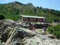
(8) From the sheepfold, cross the grassy plain in front of you heading south-east to reach the Manganu Refuge after a short climb. Cross the stream via a footbridge to reach the refuge (E).

Waypoints

  1. S : mi 0 - alt. 4,603 ft - Take the RD 84 road eastwards - Hotel-Refuge du Col de Vergio
  2. 1 : mi 2.66 - alt. 4,764 ft - Bocca San Pedru
  3. 2 : mi 4.38 - alt. 5,935 ft - Serra San Tomaghiu
  4. 3 : mi 4.84 - alt. 6,568 ft - Capu a u Tozzu
  5. 4 : mi 5.14 - alt. 6,178 ft - Bocca â Reta
  6. 5 : mi 5.17 - alt. 6,161 ft - Tavignano (fleuve)
  7. 6 : mi 5.81 - alt. 5,794 ft - Lac de Nino (Lake Nino)
  8. 7 : mi 7.23 - alt. 5,646 ft - Crossing the Tavignano - Bergeries des Inzecche
  9. 8 : mi 8.66 - alt. 5,246 ft - Vaccaghia sheepfold
  10. E : mi 9.95 - alt. 5,249 ft - Refuge de Manganu

Notes

In theory, it’s possible to camp at the Vaccaghia sheepfold, which sells cheese and offers a small selection of provisions.

Worth a visit

Stunning views from Capu a u Tozzu. Lake Nino and its horses… it’s magical!
A few spots to cool off in the Tavignano. The same goes for under the footbridge at the Manganu Refuge.

Always be cautious and plan ahead when you're outdoors. Visorando and the author of this route cannot be held responsible for any accidents occurring on this route.

The GR® and PR® markings are the intellectual property of the Fédération Française de Randonnée Pédestre.

Reviews and comments

5 / 5
Based on 1 review

Reliability of the description
5 / 5
Ease of following the route
5 / 5
Route interest
5 / 5
Christophe L
Christophe L

Overall rating : 5 / 5

Date of your route : Aug 06, 2021
Reliability of the description : ★★★★★ Very good
Ease of following the route : ★★★★★ Very good
Route interest : ★★★★★ Very good
Very busy route : Yes

We only walked as far as Lake Nino; allow about 3½ hours for the ascent without stops, without taking the detour via Capo a u Tozzu because of the gusty wind, and 3 hours for the descent. The climb between Bocca San Pedru and Bocca a Reta is long and stony, but you’re rewarded shortly afterwards with a view of Lake Nino and its pastures, where cows were grazing as we passed. On the descent, the clear weather gave us a magnificent view from Bocca San Pedru of Monte Cinto to the north and, in the distance to the south, as far as the Gulf of Ajaccio!
This route is longer but far more pleasant than the one from the Poppaghia forest lodge (Visorando walk no. 90509), which is shorter but much steeper.

Machine-translated

Other walks in the area

For more walks, use our search engine .

The GPS track and description are the property of this route's author. Please do not copy them without permission.