Scala di Santa Regina to Corscia, from Funtana Vignente

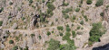
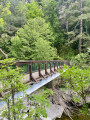
This walk follows the ancient transhumance trail that linked Aléria to Galéria. This path, which winds its way above the Fiume Golu (Golo), takes us in the footsteps of the goatherds who, moving from the mountain pastures to the coast, led their herds to graze far from the harsh winters of the peaks or the scorching heat of the plains. There are several ‘scala’ sections along the route, including the legendary climb from the pretty Accia Bridge, which spans the Ruda stream, before reaching Corscia.

Details

1785709
Creation:
Last update:
Last review:
  • Walking
    Activity: Walking
  • ↔
    Distance: 5.93 mi
  • ◔
    Average duration: 4h 20 
  • ▲
    Difficulty: Moderate

  • ⚐
    Back to start: Yes
  • ↗
    Ascent: + 1,847 ft
  • ↘
    Descent: - 1,844 ft

  • ▲
    Highest point: 2,904 ft
  • ▼
    Lowest point: 1,624 ft
  • ⚐ Country: France
  • ⚐ City: Corscia (20224)
  • ⚑
    Start/End: N 42.374131° / E 9.080099°
  • ❏
    IGN map(s): Ref. 4250OT, 4250OTR
  • Hour-by-hour weather

Photos

Description of the walk

The starting point for this walk is on the side of the RD 84 (which links Ponte Castirla to Calacuccia), at Funtana Vignente (marked by a large tree and a fountain). Please note: there are only two parking spaces at this point.

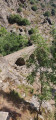
(S/E) The walk begins on a path leading uphill from Funtana Vignente. Follow the regular signposting throughout the route, consisting of two horizontal stripes in pink and purple. The path is very easy to follow and has no junctions.

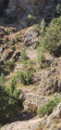
(1) At Pont di l’Accia, the main ascent begins in a series of gentle hairpin bends.

(2) At the Fork in the road, ignore the path climbing to the right (signpost: Corscia Haut) and head straight on (signpost: Corscia – direct route). Continue following the pink and purple markings.

(3) At the next Fork in the road, beneath the power line, ignore the path leading down to the left and follow the main track straight ahead (markings) to reach the first houses in the village and a tarmac road, which you should follow to the left.

(4) Leave the tarmac road as it heads downhill and take the small, steep path on the right which leads to Corscia Town Hall.

(5) At the tarmac road, turn right and walk past the town hall. Continue until you reach the bend to the left.

(6) Leave the road and turn right onto a sandy track leading out of the village.

(7) Leave the track and take the small path climbing to the left, which rejoins the track a little further up. Continue along this track to an X-shaped junction.

(8) Ignore the track that turns left and the path leading off opposite, and take a steep path to the right that descends, with a broken gate at the start. Follow the signposts and rejoin the path you took on the way there a little further down.

(2) Turn left and follow the same path as on the way out to reach the Funtana Vignente (S/E).

Waypoints

  1. S/E : mi 0 - alt. 1,624 ft - Small car park on the RD 84, Funtana Vignente
  2. 1 : mi 1.14 - alt. 1,818 ft - Accia Bridge – start of the Scala climb
  3. 2 : mi 2.32 - alt. 2,644 ft - Crossroads of the circular loop
  4. 3 : mi 2.61 - alt. 2,654 ft - Fork in the road – turn right
  5. 4 : mi 2.92 - alt. 2,713 ft - A short, steep path on the right
  6. 5 : mi 2.99 - alt. 2,789 ft - Opposite Corscia Town Hall, on the right
  7. 6 : mi 3.05 - alt. 2,815 ft - At the left-hand bend, take the track on the right
  8. 7 : mi 3.25 - alt. 2,818 ft - Path on the left
  9. 8 : mi 3.47 - alt. 2,904 ft - At the crossroads, take the path leading down to the right
  10. S/E : mi 5.93 - alt. 1,627 ft - Small car park on the RD 84, Funtana Vignente

Notes

Make sure you take plenty of water with you. Apart from Funtana Vignente at the start, there are no water sources along the way.
The path offers very little shade. Bring a hat.

Worth a visit

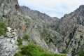
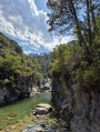
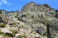
Throughout the route, the path winds high above the Golo Valley, offering magnificent views of this steep-sided gorge.
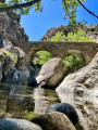
(1) The pretty Accia Bridge spans the Ruda stream. There are natural pools below. A lovely viewpoint overlooking the winding staircase of steps to be climbed.
(6) (7) A beautiful panoramic view over the valley and the village of Corscia, whose hamlets cling to the hillside.

Reviews and comments

4.6 / 5
Based on 3 reviews

Reliability of the description
4.7 / 5
Ease of following the route
4.3 / 5
Route interest
4.7 / 5
smashdc
smashdc

Overall rating : 4.3 / 5

Date of your route : Jun 03, 2025
Reliability of the description : ★★★★☆ Good
Ease of following the route : ★★★★☆ Good
Route interest : ★★★★★ Very good
Very busy route : No

/!\ After passing through the village on a dirt road, it is difficult to see the path (at the level of a pylon, I think), even though I followed the GPX track that indicates this point.
It's a steep descent through dense vegetation!
Walking sticks are recommended and you can't really see the path very well... You can't continue straight ahead because it will make the route longer.
There may be flexible wire fences, forcing you to turn back.

** You may need to go a little further, about fifty metres, to see if there is another passage.
I recommend trying to look for one (even though I did continue on).
The GPX track seems to be slightly off compared to the map.
In any case, it's a steep descent through dense vegetation and I didn't see anything that looked like a path!
Then, we take the same path as on the way there, which is very beautiful and we do it again without hesitation.

A top hike with this paved trail and retaining walls up to 8 or 10 metres high! Superb landscapes in a typical environment :-)
🚀 The full discovery is here ✔️ Top Panoramas ✨
https://youtu.be/TMsa9DfspiA

there are three parking spaces, or two or three more spaces further away near the bridge.
There are also magnificent flowers. Low view of the gorges too!
It may not look like much, but it's quite a climb... It goes down to the bridge and then zigzags back up again ;-)
Hardly any shade.

11.1 km & 635 m elevation gain/loss

Machine-translated

oponcin
oponcin

Overall rating : 5 / 5

Date of your route : Aug 26, 2023
Reliability of the description : ★★★★★ Very good
Ease of following the route : ★★★★★ Very good
Route interest : ★★★★★ Very good
Very busy route : No

One of Corsica’s most beautiful trails in the Santa Regina Gorge
captured by drone: https://youtu.be/z2lRBPw6XEk?si=5LawJb_X...
In summer: best done early in the morning
a transhumance track, paved in places, overlooking the road and the river.

Machine-translated

Polo1
Polo1

Overall rating : 4.3 / 5

Date of your route : Aug 08, 2023
Reliability of the description : ★★★★★ Very good
Ease of following the route : ★★★★☆ Good
Route interest : ★★★★☆ Good
Very busy route : No

A lovely walk along the ‘Chemin de terre et de pierre’ in the heart of the Calacuccia Valley.
Please note: the circular route through the town of Corsia between points 4 and 8 is of little interest other than the chance to walk through Corsica’s highest town.
At point 8, the descent back down to point 2 is no longer very well signposted, and a small makeshift barrier designed to keep animals out might give the impression that the path is closed. But that’s not the case at all; you simply need to follow the GPS route for the walk.
Throughout the route, the yellow markings (which have replaced the old orange and mauve markings) clearly show the way (except between points 8 and 2).
It’s also worth noting the misleading sign at the start of the walk, where the sign states it takes 1h30 to reach Corsia, rather than the 3h climb.
We climbed with a child of just under three years old on our backs; it’s a steep climb, but you don’t need to use your hands.
The descent is very easy and quick.
Make sure you bring water as there isn’t much shade along the route.
Do make sure to stop at point 1 for a quick dip in a magical setting.

To sum up, the scenery between points 1 and 3 is absolutely stunning and well worth the hike. And there’s an exceptional spot for a swim at point 1.

Machine-translated

Other walks in the area

For more walks, use our search engine .

The GPS track and description are the property of this route's author. Please do not copy them without permission.