Refine your search for walks in Laviolle
Laviolle walks


 Ruins of the Rouyon farm as seen from Laviolle
 Visorando Member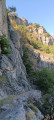
 6.01 mi
 +1,627 ft
 -1,634 ft
 4h 10
4h 10
 Moderate
 Departure from Laviolle (Ardèche)
A hike of moderate physical difficulty along the steep paths of the Ardèche Hautes Cévennes, offering incredible views over the Volane valley. A magnificent, vertiginous section requires caution but also calls for silence to minimise disturbance to nesting birds. The mid-mountain forest cover and refreshing stops by the streams make it very pleasant in summer.
Le Champ de Mars - on the heights of Antraigues-sur-Volane
 Tourism professional
 11.34 mi
+2,740 ft
-2,713 ft
7h 35
11.34 mi
+2,740 ft
-2,713 ft
7h 35
 Difficult
Departure from Antraigues-sur-Volane (Ardèche)
Difficult
Departure from Antraigues-sur-Volane (Ardèche)
"Champ" is a deformation of "Cham": a rocky, bare plateau.
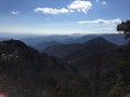
From this plateau, the Monts d'Ardèche appear as if shaped by geological forces, at the centre of a gigantic amphitheatre formed by the Cévennes, the volcanoes of Auvergne, the Vercors and the Alps. Monumental landmarks in the history of the Earth. A grandiose scene where the presence of man seems very discreet, yet his mark is clearly there, engraved in the landscape. Wild valleys with crystal-clear waters.
Le Champ de Mars – Le Mazoyer
 7.87 mi
+2,136 ft
-2,133 ft
5h 30
Moderate
Departure from Marcols-les-Eaux (Ardèche)
7.87 mi
+2,136 ft
-2,133 ft
5h 30
Moderate
Departure from Marcols-les-Eaux (Ardèche)
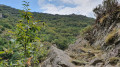
A circular walk offering magnificent 360° views of the Ardèche mountains… provided, of course, that the sky is clear.
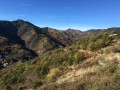
Circular Loop of Antraigues-sur-Volane: from Bise to the Col d'Aizac
 13.65 mi
+3,563 ft
-3,353 ft
9h 25
Difficult
Departure from Genestelle (Ardèche)
13.65 mi
+3,563 ft
-3,353 ft
9h 25
Difficult
Departure from Genestelle (Ardèche)
First circular stage of the Grand Boucle d'Antraigues-sur-Volane, which takes you from Bise, a small hamlet at the bottom of the valley, to Aizac, a small village in the Cévennes of the Ardèche, perched on its pass between Volane and Besorgues.
With crystal-clear rivers, passes offering breathtaking views and numerous hamlets along the way, the mountains are far from barren: life, water and nature are everywhere.
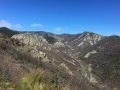
The Antraigues-sur-Volane circular route
 27.49 mi
+6,821 ft
-6,831 ft
2 days
Difficult
Departure from Genestelle (Ardèche)
27.49 mi
+6,821 ft
-6,831 ft
2 days
Difficult
Departure from Genestelle (Ardèche)
A circular two-day tour in the Cévennes of the Ardèche.
Antraigues-sur-Volane: a picturesque village full of character perched on a rocky outcrop, about fifteen kilometres north of Aubenas. It is also known as the home of the late poet Jean Ferrat.
This two-day hike will take you on a journey to discover ‘his’ mountain, the stone walls, the paved slanting streets, the chestnut groves and the steep slopes leading down to deep valleys: the Volane, the Bise and the Mas. Water everywhere.
Suc de Montivernoux
 3.54 mi
+653 ft
-636 ft
2h 10
3.54 mi
+653 ft
-636 ft
2h 10
 Easy
Departure from Mézilhac (Ardèche)
Easy
Departure from Mézilhac (Ardèche)
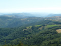
A short, easy walk offering a stunning 360° view from the summit of the knoll of Montivernoux.
The summit of Rouyon from Aizac
 3.86 mi
+1,516 ft
-1,516 ft
3h 05
Moderate
Departure from Aizac (Ardèche)
3.86 mi
+1,516 ft
-1,516 ft
3h 05
Moderate
Departure from Aizac (Ardèche)
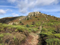
A lovely walk along the ridges between Bézorgue and Volane.
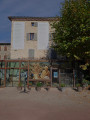
Antraigues-sur-Volane, Jean Ferrat’s adopted village
 2.60 mi
+407 ft
-407 ft
1h 35
Easy
Departure from Antraigues-sur-Volane (Ardèche)
2.60 mi
+407 ft
-407 ft
1h 35
Easy
Departure from Antraigues-sur-Volane (Ardèche)
Adopted by the famous singer Jean Ferrat, who made his home here, this charming little village overlooks the Volane Valley and offers an experience rich in history and emotion. A route that allows you to stroll through picturesque narrow streets, discover various geological sites, and pay your respects at the grave of this singer-songwriter.
The ridges of Labastide-sur-Bésorgues
7.93 mi
+2,123 ft
-2,119 ft
5h 30
Moderate
Departure from Labastide-sur-Bésorgues (Ardèche)
Superb hike on the Cime de Rouyon and the Rocher de Faux-Fay. Splendid panorama on the sides of the Bésorgues valley where paths, paved slanting streets, terraces and pastures draw the Ardèche mountain landscape: exceptional and wild landscape, magnificent basalt rocks, streams, torrents, impetuous waterfalls.
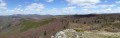
The Cheylard rock in Labastide-sur-Bésorgues
 10.35 mi
+2,831 ft
-2,844 ft
7h 15
Difficult
Departure from Labastide-sur-Bésorgues (Ardèche)
10.35 mi
+2,831 ft
-2,844 ft
7h 15
Difficult
Departure from Labastide-sur-Bésorgues (Ardèche)
This magnificent hike in Vivarais Cévenol follows trails and ridge paths offering beautiful views. The Bésorgues river, blocked by basalt flows, has shaped some remarkable sites. The ancient lava lake of Ranc Ranier and the prismatic neck of the Cheylard rock, from which you can enjoy a vast and exceptional 360° panorama, are geological curiosities not to be missed.
Tour of Ranc Chabrier and Mas Valley
8.57 mi
+1,624 ft
-1,624 ft
5h 20
Moderate
Departure from Antraigues-sur-Volane (Ardèche)
A very beautiful hike in volcanic Ardèche: magnificent scenery, rocky peaks, scree, clapas. The lava flow at Antraigues, from the young Aizac volcano (approximately 80,000 years old), invaded the Mas, Bise and Volane valleys due to the steepness of the terrain, leaving numerous traces of this eruptive period.
The promontory on which the village is built, with its variety of colours and shapes, is surprising.
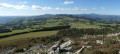
Loop from the Col de Mézilhac to Lachamp-Raphaël, Knoll of Montivernoux
 9.62 mi
+2,326 ft
-2,303 ft
6h 25
Moderate
Departure from Mézilhac (Ardèche)
9.62 mi
+2,326 ft
-2,303 ft
6h 25
Moderate
Departure from Mézilhac (Ardèche)
This is a beautiful hike through wild, unspoilt landscapes in the heart of the Ardéchoise mountains, with all their splendour and curiosities. The flora and fauna are rich and diverse, with some rare protected species.
On a clear day, the summit of Montivernoux offers an exceptional panorama of the Cévennes, the Monts Lozère, the Tanargue, the knolls of the Ardèche plateau, Mont Gerbier de Jonc, Mézenc, Montfol, Mont Ventoux, the Alps and Mont Blanc.
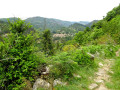
Around the volcano and Château de Craux
 4.70 mi
+1,053 ft
-1,056 ft
3h 05
Moderate
Departure from Antraigues-sur-Volane (Ardèche)
4.70 mi
+1,053 ft
-1,056 ft
3h 05
Moderate
Departure from Antraigues-sur-Volane (Ardèche)
You will discover a magnificent view of the Hautes Cévennes Ardéchoises and the land of young volcanoes.
The Château de Craux is located in the commune of Genestelle, at an altitude of around 650 m. It is built on the crater of the volcano (neck). It stands in the middle of vast meadows, surrounded by a superb chestnut grove, and overlooks the Volane and Sandron valleys.
6/10/2023 Moderator's message: at point (4) hike modified because the educational trail around the neck plateau has been closed.
La Cham de Mars from Mézilhac
 7.07 mi
+873 ft
-863 ft
4h 00
Moderate
Departure from Mézilhac (Ardèche)
7.07 mi
+873 ft
-863 ft
4h 00
Moderate
Departure from Mézilhac (Ardèche)
This hike on the Ardèche plateau is relatively flat and takes you to a summit with superb 360° views of the Massif Central and the Alps, and even Mont Blanc on a clear day.
Please note: the route on the way there has been designed to showcase the beauty of the paths and landscapes. The paths are not marked and can sometimes be difficult to find. A good knowledge of the area and maps is necessary. The return via theGR® de Pays is easier and more direct.
The Champ de Mars and the Col des Quatre Vios
 Association / Club / Walk leader
 8.00 mi
+1,535 ft
-1,509 ft
5h 00
Moderate
Departure from Mézilhac (Ardèche)
8.00 mi
+1,535 ft
-1,509 ft
5h 00
Moderate
Departure from Mézilhac (Ardèche)
The Champ de Mars is a superb viewpoint over the Ardèche mountains. Easy to access, it offers a 360° panoramic view with an orientation table allowing you to see all the surrounding mountains as far as the Vercors.
Sainte-Marguerite – via the summit: from the Col d’Aizac to Neyrac-les-Bains
 11.69 mi
+2,598 ft
-3,471 ft
7h 40
Moderate
Departure from Aizac (Ardèche)
11.69 mi
+2,598 ft
-3,471 ft
7h 40
Moderate
Departure from Aizac (Ardèche)
Second stage of the Sainte-Marguerite circular route, which takes you back via a different route to your starting point from the previous day: Neyrac-les-Bains.
The first section is high up, taking you over the summit – the highest point of the two-day walk – offering breathtaking views of the Lower Ardèche, the Tanargue, the Ardèche Plateau and the surrounding valleys.
The second section focuses more on built and/or historical heritage, featuring the village of Niègles, the castles of Vantadour and Hautségur, and the Via Domitia.
Antraigues-sur-Volane Circular Loop: from the Col d’Aizac to Bise
 13.84 mi
+3,255 ft
-3,478 ft
9h 10
Difficult
Departure from Aizac (Ardèche)
13.84 mi
+3,255 ft
-3,478 ft
9h 10
Difficult
Departure from Aizac (Ardèche)
The second circular stage of the Grand Boucle d’Antraigues-sur-Volane, which, via a different route, takes you back to your starting point from the previous day: Bise. You’ll discover, in particular, the more rocky side of the Volane Valley upstream from Antraigues-sur-Volane. Then there are sections along the ridges, inviting you to contemplate the wild natural surroundings.
The tour of the Lower Besorgues in the Ardèche Cévennes
 13.40 mi
+2,776 ft
-2,776 ft
8h 35
Difficult
Departure from Aizac (Ardèche)
13.40 mi
+2,776 ft
-2,776 ft
8h 35
Difficult
Departure from Aizac (Ardèche)
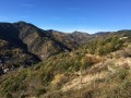
The Besorgues rises on the edge of the Ardèche Plateau, south of Lachamp Raphaël (the highest village in the Ardèche: 1,320 m). The steep slopes running southwards give this seemingly peaceful river a torrential character during ‘Cévennes downpours’! Much further down (alt. 280 m), it flows into the Volane, which in turn feeds into the Ardèche.
It is this lower stretch that we shall be following today, rarely at the bottom of the valley, but mainly along the surrounding ridges.
The Three Valleys - From Aizac to Saint-Julien-du-Serre
 12.33 mi
+2,195 ft
-3,173 ft
7h 35
Moderate
Departure from Aizac (Ardèche)
12.33 mi
+2,195 ft
-3,173 ft
7h 35
Moderate
Departure from Aizac (Ardèche)
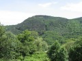
This second stage of the Three Valleys circular walk takes you to Saint-Julien-du-Serre, the starting point of the previous day’s walk, via a different route.
Following the ridge for the first part, you will once again descend into the coolness of the three valleys. You’ll pass through the magnificent hamlet of Thieurre, perched on its rocky outcrop offering breathtaking views of the Lower Ardèche, the Volane Valley and the Besorgues Valley.
Picnic at the Rocher de Casse-Noix
 6.78 mi
+1,788 ft
-1,791 ft
4h 40
Moderate
Departure from Aizac (Ardèche)
6.78 mi
+1,788 ft
-1,791 ft
4h 40
Moderate
Departure from Aizac (Ardèche)
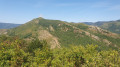
A short, easy hike in the Ardèche Cévennes, to discover a few hamlets, pretty chestnut groves, a few streams with crystal-clear water and, above all, one of the lesser-known highlights of the Besorgues valley: the Rocher de Casse-Noix (854 m). The name alone makes us want to go there for a picnic.
The Aizac Volcano ... commonly known as the "Aizac Volcano Cup"
 3.90 mi
+869 ft
-876 ft
2h 35
Easy
Departure from Aizac (Ardèche)
3.90 mi
+869 ft
-876 ft
2h 35
Easy
Departure from Aizac (Ardèche)
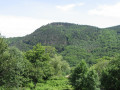
Rising to 808m, the Aizac Volcano is of the Strombolian type: eruptions, explosions and lava flows. It has towered over the village for 80,000 years.The basalt flow resulting from its activity features a remarkable prismatic structure, which can be seen particularly near Antraigues-sur-Volane.It is an easy, themed, family-friendly walk that will appeal to children: information boards are placed along the route to help both children and… adults learn more.
The tour of the Basse Volane in the Cévennes of the Ardèche
 12.50 mi
+3,054 ft
-3,064 ft
8h 25
Difficult
Departure from Aizac (Ardèche)
12.50 mi
+3,054 ft
-3,064 ft
8h 25
Difficult
Departure from Aizac (Ardèche)
The Volane rises on the edge of the Ardèche plateau, at an altitude of 1,400 m, near Lachamp-Raphaël (the highest village in the Ardèche).
In its upper reaches, it is a mountain torrent, rushing southwards down steep slopes.
At Antraigues-sur-Volane, the gradient eases and the more docile torrent becomes a river, eventually joining the waters of the Ardèche.
This hike will take you on a journey through this section of the Volane and the surrounding ridges around Antraigues.
The river and hamlets of Labastide-sur-Besorgues
 10.61 mi
+2,621 ft
-2,621 ft
7h 10
Moderate
Departure from Aizac (Ardèche)
10.61 mi
+2,621 ft
-2,621 ft
7h 10
Moderate
Departure from Aizac (Ardèche)
The Besorgues is one of many rivers, not to say "torrents" during Cévennes phenomena, which rises on the edge of the Ardèche plateau, then flows southwards down the steep slopes of the Ardèche Cévennes, ending its course in the Ardèche.
Halfway along its course, north of Freyssenet (a small hamlet of Labastide/Besorgues), lies a little treasure, hidden away in the middle of unspoilt nature: secret swimming spots in a heavenly setting.
Rocher de Cheylard - from the Col d'Aizac to the Ray-Pic
 11.84 mi
+4,206 ft
-2,972 ft
9h 05
Difficult
Departure from Aizac (Ardèche)
11.84 mi
+4,206 ft
-2,972 ft
9h 05
Difficult
Departure from Aizac (Ardèche)
Second stage of this two-day loop around the Rocher de Cheylard, which takes you back to your starting point from the previous day via a different route: the Ray-Pic waterfall.After passing the summit of the Rouyon massif, descend towards the Besorgues river and climb up the other side towards the Ardèche plateau, where broom gives way to wild blueberries.
Between Volane and Besorgues, Aizac - Rouyon
 8.26 mi
+2,562 ft
-2,562 ft
6h 00
Moderate
Departure from Aizac (Ardèche)
8.26 mi
+2,562 ft
-2,562 ft
6h 00
Moderate
Departure from Aizac (Ardèche)
A beautiful walk through the chestnut groves on both the Volane and Besorgues sides. On the upper part, around the Cime de Rouyon, there is an unobstructed view of the Ardèche plateau to the north and west, and to the east and south, the Coiron, the Alps, the Cévennes and the Tanargue.
Circular loop from Aizac to Rouyon
 3.96 mi
+1,168 ft
-1,168 ft
2h 50
Moderate
Departure from Aizac (Ardèche)
3.96 mi
+1,168 ft
-1,168 ft
2h 50
Moderate
Departure from Aizac (Ardèche)
From chestnut trees to the moorland that precedes the Ardèche plateau, along beautiful paths with wide views, this is a relatively short but varied circular route with a slight elevation gain and a somewhat challenging start to the descent.
Between Besorgues and Bourges: La Tour
 10.63 mi
+3,379 ft
-3,402 ft
7h 50
Moderate
Departure from Aizac (Ardèche)
10.63 mi
+3,379 ft
-3,402 ft
7h 50
Moderate
Departure from Aizac (Ardèche)
Seen from the Col d'Aizac, the summit of La Tour is an almost perfect pyramid. The advantage is that, once at the top, you have 360° views without moving from the spot, simply by turning your head.
It overlooks the Besorgues and Bourges valleys, the Juvinas and Moucheyre passes... as well as its little sister, Sainte-Marguerite, just to the south.
A few sections off the beaten track, with no markings... for a bit of adventure!
Suc de Chalembelle via the ridge
 4.95 mi
+1,335 ft
-1,339 ft
3h 25
Difficult
Departure from Burzet (Ardèche)
4.95 mi
+1,335 ft
-1,339 ft
3h 25
Difficult
Departure from Burzet (Ardèche)
The Knoll of Chalembelle overlooks the Bourges valley. This route takes you there via a track running along the ridge. The track isn’t always easy to follow, but it offers magnificent views throughout of the whole of the Lower Ardèche and the edge of the Ardèche plateau.