Country:

 City:
City:


Park at the Info Rando sign, opposite the entrance to Laviolle church.
(S/E) With your back to the sign, go down the steps and then follow the paved slanting street along the stream to the road. Follow the road to the right, cross the bridge, and walk through a coniferous woodland (Douglas fir). You will then reach the first house.
(1) Leave the small road and head up the path on the right, lined with walls, to the hamlet of Villaret. At the small square, walk down the street to the crossroads, marked by the ‘Villaret Haut’ signpost.
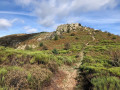
(2) Head straight on towards Aubert, crossing the hamlet and passing the wash house. Cross the bridge and, at the end of the road, climb the paved slanting street through the chestnut grove and then the broom-covered heathland. There is a stunning view over the Volane valley and the hamlets of Le Chambon and Le Villaret. Continue climbing, amongst the chestnut trees and sessile oaks (or ‘rouvre’), then beech trees (or ‘fayards’). Cross the Fontfreyde stream and reach a ledge.
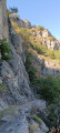
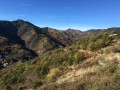
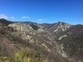
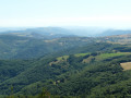
(3) Turn right, heading south-west into the steep slopes, and follow the path flanked by high dry-stone walls. Proceed with caution, stay on the path and keep quiet to avoid disturbing the nesting birds. Stretching out before you are the Volane valley, the Coiron plateau and, on a clear day, Mont Ventoux and the Alps. Continue to the ruins of Rouyon Farm.
(4) The ruins of the farm lie just below the path, flanked by high terrace walls that are now reforested. Walk round them and pass in front of the old mill (a ‘moulin à rodets’, i.e. a mill with a horizontal wheel directly driving the millstone on the upper floor). Head down the forest track that winds through the Douglas firs to the water intake. The long descent to the hamlet of Aubert follows the wide, winding track. You’ll reach the Aubert signpost.
(5) Head towards Villaret Bas, leaving the track for the small, well-trodden path that plunges down to the left. A splendid view of the Volane valley unfolds before you. The path crosses woodland and a stream before running alongside the Volane, offering several lovely spots for a swim. Follow the path to the hamlet of Villaret. At the road, head down to the right for a few dozen metres to reach the crossroads and the Villaret Bas signpost. Walk back up the lane to reach the crossroads marked by the Villaret Haut sign.
(2) Turn right and retrace your steps along the route you took on the way there, in the opposite direction, to return to the car park opposite the entrance to Laviolle church (S/E).

 Tourism professional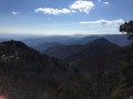
 Difficult
 Visorando Member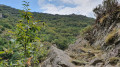
 Easy
Easy