Country:

 City:
City:


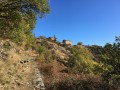
Start from the Col d’Aizac.
(S/E) Take the small road heading south-west for 150m until you reach the signpost slightly further down the slope.
(1) Turn right onto theGRP® trail (marked in yellow and red). Continue downhill until you reach the Besorgues valley. Cross the bridge and, 30 metres further on, take the very narrow road on the right. Immediately turn onto the path on the left, crossing a stream via a concrete footbridge. You’ll come out onto the D243.
(2) Cross the road and take the tarmac track heading south-east. Follow it for 200m, then, just after a hairpin bend to the right, leave thisGRP® path and take the path climbing up to the left, due south, through the chestnut trees (yellow markings). Follow this path to the hamlet of La Roche.
(3) You’ll come out onto a small road; follow it westwards. At the first junction, carry straight on. Shortly afterwards, at the second junction, take the road on the right which climbs for 30 metres.
(4) Start of an unmarked section. Just past the first house, turn left onto a path (concrete at the start) bordered by a low wall on your right and overlooking the houses on your left. It is unmarked but clearly visible; follow it through the chestnut groves for several kilometres.
(5) Pass by the foot of a house (lovely views due east over the Besorgues valley), then cross a first small stream; continue on and cross a second small stream (often dry!).
(6) Just after this (and a large holly bush), leave the path to the right. Head south then due west (off the path – unmarked) for about a hundred metres to find a path that becomes increasingly well-marked as it veers north-west. It climbs through chestnut trees and then a small copse of firs before emerging onto a track at a concrete spring intake.
(7) Take the track on the right. After a sharp bend to the left, join another track (yellow markings), which you should follow to the left as far as the Col de Font Rognon. End of the unmarked section.
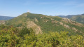
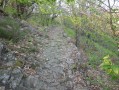
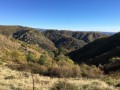
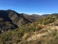
(8) At the junction, take the track on the left, which descends gently, heading due east. Then, at the next junction (about 1 km further on), turn left, following the markings. Stay on this track, which is suitable for vehicles and descends gently for several kilometres, offering superb views of the Besorgues valley below and the hamlet of Thieurre directly opposite, due east.
(9) Ignore a wide path leading uphill to the right and continue downhill. After several sharp bends, you’ll come out onto a small road, near the hamlet of Le Ranc.
(10) Follow this road to the left and pass through the hamlet of Les Tineaux.
(11) Leave the road and take an easy, pleasant contour path on the left (heading north).
(12) Pass an old wash house on your left and, immediately afterwards, go down the steps on your right. After the steps, take the path leading down to the right, then immediately turn left, following a low wall (to the left of the path), before continuing to the right.
(13) The construction of a house has slightly altered the route. At this point, turn right for 10 metres and go down the brand-new wooden-beamed steps on the left. Continue along the path and cross the D243.
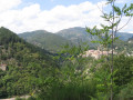
(14) Leave the road just before the bridge and take the path on the left, which crosses the Besorgues via another tiny bridge. The path then climbs in well-marked hairpin bends to the hamlet of Thieurre. Breathtaking views over the Besorgues valley and the Aubenas plain to the south.
(15) There is a hiking information point here. This hamlet is situated on a rocky spur, overlooking the Aubenas plain to the south, the Volane valley to the east, and the Besorgues valley to the west. Take the small road heading north, pass the Croix du Coulet and continue straight on.
(16) At a wooden gate, leave the road and head up the track on the right.
(17) At the foot of the henhouse, head up the well-marked path to the right. This turns into a track, continues northwards, then becomes a path again before joining a wide, motorable track.
(18) Take the track on the right and stay on it. After a gentle climb, the descent towards Aizac begins. You’ll come out onto the D443.
(1) Turn right onto the road and head uphill to reach the Col d’Aizac (S/E).

 Tourism professional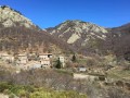

 Moderate
 Easy
Easy