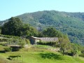
Suc de Chalembelle via the ridge

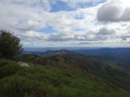
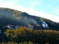
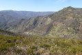
The Knoll of Chalembelle overlooks the Bourges valley. This route takes you there via a track running along the ridge. The track isn’t always easy to follow, but it offers magnificent views throughout of the whole of the Lower Ardèche and the edge of the Ardèche plateau.

Details

n°2622992
Creation:
Last update:
Last review:
  • Walking
    Activity: Walking
  • ↔
    Distance: 4.95 mi
  • ◔
    Average duration: 3h 25 
  • ▲
    Difficulty: Difficult

  • ⚐
    Back to start: Yes
  • ↗
    Ascent: + 1,335 ft
  • ↘
    Descent: - 1,339 ft

  • ▲
    Highest point: 4,154 ft
  • ▼
    Lowest point: 2,815 ft

Photos

Description of the walk

Start at the Col de Moucheyre on the D254 between Burzet and Labastide-sur-Bezorgues.

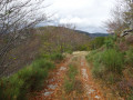
(S/E) Leave the car park via a forest track – tarmac at the start – heading north-east. Follow the white-and-yellow markings towards Lachamp Raphaël, staying on the same track, heading roughly north-north-east.

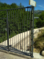
(1) A few hundred metres past the barrier marking the entrance to the state-owned forest, leave the signposted route and turn sharply left, heading south, onto a level path that curves back towards the rear.

(2) On leaving the forest, turn right onto a stony path climbing along the edge of the woodland. Reach the ridge.

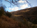
(3) Turn right, heading north, and follow this ridge along a path winding its way through the broom and ferns. When the vegetation becomes too dense, you can also head into the woods; the undergrowth is passable.
Continue along a more visible track through the broom until you reach a clear, open area.

(4) To reach the summit of Suc de Chalembelle (360° view), take a track to the left of this clearing, winding its way through the broom alongside a derelict wire fence.
Carry on straight ahead and rejoin a path (not marked on the IGN map). Turn right to rejoin the path coming directly from the point (4).
Then turn left. Continue along this path, which skirts the summit of La Courbe.

(5) Leave the path coming from Cros du Loup on your left.
From here, you’ll come across the white-and-yellow markings again. Follow them along the track.

(1) Retrace your steps along the route you took on the way there until you reach the Col de Moucheyre (S/E).

Waypoints

  1. S/E : mi 0 - alt. 2,818 ft - Col de Moucheyre
  2. 1 : mi 1.1 - alt. 3,337 ft - Crossroads of the circular loop
  3. 2 : mi 1.35 - alt. 3,327 ft - To the right, at the edge of the woods
  4. 3 : mi 1.48 - alt. 3,445 ft - Follow the ridge
  5. 4 : mi 2.14 - alt. 4,117 ft - Viewing platform below the summit
  6. 5 : mi 2.78 - alt. 3,878 ft - Cros du Loup Trail
  7. S/E : mi 4.95 - alt. 2,818 ft - Col de Moucheyre

Notes

Between (3) and (4), there isn’t really a proper path, although it is marked on the IGN map. There’s no risk of getting lost as you’re always following the edge of the forest as you climb up to a ridge, but navigating through the vegetation can be a bit tricky at times. This is why this walk is classified as ‘difficult’.
For an easier walk, you can simply do a return trip to the point (4) by following the forest track. The view at the end is well worth it. The distance is then 9 km.

Reviews and comments

4 / 5
Based on 2 reviews

Reliability of the description
4 / 5
Ease of following the route
4 / 5
Route interest
4 / 5
Mich0726
Mich0726

Overall rating : 4 / 5

Date of your route : Aug 24, 2023
Reliability of the description : ★★★★☆ Good
Ease of following the route : ★★★★☆ Good
Route interest : ★★★★☆ Good
Very busy route : No

A lovely view from up here.
If you have any trouble finding the path between (3) and (4), don’t hesitate to head into the woods, keeping the edge of the woodland in sight; follow the wild boar tracks uphill and emerge from the woods after the 1192-metre mark (the rocks visible in the woods) to rejoin the path through the broom. The descent is brilliant.

Machine-translated

thueyts
thueyts
• Edited:

Overall rating : 4 / 5

Date of your route : Oct 29, 2019
Reliability of the description : ★★★★☆ Good
Ease of following the route : ★★★★☆ Good
Route interest : ★★★★☆ Good

Hello
The path up to the ridge isn’t very pleasant, but the view is magnificent

Machine-translated

Other walks in the area

For more walks, use our search engine .

The GPS track and description are the property of this route's author. Please do not copy them without permission.