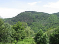
The summit of Rouyon from Aizac

A lovely walk along the ridges between Bézorgue and Volane.

Details

41748663
Creation:
Last update:
Last review:
  • Walking
    Activity: Walking
  • ↔
    Distance: 3.86 mi
  • ◔
    Average duration: 3h 05 
  • ▲
    Difficulty: Moderate

  • ⚐
    Back to start: Yes
  • ↗
    Ascent: + 1,516 ft
  • ↘
    Descent: - 1,516 ft

  • ▲
    Highest point: 3,809 ft
  • ▼
    Lowest point: 2,293 ft

Photos

Description of the walk

To get to the start point at the Col d’Aizac, head to the hamlet of Roux via the Chemin des Auches and park at the side of the road.

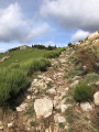
(S/E) Take the signposted path, which resembles a stream bed, and head uphill. Pass through a chestnut wood and, just before a stone building, you’ll reach a fork in the path.

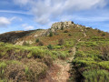
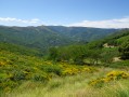
(1) Continue climbing along the path on the left (marker on the tree, see photo) and you’ll soon emerge onto an open view with beautiful rocks on the ground, revealing the first stretch of heathland overlooking the Volane valley. Cross a woodland and arrive at a small gate and a grassy path.

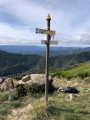
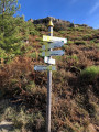
(2) Continue uphill to the left and cross a second heathland area of broom (l’Huguenot) until you reach the next marker (Pargeades marker).

(3) Take the steep path on the right (easier to tackle on the way up) and arrive at a flat area.

(4) Carry on along the path which leads through a field of boulders to the Col de Rouyon (Faux-Fays marker).

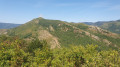
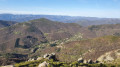
(5) Enjoy the stunning view over the Ardèche Cévennes, then take the path leading down to the left. Carry on until you rejoin the route you took earlier (Pargeades signpost).

(3) Follow the path back the way you came and return to the hamlet of Roux (S/E).

Waypoints

  1. S/E : mi 0 - alt. 2,293 ft - Le Roux - Gîte & Chambres d'Hôtes "LE VOLCAN D'AIZAC" ... juste au pied du Volcan d'Aizac !
  2. 1 : mi 0.35 - alt. 2,598 ft - Marker on the tree
  3. 2 : mi 0.61 - alt. 2,720 ft - Gate
  4. 3 : mi 1.16 - alt. 3,140 ft - A-R junction, Pargeades
  5. 4 : mi 1.6 - alt. 3,727 ft - Flat section
  6. 5 : mi 2.03 - alt. 3,809 ft - Col de Rouyon, Faux-Fays signpost
  7. S/E : mi 3.86 - alt. 2,293 ft - Le Roux

Reviews and comments

5 / 5
Based on 2 reviews

Reliability of the description
5 / 5
Ease of following the route
5 / 5
Route interest
5 / 5
User 13611756

Overall rating : 5 / 5

Date of your route : Aug 25, 2025
Reliability of the description : ★★★★★ Very good
Ease of following the route : ★★★★★ Very good
Route interest : ★★★★★ Very good
Very busy route : No

A hike of "only" 6.5 km... but what a variety of landscapes! I highly recommend it for everything you see along the way; real landscapes worthy of paintings as soon as you look up.
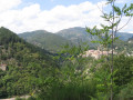
Whether on the eastern slope towards the "Faux Fay" and its multi-layered view (Antraïgues, Châteaux de Craux, the ridges of the Ardèche valleys, Aubenas and, in the distance, the Vercors?) or on the western slope overlooking Labastide-sur-Bésorgues, there isn't a single view to be missed.

A big thank you to the person who recorded this guide: it's easy to follow, memorable and, as it's well signposted, it opens up the possibility of other hikes in the region!

Machine-translated

Algod
Algod

Overall rating : 5 / 5

Date of your route : May 06, 2024
Reliability of the description : ★★★★★ Very good
Ease of following the route : ★★★★★ Very good
Route interest : ★★★★★ Very good
Very busy route : No

A lovely walk offering a fine variety of views, particularly of Antraigues.
Do take care, however, at the start (and therefore at the end too) of the walk: after periods of rain, the path is partially submerged by a small stream, which makes the stones very slippery.

Machine-translated

Other walks in the area

For more walks, use our search engine .

The GPS track and description are the property of this route's author. Please do not copy them without permission.