Country:

 City:
City:


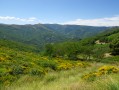
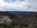
Start from the Col d’Aizac.
(S) Take the small road heading south-west for 150m to the signpost slightly further down the slope.
(1) Turn right onto the path, which is none other than theGRP® you came across the day before (marked in yellow and red). Follow the path downhill until you reach the Besorgues valley. Cross the bridge and, 30 metres further on, take the very narrow road on the right. Immediately turn onto the path on the left, crossing a stream via a concrete footbridge. You’ll come out onto the D243.
(2) Cross the road and take the tarmac track heading south-east, then veer off, climbing gently, due west. It turns into a track and, at the first houses in Juvinas, joins a road which you follow to the right as far as the church. At this point, leave theGRP® which climbs up opposite, and take the road to the left. At the sign marking the end of the built-up area, take the path climbing up to the right until you reach the Col de Juvinas
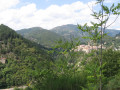
(3). There’s a lovely view of the Col d’Aizac to the east (your starting point) and the Bourges valley to the west.
Cross the road and head steeply uphill straight ahead: this is the day’s toughest stretch, the climb to Sainte-Marguerite. Stay on the main, well-signposted path at all times, ignoring the others. General direction: south-southeast. Reach the Col de Font Rognon (841 m) and continue for a further hundred metres or so.
(4) Ignore the track leading down to the right and take the only road going uphill opposite (signposted Sainte-Marguerite). Shortly afterwards, to avoid walking on tarmac, take a small path on the right marked by a few attractive hand-drawn signs. It runs alongside, cuts across and more or less joins the small road all the way to the summit.
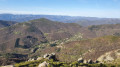
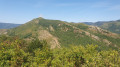
(5) Enjoy the 360° views, ignoring the transmission masts (if you can!). Walk past the chapel and head towards the last mast at the southernmost point. Go round it to find the path leading down towards the coniferous forest. Following recent logging, it has all but disappeared. However, a wide forest track has taken its place (unmarked); follow this, beneath the canopy of conifers, on a steep descent heading south-south-east. You’ll come out at a crossroads of tracks.
(6) Head left to the signpost, then turn right – still descending – onto the well-marked track towards Lalevade. Ignore the side paths on either side. You’ll reach the first houses of Bruen Haut and a small road to follow on the left.
There are few signposts in this area. After the first hairpin bend to the right, the path veers left at the foot of three majestic cedars. Reach and cross the D253, then take a small road directly opposite heading due south towards Peyrajol (follow it for approximately 1.5 km).
(7) Turn right at the signpost for Sétias. At the farm, turn right to reach the Col de Sétias hiking signpost.
(8) Be careful not to go straight on; instead, turn off to the left. Although there are few (if any) signposts, this path beneath the chestnut trees is clearly marked on the ground. At a junction, stay on the left-hand path, which leads to the Bidet farm. Follow the small road to the hairpin bend and, at this point, take the track on the right and then immediately the descending path (stairs) on the left. This path leads onto a road; take this to the right as far as Niègles.
(9) A remarkable view of Ventadour Castle, directly opposite, and the Ardèche Valley, into which the Lignon and the Fontolière flow in turn. Pass to the right of the church and head downwards north-west towards the bridge over the Fontolière. Pass two hairpin bends and cross the Pont de la Fontolière.
(10) You’ll come out onto the D536 (150m to the left towards Ventadour Castle); follow it to the right for 1km. At the hamlet of Pradel, climb the steps on the left between the houses and head due north along a path that soon veers westwards.
(11) Once you reach the road, carry straight on (despite the crosses!) and pass through the hamlet of Champ-Guérin. When you reach a road, follow it to the left, heading south, for 300 m. At a house, take the footbridge on the right. At the road, turn due north, then 200 m further on, turn due west again to reach Hautségur Castle. Continue along the tarmac road to the next junction and turn left to join the Via Domitius.
(12) Follow this Roman road – a pretty paved slanting street in good condition (slippery in wet weather) – until you cross the Roman bridge, then immediately turn left to reach, at the side of the N102, the point (1) from the previous day.
Cross this main road, turn right for 30 metres, and finally turn left to reach Neyrac-les-Bains at the start/finish point (E), after crossing the Ardèche.

 Tourism professional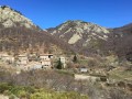
 Difficult
 Easy
Easy