Country:

 City:
City:


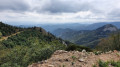
From the Col de l’Escrinet, turn left onto the D122 towards Mézilhac. About 2 km from Mézilhac, take the forest track on the left at a place called Le Brouas.
Follow this Pradou forest track (on which vehicles are permitted) to a junction of three tracks and park at the ‘Bois de Rauset’ signpost.
(S/E) From the ‘Bois de Rauset’ signpost, take the track opposite towards the Champ de Mars.
After about 400 m, you’ll reach the Bourlateyron signpost.
(1) Take the path on the left towards Champ de Mars and, about 500 m further on, take a path on the right that runs alongside a fence. When you reach another fork, take the path on the right signposted ‘Champ de Mars’. Continue to the summit, where there are two lovely orientation tables.
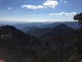
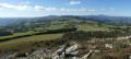
(2) From this summit, there should be a 360° view. However, as we were walking in the clouds for three-quarters of the route, we were unable to enjoy it.
Return along the same route as before until you reach the Bourlateyron marker.
(1) Take the track on the left towards Mazoyer; this track crosses the forest.
(3) At the Coulet Gras signpost, turn right until you reach a track junction about 100 metres further on. Take the track on the right and continue straight on to Mazoyer.
At the entrance to the village, continue along the path on the left which skirts Mazoyer at the bottom until you reach the ‘Mazoyer – 750 m’ signpost, heading towards Mézilhac.
(4) Carry on straight ahead and, after a hairpin bend on leaving the village, you’ll come to a small gate; go through it and follow the path on the right which climbs up towards Mézilhac.
The path joins a track. Follow it to the left for a short distance. Just before the track crosses the stream, take the small path on the right.
(5) The path reaches the stream. Cross it to reach the right bank and continue until you reach a wide track at the ‘Le Chabrol’ signpost.
(6) Take this track to the right and head back towards the ‘Bois de Rauset’ signpost (S/E).

 Visorando Member

 Association / Club / Walk leader
 Tourism professional
 Difficult