The Antraigues-sur-Volane circular route

A circular two-day tour in the Cévennes of the Ardèche.
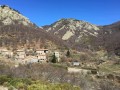
Antraigues-sur-Volane: a picturesque village full of character perched on a rocky outcrop, about fifteen kilometres north of Aubenas. It is also known as the home of the late poet Jean Ferrat.

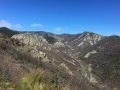
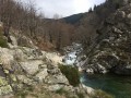
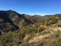
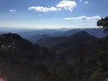
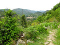
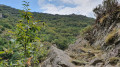
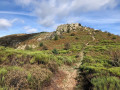
This two-day hike will take you on a journey to discover ‘his’ mountain, the stone walls, the paved slanting streets, the chestnut groves and the steep slopes leading down to deep valleys: the Volane, the Bise and the Mas. Water everywhere.

Details

n°1032485
Creation:
Last update:
Last review:
  • Walking
    Activity: Walking
  • ↔
    Distance: 27.49 mi
  • ◔
    Average duration: 2 days 
  • ▲
    Difficulty: Difficult

  • ⚐
    Back to start: Yes
  • ↗
    Ascent: + 6,821 ft
  • ↘
    Descent: - 6,831 ft

  • ▲
    Highest point: 3,176 ft
  • ▼
    Lowest point: 981 ft

Photos

Stages of the route

This route needs several days, find the details below:

  1. S
  2. E

Notes

- Rocky paths; make sure you wear sturdy shoes.

- Drinking water and provisions available in all the villages you pass through, particularly Genestelle, Saint-Andéol de Vals and Aizac on the first day.
On the second day, you’ll pass through fewer villages; plan accordingly.

- (E) Aizac: end of the first stage and start of the second.
Restaurants, a bar and a small grocery shop in the village.
Accommodation available at the “Le Volcan d’Aizac” lodge and B&B – 04 75 38 77 81 – breakfast, packed lunches, etc.

Worth a visit

- (S) Bise: Small inn “Chez Christiane” 04 75 38 70 19

- (S) Bise: in summer, in July/August, don’t miss the “Mercredis de Bise” (late afternoons in July and August): a local farmers’ market – with barbecues, tables and benches provided – where you can cook and enjoy what you’ve just bought. A friendly atmosphere is guaranteed.

- (4) Genestelle: enjoy the views over the Lower Ardèche and the Vercors. This pretty village’s name means ‘where the stars are born’.

- Antraigues: Jean Ferrat’s village. Place de la Résistance, House-Museum, a village of character (and a tourist destination) perched on a rocky outcrop.

- (E) Col d’Aizac: A pretty, peaceful village surrounded by nature. At the foot of the Volcan d’Aizac.
You can go on a themed walk exploring the ancient activity of the Volcan d’Aizac. A short hike of 1 to 2 hours takes you to the summit, with information boards along the route.You can contact the “Le Volcan d’Aizac” lodge and guesthouse, where they’ll be happy to provide information and lend you documents and guidebooks about this 80,000-year-old volcano, which is now extinct… unfortunately!

Always be cautious and plan ahead when you're outdoors. Visorando and the author of this route cannot be held responsible for any accidents occurring on this route.

Reviews and comments

4.3 / 5
Based on 2 reviews

Reliability of the description
4.5 / 5
Ease of following the route
4 / 5
Route interest
4.5 / 5
Savitri
Savitri

Overall rating : 5 / 5

Date of your route : Feb 25, 2024
Reliability of the description : ★★★★★ Very good
Ease of following the route : ★★★★★ Very good
Route interest : ★★★★★ Very good
Very busy route : No

Hike on 5 and 6 February 2024: two truly lovely days away from it all! We only came across a few people over the two days; the hamlets are very peaceful, and the paths are varied, winding through forests and along ridges with magnificent, unobstructed views.
It was around 15 degrees during the day, with plenty of sunshine. The ‘Le Volcan’ lodge at the Col d’Aizac is very good – simple and affordable, with breakfast included. Make sure to pack picnics for both days as there are no shops along the routes.
It took us about 7 hours each day, walking at a steady pace but without rushing.
Well worth a go!

Machine-translated

Pégase07530
Pégase07530

Hello;
Thank you for your feedback!
You say: “The two-day circular route is very difficult for a group comprising people who are moderately experienced as well as those who are completely new to hiking.”
This hike is classified as “difficult”, covering over 44 km with more than 2,000 m of elevation gain over two days! The decision to take such a group on this hike in such hot weather was perhaps not the best one....
There are plenty of other, more accessible hikes on offer in the area.
Eric

Machine-translated

Castor Fossile
Castor Fossile

Overall rating : 3.7 / 5

Date of your route : Jun 27, 2020
Reliability of the description : ★★★★☆ Good
Ease of following the route : ★★★☆☆ Average
Route interest : ★★★★☆ Good
Very busy route : No

The two-day circular route is very challenging for a group comprising people who are moderately experienced as well as those who are completely new to hiking. The first part of the route is gruelling and we were unable to complete it in a single day. It passes through some lovely spots, but there isn’t really a panoramic viewpoint overlooking the area. The following day, we therefore altered our route to a shorter one that took us to a summit from which we could see the whole region, 45 minutes south-west of Bise. It is possible to camp on the football pitch at Antraïgues, below the village.

Machine-translated

Other walks in the area

For more walks, use our search engine .

The GPS track and description are the property of this route's author. Please do not copy them without permission.