Antraigues-sur-Volane Circular Loop: from the Col d’Aizac to Bise

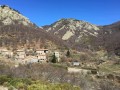
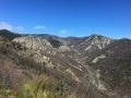
The second circular stage of the Grand Boucle d’Antraigues-sur-Volane, which, via a different route, takes you back to your starting point from the previous day: Bise. You’ll discover, in particular, the more rocky side of the Volane Valley upstream from Antraigues-sur-Volane. Then there are sections along the ridges, inviting you to contemplate the wild natural surroundings.

This walk is part of a multi-day hike: La Grande Boucle d'Antraigues-sur-Volane

Details

551338
Creation:
Last update:
Last review:
  • Walking
    Activity: Walking
  • ↔
    Distance: 13.84 mi
  • ◔
    Average duration: 9h 10 
  • ▲
    Difficulty: Difficult

  • ⚐
    Back to start: No
  • ↗
    Ascent: + 3,255 ft
  • ↘
    Descent: - 3,478 ft

  • ▲
    Highest point: 3,176 ft
  • ▼
    Lowest point: 1,647 ft
  • ⚐ Country: France
  • ⚐
  • ⚐ City: Aizac (07530)
  • ⚑
    Start: N 44.714031° / E 4.330088°
  • ⚑
    End: N 44.742285° / E 4.379828°
  • ❏
    IGN map(s): Ref. 2937OT
  • Hour-by-hour weather

Photos

Description of the walk

(S) From the Col d’Aizac, take the D254 north-west and, 10 metres further on, after the first house, turn right into the path leading uphill between the houses and continue for about 200 metres.

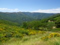
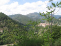
(1) Leave the small road on your right, following it along the path that runs above it, then, at the hiking signpost, carry on straight ahead towards Rouyon. At the hamlet of Le Roux, cross the road and continue uphill, first between two low walls, then beneath the chestnut trees. The path is well signposted. You’ll pass along a clear ridge with breathtaking views over the Volane Valley and the rising sun.

(2) Head down the track on the right; it turns into a small road at the farm, then joins the Route des Auches, which you should follow to the left.

(3) Just past the first house, head down to the right along a path winding through the chestnut trees. It leads onto a small road, which you follow in the same direction (south-east). At the hairpin bend, follow it due north to reach the cluster of houses at Le Bouchet. The road ends and continues as a path that runs above the last house.

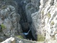
(4) Head up to the left towards Froment/Laviolle. A lovely paved slanting street offering superb views over this very rocky part of the Volane Valley. Join a small road and follow it to the left, passing at the foot of the Froment farm.

(5) At a large rock where the signpost has disappeared, continue along the small road.
Further on, at a fork in the road, continue uphill, heading due north. After a few hairpin bends, you’ll reach the Aubert farm; walk past it for 50 metres.

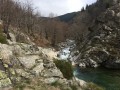
(6) At this point, leave the road and take the gently descending path on the right. Cross a first small stream, then you’ll reach the Rouyon torrent.

(7) Cross the Rouyon (fording point) at a large fallen tree lying across the path. The path continues to the right and runs along the edge of the Volane.

(8) Take care here, otherwise you risk heading straight for Le Villaret: at a low wall, go down to the right (unmarked) and then immediately left. Pass between the houses to reach a footbridge, then the bridge spanning the Volane. At this point, rejoin theGRP® of the Haute Cévenne d’Ardèche, marked in yellow and red. Follow it due south along the road for over 1 km.

(9) Turn left onto the small road, which is still marked in yellow and red.

(10) Let theGRP® trail continue off to the right, and carry on up this small road, which soon branches off to the north.
After the Saint-Vincent farm, it turns into a track suitable for vehicles. Stay on this ascending track, marked in yellow, to pass by the foot of the TV relay station. You’ll eventually come out onto another track running along the ridge.

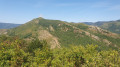
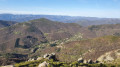
(11) Turn left and head due north. Magnificent views to the east, over the Mas Valley and the hamlets of Le Mas and Le Mazoyer.

(12) Head down to the right towards Le Mazoyer. In the hamlet, you’ll come out onto a small road. Cross the Fédou, continue to the right, and head uphill through the hamlet to join a track.

(13) Continue along the track, which descends gently, to cross the Lavanches stream via a very pretty “ford”; shortly afterwards, ignore the track leading uphill to the left and stay on the one to the right. At the first junction, take the sharp left-hand bend to follow the track north-eastwards and, after a few long hairpin bends, reach a small pass (965m).

(14) Head down due east (no signposting). At the first junction, keep left; at the second, head down to the right. Join a small road at Mason.

(15) Leave this immediately to take the path descending to the right, marked in yellow, towards Bise. A pleasant descent through the pine trees. You’ll come out onto a small road and continue downhill to the left until you reach the hairpin bend.

(16) Leave the road and take the small path leading down opposite, which soon heads due south. It leads to the first houses on the hillside above Bise. Cross the small road twice to find a recently renovated paved slanting street between the houses.

(17) Opposite the church, join the small road crossing the River Bise to return to the car park at the starting point (E).

Waypoints

  1. S : mi 0 - alt. 2,106 ft - Gîte & Chambres d'Hôtes "LE VOLCAN D'AIZAC" ... juste au pied du Volcan d'Aizac !
  2. 1 : mi 0.11 - alt. 2,165 ft - Junction with a small road - Gîte & Chambres d'Hôtes "LE VOLCAN D'AIZAC" ... juste au pied du Volcan d'Aizac !
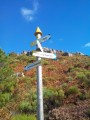
  3. 2 : mi 1.03 - alt. 2,703 ft - Huguenot hiking signpost
  4. 3 : mi 1.97 - alt. 2,260 ft - Les Auches hamlet
  5. 4 : mi 2.76 - alt. 1,647 ft - Bouchet hiking signpost. Valley of the - Volane (rivière) - Affluent de l'Ardèche
  6. 5 : mi 3.76 - alt. 1,847 ft - Froment hiking signpost
  7. 6 : mi 4.58 - alt. 2,224 ft - Aubert Farm
  8. 7 : mi 4.85 - alt. 2,021 ft - Le Rouyon; fording
  9. 8 : mi 5.54 - alt. 1,946 ft - Junction
  10. 9 : mi 6.24 - alt. 1,893 ft - Small road junction
  11. 10 : mi 6.7 - alt. 2,067 ft - St Vincent hiking signpost
  12. 11 : mi 8.2 - alt. 2,726 ft - Ridge trail – Ranc Chabrier
  13. 12 : mi 9.08 - alt. 2,940 ft - Hiking signpost - Rocher de la Clé
  14. 13 : mi 9.96 - alt. 2,503 ft - Le Mazoyer hamlet
  15. 14 : mi 11.67 - alt. 3,173 ft - Pass
  16. 15 : mi 12.5 - alt. 2,703 ft - Mason hiking signpost
  17. 16 : mi 13.06 - alt. 2,352 ft - Hairpin bend
  18. 17 : mi 13.74 - alt. 1,916 ft - The hamlet of Bise
  19. E : mi 13.84 - alt. 1,893 ft - Car park at the village hall – Bise

Notes

- Rocky paths: make sure you wear sturdy footwear.

- Drinking water and provisions available in all the villages you pass through, particularly Genestelle, St-Andéol-de-Vals and Aizac on the first day.
On the second day, you’ll pass through fewer villages; plan accordingly.

- (E) Aizac: end of the first stage and start of the second.
There is a restaurant, a bar and a small grocery shop in the village.
Accommodation available at the “Le Volcan d’Aizac” lodge and B&B – 04 75 38 77 81 – breakfasts and packed lunches.

Worth a visit

- (S) Col d’Aizac: A pretty, peaceful village surrounded by nature… at the foot of the Aizac Volcano!

You can take the themed walk exploring the Volcan d’Aizac’s ancient volcanic activity. A short hike of 1 to 2 hours takes you to the summit, with information boards along the route.You can contact the “Le Volcan d’Aizac” lodge and guesthouse, where the hosts will be delighted to provide you with information and lend you brochures and guidebooks on this 80,000-year-old volcano, which is now extinct… unfortunately!

- (S) Aizac: Tour of the vinegar factory

- (5) Just before this point, due east, on the other side of the valley: Ranc Chabrier (927 m), a very popular summit and walking route in the hills above Antraigues-sur-Volane.

- Between (7) and (8), you can cross the Volane (you’ll need to take your shoes off!) to reach (9) directly on the opposite bank.

- (11) You can do a round trip to the summit of Ranc Chabrier (adding about 2 km and 100 m of elevation gain)

- (E) Bise: a lovely little inn, “Chez Christiane” 04 75 38 70 19

- (E) Bise: in summer, during July and August, don’t miss the “Mercredis de Bise” (late afternoons): a local farmers’ market – with barbecues, tables and benches provided – where you can cook and enjoy what you’ve just bought. A friendly atmosphere is guaranteed.

- Antraigues: the village of Jean Ferrat – a tour of the village – Place de la Résistance, the House-Museum, a charming (and popular with tourists) village perched on a rocky outcrop.

Reviews and comments

4.8 / 5
Based on 2 reviews

Reliability of the description
5 / 5
Ease of following the route
4.5 / 5
Route interest
5 / 5
marcheurs07
marcheurs07

Overall rating : 4.7 / 5

Date of your route : May 07, 2023
Reliability of the description : ★★★★★ Very good
Ease of following the route : ★★★★☆ Good
Route interest : ★★★★★ Very good
Very busy route : No

We set off from the lodge on Sunday in a morning drizzle, followed by sunshine until 2.00 pm,
Then a proper storm (an hour in the rain) – we had a lovely descent past the ‘Male Mort’ rock
— pure enjoyment.

Stunning scenery – our Ardèche is so beautiful!!!

Thanks to the author of this walk

Machine-translated

maricarojul
maricarojul

Thank you!!

Machine-translated

Pégase07530
Pégase07530

Hello;
I was the one who posted this walk online.
It’s true that the estimated time shown is calculated automatically by the software.
If you’re an average, regular walker with a bit of fitness, you can expect to walk for 7 hours, excluding breaks.

Machine-translated

grandin
grandin ★

maricarojul

This time is calculated by the software and corresponds to the average duration calculated on the basis of the distance, the elevation gain and an average speed of 3.5 km/hr. For an average walker, this duration includes reasonable breaks

Machine-translated

maricarojul
maricarojul

Hello, do your timings include breaks?

Thank you, as I’m planning this hike over two days, but the ‘9 hours 20 minutes’ of walking has me wondering!!!

Machine-translated

Pégase07530
Pégase07530

Hello, "spwa"? ...
Thanks for those enthusiastic and warm comments!
It encourages me to post some lovely walks online. Glad you enjoyed them!
Eric

Machine-translated

spvva
spvva

Overall rating : 5 / 5

Date of your route : Aug 17, 2018
Reliability of the description : ★★★★★ Very good
Ease of following the route : ★★★★★ Very good
Route interest : ★★★★★ Very good

This second section, which leads back to Bise, is pure bliss

Just like the first section from Bise to the Col d’Aizac, the scenery is magnificent

Thank you for this magnificent hike

Machine-translated

Other walks in the area

For more walks, use our search engine .

The GPS track and description are the property of this route's author. Please do not copy them without permission.