Refine your search for walks in La Flachère
La Flachère walks


 The Teppes Cochon Waterfall and the Sentier du Facteur circular loop
 Visorando Member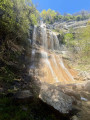
 5.10 mi
 +2,316 ft
 -2,333 ft
 4h 20
4h 20
 Difficult
 Departure from La Flachère (Isère)
A low-altitude circular route that is demanding, rising first to the beautiful Teppes Cochon waterfall, then climbing up to the Plateau des Petites Roches via the well-marked Pierre-Plate path, before crossing along the hillside towards Les Prés, and then descending back down to Grésivaudan via the tricky Pas du Facteur.
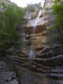
Circuit of the Northern Waterfalls of the Petites Roches
 15.71 mi
+6,549 ft
-6,532 ft
10 hrs
15.71 mi
+6,549 ft
-6,532 ft
10 hrs
 Very difficult
Departure from Saint-Vincent-de-Mercuze (Isère)
Very difficult
Departure from Saint-Vincent-de-Mercuze (Isère)
Numerous streams flow down from the Petites Roches plateau into the Isère valley, creating several spectacular waterfalls. This route allows you to explore those at the northern end of the Petites Roches plateau, which are not part of the ‘Tour des Petites Roches’GR® de pays route, which runs further south. If the full hike is too long, you can use this as inspiration for easier alternatives.
Circular route around Sainte-Marie-du-Mont
5.27 mi
+1,050 ft
-1,033 ft
3h 20
 Moderate
Departure from Sainte-Marie-du-Mont (Isère)
Moderate
Departure from Sainte-Marie-du-Mont (Isère)
A route offering stunning views of the Chartreuse, Belledonne, Maurienne and, time and again, Mont Blanc (especially when the trees have no leaves or have shed them).
Numerous streams and torrents create a lovely atmosphere, but require good footwear, unless you fancy having wet feet.
Unfortunately, my route description seems to be causing problems, so I strongly recommend using GPS and the map on your phone!
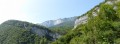
Alloix waterfalls from Montalieu
 3.15 mi
+1,234 ft
-1,234 ft
2h 30
Moderate
Departure from Saint-Vincent-de-Mercuze (Isère)
3.15 mi
+1,234 ft
-1,234 ft
2h 30
Moderate
Departure from Saint-Vincent-de-Mercuze (Isère)
This is a short, unusual walk that follows the Alloix torrent. Curious walkers will spend more time admiring the work of the water than walking. This walk can end with a leisurely stroll through the narrow streets of the old village or, as the locals say, "on the paths of yesteryear", where local markings will guide you.
Circular of the Alloix waterfalls and return via Bellechambre
 5.82 mi
+1,818 ft
-1,811 ft
4h 15
Moderate
Departure from Saint-Vincent-de-Mercuze (Isère)
5.82 mi
+1,818 ft
-1,811 ft
4h 15
Moderate
Departure from Saint-Vincent-de-Mercuze (Isère)
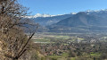
From Saint-Vincent-de-Mercuze, this is a varied, beautiful and enjoyable hike, accessible to children in dry weather. Please note that the climb up the Ruisseau l'Alloix can be very slippery in wet weather. Most of the route is under trees. It is pleasant to do in hot weather, with a short stop halfway to eat at Moulin Tardy (picnic table) and the possibility of swimming in the Alloix. It is best to do this in spring when there is plenty of water and the waterfalls are magnificent.
Griffes de l’Ours circular loop and Belles Ombres trails
 5.36 mi
+2,369 ft
-2,352 ft
4 hrs
5.36 mi
+2,369 ft
-2,352 ft
4 hrs
 Extremely difficult
Departure from Sainte-Marie-du-Mont (Isère)
Extremely difficult
Departure from Sainte-Marie-du-Mont (Isère)
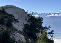
A circular loop exploring the Griffes de l’Ours and emerging onto the Belles Ombres ridge after a short stretch along the eponymous ‘sangle’.
The Griffes de l’Ours are usually tackled by returning via the same path as the outward journey. Our route allows you to climb up onto the ridge via a few rocky sections, enabling you to admire the Griffes de l’Ours from every angle.
Lower and upper ‘sangles’ and the ridge of the Rochers de Belles Ombres
 5.69 mi
+2,303 ft
-2,303 ft
4h 35
Difficult
Departure from Sainte-Marie-du-Mont (Isère)
5.69 mi
+2,303 ft
-2,303 ft
4h 35
Difficult
Departure from Sainte-Marie-du-Mont (Isère)
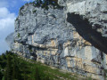
This circular loop, which takes you off the beaten track, allows you to explore the distinctive rocks of the lower Belles Ombres ridge, then climb up to the upper ridge to walk through its impressive cirques, before ascending to the ridge and returning via the Rochers de Belles Ombres to the pass of the same name.
Grand Manti via the Pas du Fourneau and back via the Pas de la Rousse
 Tourism professional
 7.01 mi
+3,005 ft
-3,241 ft
5h 50
Extremely difficult
Departure from Sainte-Marie-du-Mont (Isère)
7.01 mi
+3,005 ft
-3,241 ft
5h 50
Extremely difficult
Departure from Sainte-Marie-du-Mont (Isère)
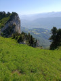
This hike takes in two of the most challenging passes in the Chartreuse, where sure-footedness is essential; take great care on the descent from the Pas de la Rousse. Its highest point is very close to the Tunnel du Trèfle and, if you look carefully from the tunnel, you can catch a glimpse of the inaccessible Arche de la Morille.
Sangle des Belles Ombres and Porte de l'Alpette
 7.44 mi
+3,432 ft
-3,419 ft
6h 25
Difficult
Departure from Sainte-Marie-du-Mont (Isère)
7.44 mi
+3,432 ft
-3,419 ft
6h 25
Difficult
Departure from Sainte-Marie-du-Mont (Isère)
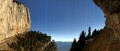
A wild and off-the-beaten-track hike linking the high-altitude ridge of Les Belles Ombres, where chamois frolic all year round, with the bucolic meadows of L’Alpette, where marmots abound.
This route is mainly off-trail and requires sure-footedness and a good sense of direction. It is unlikely that you will encounter other walkers, except at the Croix de l’Alpe and on the section of path leading there.
Col de l'Alpe via Sainte-Marie-du-Mont
3.34 mi
+1,365 ft
-1,352 ft
2h 45
Moderate
Departure from Sainte-Marie-du-Mont (Isère)
This short hike leads to the Col de l'Alpe via the path used by cows going up and down from the mountain pasture.
From the Pas de la Rousse to the Col de Belles Ombres via the Croix de l'Alpe
 4.34 mi
+2,333 ft
-2,320 ft
4h 00
Difficult
Departure from Sainte-Marie-du-Mont (Isère)
4.34 mi
+2,333 ft
-2,320 ft
4h 00
Difficult
Departure from Sainte-Marie-du-Mont (Isère)
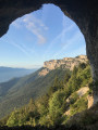
A circular route along the eastern ridge of the Hauts de Chartreuse, combining a variety of terrain (rocks, forests, mountain pastures) with stunning views across the Alps. Can be completed in half a day, preferably in the morning.
Please note: read the information regarding the difficulties in the ‘Practical Information’ section carefully.
Circular route from Château du Touvet to Château du Montalieu
 4.11 mi
+807 ft
-797 ft
2h 35
4.11 mi
+807 ft
-797 ft
2h 35
 Easy
Departure from Le Touvet (Isère)
Easy
Departure from Le Touvet (Isère)
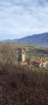
An easy circular route, half through woodland and half along small tarmac roads, from one castle to another. This circular route can be combined with another circular route, from the fortified house of La Frette to Château du Touvet.
Route from Barraux to Saint-Georges and Saint-Marcel
 6.15 mi
+2,028 ft
-2,011 ft
4h 35
Moderate
Departure from Barraux (Isère)
6.15 mi
+2,028 ft
-2,011 ft
4h 35
Moderate
Departure from Barraux (Isère)
Circular walk around the foothills of the Chartreuse with a beautiful view of Belledonne and a walk past the Furet Waterfall.
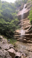
The Teppes Cochon waterfall
 6.47 mi
+2,559 ft
-2,543 ft
5h 10
Moderate
Departure from Barraux (Isère)
6.47 mi
+2,559 ft
-2,543 ft
5h 10
Moderate
Departure from Barraux (Isère)
The first part of the walk is a bit of a slog, but the rest is fairly easy. It’s best to do this walk after a spell of rain to get the most out of the waterfalls.
L’Aulp du Seuil
 4.99 mi
+2,648 ft
-2,644 ft
4h 35
Moderate
Departure from Saint-Bernard (Isère) (Isère)
4.99 mi
+2,648 ft
-2,644 ft
4h 35
Moderate
Departure from Saint-Bernard (Isère) (Isère)
Please note: the route is closed from 15 August until the end of September 2026.
The Aulp du Seuil crossing: this hike ranks among the most beautiful in the Chartreuse.
The Pas de l’Écharasson round trip
 6.17 mi
+2,569 ft
-2,572 ft
5h 05
Extremely difficult
Departure from Saint-Bernard (Isère) (Isère)
6.17 mi
+2,569 ft
-2,572 ft
5h 05
Extremely difficult
Departure from Saint-Bernard (Isère) (Isère)
Starting from the Col de Marcieu, this hike to the Pas de l’Écharasson begins with a walk through the forest before continuing along a path that leads to the foot of the Crête de l’Alpette at a scree slope. After negotiating its narrow gap and climbing two rocky outcrops, you’ll discover a magnificent cirque in a breathtaking setting. The route continues along a ledge sheltered by rock; climbing through a gap, then over a small, cable-secured rock barrier and finally along a ridge takes you to the crest and its magnificent viewpoint.
Mont Granier via the Pas des Barres and the Balme à Colon
 7.02 mi
+2,956 ft
-2,979 ft
6 hrs
Very difficult
Departure from Entremont-le-Vieux (Savoie)
7.02 mi
+2,956 ft
-2,979 ft
6 hrs
Very difficult
Departure from Entremont-le-Vieux (Savoie)
A beautiful loop in the northern Chartreuse with magnificent 360° views of the Alps.
Le Mont Granier en boucle par le Pas des Barres et celui de Tencovaz
8.79 mi
+3,369 ft
-3,383 ft
7h 00
Very difficult
Departure from Entremont-le-Vieux (Savoie)
La montée emprunte le parcours le plus fréquenté de l'accès au Granier, celui par le Col de l'Alpette et le Pas des Barres. La descente par le Pas de Tancovaz reste beaucoup plus secrète, la désescalade de deux étroitures nécessitant une certaine agilité doublée d'un bon sens d'orientation dans la descente hors sentier d'un pierrier pentu. Mais ces difficultés font tout le charme de ce retour atypique.
Le Pinet or Truc from La Plagne
 6.15 mi
+2,802 ft
-2,802 ft
5h 15
Moderate
Departure from Entremont-le-Vieux (Savoie)
6.15 mi
+2,802 ft
-2,802 ft
5h 15
Moderate
Departure from Entremont-le-Vieux (Savoie)
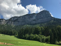
Le Pinet is a viewpoint overlooking Les Entremonts. Less frequented than its neighbour, Le Granier, it is just as much a part of the Hauts de Chartreuse Nature Reserve and its access via the normal route is well suited to families, with a few variations possible.
 From La Plagne to the Chalet de l'Alpe or Habert Saint-Vincent
6.65 mi
+2,073 ft
-2,041 ft
7 hrs
Moderate
Departure from Entremont-le-Vieux (Savoie)
This is a snowshoe hike with no specific markings for this activity; however, theGR® 9 markings do exist, though they are less visible in winter conditions
The appeal of this hike lies not in the markings but rather in the atmosphere you experience along the route across the plateau.
Not Charassons and Arche Miracle
 8.16 mi
+4,783 ft
-4,780 ft
6 hrs
Extremely difficult
Departure from Saint-Bernard (Isère) (Isère)
8.16 mi
+4,783 ft
-4,780 ft
6 hrs
Extremely difficult
Departure from Saint-Bernard (Isère) (Isère)
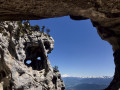
A breathtaking circular route linking together numerous wonders: the rugged Pas des Charassons, the scenic Crête de l’Alpette, the magnificent Écaille du Pas de Ragris, the famous Tour Percée, the precarious Arche Miracle and the beautiful Aup du Seuil pass.
This hike, covering less than 13km with 1,500m of elevation gain, requires a good sense of direction and sure-footedness (short sections of grade 3c climbing). Please note: the IGN topographic map is completely unreliable here!
An agreement has been signed between the department and the owner of the 800 hectares in the Hauts de Chartreuse nature reserve to allow free access to the two paths that run across the Marcieu plateau. The exit at Pas des Charassons, which leads back onto the plateau, joins one of these paths within a few metres. You may request permission to pass from the landowner, although there are no visible prohibition signs on the ground.
Hanging gardens of Les Charassons
 6.09 mi
+3,389 ft
-3,383 ft
5h 45
Extremely difficult
Departure from Saint-Bernard (Isère) (Isère)
6.09 mi
+3,389 ft
-3,383 ft
5h 45
Extremely difficult
Departure from Saint-Bernard (Isère) (Isère)
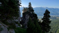
Spectacular hike to the hanging gardens of Charassons with two magnificent arches to discover.As the Marcieu valley is entirely private, the hike never passes through it and always remains on authorised terrain.
This hike is extremely difficult, beyond what is usual on Visorando, and requires climbing a short 3c section (a single move). An ice axe is recommended even (especially) in summer to tackle the steep slopes of the hanging gardens without stress. Most of the hike takes place on unmarked and (very) poorly marked paths. See Practical Information.
This hike takes place largely at the foot of cliffs. Geolocation (GPS, etc.) is therefore approximate, with errors exceeding 40 m. You must therefore use your brain and critical thinking skills and act according to the terrain.
As is often the case, this hike is a variation on a theme by Pascal Sombardier.
Col de l'Alpette
 2.22 mi
+1,470 ft
-1,470 ft
2h 20
Moderate
Departure from Entremont-le-Vieux (Savoie)
2.22 mi
+1,470 ft
-1,470 ft
2h 20
Moderate
Departure from Entremont-le-Vieux (Savoie)
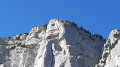
Very pretty hike in the foothills of Granier. At the summit, there is a large plateau ideal for picnics, with views of the surrounding peaks and Mont Blanc in good weather.
An easy family walk, done with a 3½-year-old girl who is used to walking, as it is quite steep.
The summit of Mont Granier
 Tourist office5.42 mi
+3,235 ft
-3,222 ft
5h 20
Difficult
Departure from Entremont-le-Vieux (Savoie)
Tourist office5.42 mi
+3,235 ft
-3,222 ft
5h 20
Difficult
Departure from Entremont-le-Vieux (Savoie)
In the heart of the Hauts de Chartreuse Nature Reserve, the majestic Mont Granier welcomes you. Although the cross is inaccessible for safety reasons, this hike reveals astonishing geology and remarkable biodiversity.