Refine your search for walks in La Chapelle-de-Brain
La Chapelle-de-Brain walks


 Gannedel Marshes
 Visorando Member
 4.08 mi
 +10 ft
 -10 ft
 1h 55
 Easy
 Departure from La Chapelle-de-Brain (Ille-et-Vilaine)
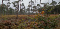
From one season to the next, the Gannedel marsh can be explored under a large sun hat or in wellies! It can be difficult to explore fully when it is flooded, but it is particularly popular in spring when migratory birds stop off there: herons, egrets, ducks and storks all nest there. A local organisation also offers guided tours: Les Rives de Gannedel
 The Gannedel and Massérac Marshes
21.40 mi
+443 ft
-443 ft
2.5 hrs
Easy
Departure from Sainte-Marie (Ille-et-Vilaine) (Ille-et-Vilaine)
Upstream from Redon, the Vilaine valley stretches out between the hillsides that flank it to the north and south. Vast expanses of wild or cultivated marshland follow one another, through the midst of which the river flows.
Cycling along the small roads that wind around these marshes is a refreshing way to explore the area and its villages, away from the main roads.
Land and river around Port-de-Roche
 13.14 mi
+476 ft
-472 ft
6h 25
 Moderate
Departure from Langon (Ille-et-Vilaine) (Ille-et-Vilaine)
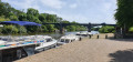
The route allows you to discover the countryside between Langon, Beslé and Brain-sur-Vilaine, passing through pretty little typical villages, crossing woods and forests and ending on the towpath along the Vilaine, for more than 9 km. Most of the trail is on beautiful stone paths. The Vilaine is very popular in these areas. You will see pleasure boats and fishermen in their boats. Don't miss the egrets and grey herons on the banks of the Vilaine.
The Saint-Pierre Cross at the Saint-Just megalithic alignments
 1.18 mi
+75 ft
-75 ft
0h 35
Easy
Departure from Saint-Just (Ille-et-Vilaine) (Ille-et-Vilaine)
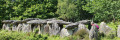
It’s a short walk suitable for children and ideal for families, whatever the season.This short circular loop runs along the western side of the Allée des Demoiselles de Cojoux, offering a view of the Étang du Val.Adults can extend the walk by heading east to see the famous Demoiselles de Cojoux and the Alignements du Moulin.
Finally, it’s well worth rounding off the walk by exploring the magnificent Allée Couverte de Tréal, which is just a 3-minute drive away.
Tour of the Étang du Val
4.49 mi
+233 ft
-240 ft
2h 15
Easy
Departure from Saint-Just (Ille-et-Vilaine) (Ille-et-Vilaine)
Walk around the Étang du Val, crossing the Lande de Cojoux and then skirting the Château du Val.
Étang du Val and megaliths in Saint-Just
 3.43 mi
+167 ft
-194 ft
1h 45
Easy
Departure from Saint-Just (Ille-et-Vilaine) (Ille-et-Vilaine)
Walk along the Étang du Val, then along the river, under the cover of the forest, then climb up to the plateau in the moorland to explore the varied megaliths of this exceptional site. There are many paths on the site, offering numerous possible variations.
Île aux Pies and Vallée de l'Oust
 19.02 mi
+719 ft
-719 ft
9h 20
 Difficult
Departure from Redon (Ille-et-Vilaine)
Discover the Oust Valley and the Nantes-Brest Canal, near Redon, and Bains-sur-Oust with this circular route that combines towpaths, forest paths and communal roads.
A few high points will give you a magnificent view of Île aux Pies and the Oust Valley.
Bailey Bridge seen from Saint-Perreux
 5.64 mi
+20 ft
-16 ft
2h 35
Easy
Departure from Saint-Perreux (Morbihan)
A pleasant route along the Oust and the Arz, ideal for anglers.
Along the Oust to discover the Chapel of Saint-Méen
 3.68 mi
+243 ft
-217 ft
1h 55
Easy
Departure from Bains-sur-Oust (Ille-et-Vilaine)
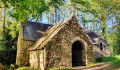
This short circular walk allows you to enjoy the panoramic views over Île-aux-Pies, before setting off in search of the Chapel of Saint-Méen, the last remaining vestige of the former Abbey of Busal.It is a place to connect with nature, silence and serenity.
The tour of Île aux Pies, starting from La Potinais
 13.25 mi
+492 ft
-492 ft
6h 30
Difficult
Departure from Saint-Vincent-sur-Oust (Morbihan)
To cross the geological fold that extends the Landes de Lanvaux, the Oust has carved its way through the rocky plateau to wind its way through the Île aux Pies gorge. Upstream, at the confluence of the Oust and the Aff, the alluvial plain is sometimes dry, sometimes covered in water. You need to choose the right time to set off. Early spring seems to be the best season to fully enjoy the landscapes you pass through... without getting your feet wet.
Étang Aumée and the Nantes–Brest Canal around Fégréac
 17.97 mi
+449 ft
-456 ft
8h 40
Difficult
Departure from Fégréac (Loire-Atlantique)
A lovely walk that will take you through fields and woodland towards the Nantes–Brest Canal, following theGRP® des Trois Rivières. Much of the route runs along the heights overlooking the Vilaine Valley and the canal, offering you beautiful, unobstructed views. You’ll also get to enjoy the tranquillity of the canal as you follow the greenway, and round off the walk with a route of the Étang Aumée after passing through an unusual spot: the Carrière du Bellion in Fégréac (the route can be done by mountain bike).
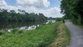
Boro Castle as seen from Saint-Vincent-sur-Oust
 6.29 mi
+282 ft
-272 ft
3h 10
Moderate
Departure from Saint-Vincent-sur-Oust (Morbihan)
A route starting from Saint-Vincent-sur-Oust, through woodland and along the River Oust.
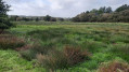
The Coinanton Marshes in Saint-Vincent-sur-Oust
 6.97 mi
+289 ft
-272 ft
3h 25
Moderate
Departure from Saint-Vincent-sur-Oust (Morbihan)
A very lovely walk in the area around Saint-Vincent-sur-Oust through the marshes and woods.
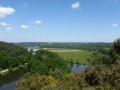
Saint-Vincent-sur-Oust Day 1/2
 11.26 mi
+387 ft
-361 ft
5h 30
Moderate
Departure from Saint-Vincent-sur-Oust (Morbihan)
This first day of a two-day route will take us up the River Oust via the upper reaches. We’ll be walking above the river, offering lovely views of Île aux Pies.
The final stretch will be mainly through woodland and meadows.
Saint-Jean-la-Poterie circular loop
 3.53 mi
+341 ft
-361 ft
1h 55
Easy
Departure from Saint-Jean-la-Poterie (Morbihan)
A walk around Saint-Jean-la-Poterie along the banks of the Oust.
From La Gacilly to the Chapel of Saint-Jugon via the Black Forest
 7.95 mi
+436 ft
-410 ft
4h 00
Moderate
Departure from La Gacilly (Morbihan)
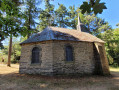
Starting from the marina, we begin by following the banks of the Aff, a charming little Breton river. Then, crossing the Forêt Neuve, we cross the Ruisseau des Brelles to enter the Forêt Noire. At the end of the path, we can stop for refreshments in the shade of the Chapelle Saint-Jugon.
The return journey is just as peaceful, taking the sunken lanes and ending up in the streets where the craftspeople's stalls are well worth stopping at.
The Canal and Étang Aumée in Fégréac
8.27 mi
+299 ft
-299 ft
4h 05
Moderate
Departure from Fégréac (Loire-Atlantique)
The landscape around Fégréac is characterised by three small valleys overlooked by the village. The first is home to the River Isac and the canal linking Nantes to Brest; the second is home to the Dréneuc stream and the marshes bordering it; and the third has been transformed into a large pond which once supplied the Aumée Mill. All converge on the River Vilaine, which can be seen at the Bellion lock. After passing through all these water-dominated spots, you return to the starting point by following the canal.
The Saint-Jugon Chapel via the Black Forest
8.08 mi
+469 ft
-440 ft
4h 10
Moderate
Departure from La Gacilly (Morbihan)
La Gacilly is, first and foremost, a bridge spanning the River Aff, where the river winds its way between two wooded hills. By climbing the hill overlooking the town to the west, you can enjoy a lovely circular walk through a densely wooded landscape. The Saint-Jugon Chapel, nestled in its green surroundings, is a lovely spot to stop for a break halfway along the route.
Route de La Fée Carabosse
 Association / Club / Walk leader
 10.68 mi
+801 ft
-817 ft
5h 35
Moderate
Departure from Guémené-Penfao (Loire-Atlantique)
Hike from the Chapelle des Lieux Saints to the Lizien racecourse in Guémené-Penfao. Magnificent views over the Don valley and the Guénouvry countryside.
Don Valley route from the Chapel of St Anne to La Vallée
6.44 mi
+472 ft
-499 ft
3h 20
Moderate
Departure from Guémené-Penfao (Loire-Atlantique)
Superb hike starting from the Chapelle des Lieux Saints, through the woods, with magnificent views of the rolling landscapes of Guénouvry. At a bend in the path, you will see the Château de Juzet and overlook the Don River as you head towards the village of Tréguély, then return to the chapel.
The woods of Tréguély
4.34 mi
+141 ft
-148 ft
2h 05
Easy
Departure from Guémené-Penfao (Loire-Atlantique)
A 7 km walk starting from the Chapelle des Lieux Saints in Tahun, Guénouvry, passing through several woods around Tréguély, with magnificent views over the Guénouvry countryside and Conquereuil.
Cycling loop between Guenrouët and the Bellion lock
23.65 mi
+436 ft
-433 ft
3 hrs
Moderate
Departure from Plessé (Loire-Atlantique)
The Isac Valley connects Guenrouët to the Vilaine. Small country roads and wide carriageways, then the towpath of the Nantes-Brest Canal, lead to the Bellion Lock, a nautical stop at the confluence of the canal and the Vilaine. The return journey is the same, via other equally pleasant routes. A bucolic atmosphere is guaranteed on this ride on the edge of the Pays de Redon.
In the countryside on the border between the municipalities of Messac, Pléchâtel and Bain
9.81 mi
+502 ft
-499 ft
4h 55
Moderate
Departure from Messac (Ille-et-Vilaine) (Ille-et-Vilaine)
A route through the countryside and through the woods. The route passes at the foot of the wind farm, then follows small paths to the Chêne and the Landes de Brelon, before passing through Bagaron and ending gently on the Voie Verte.
Around the Roho Mill and the Saint-Dolay marshes
4.58 mi
+335 ft
-308 ft
2h 25
Easy
Departure from Saint-Dolay (Morbihan)
Saint-Dolay features the typical landscapes of the region, though with a notable abundance of water and mills.This runoff and surface water has created marshes and ponds around the Moulin de Roho.This circular route is part ofthe PR®® known as the Boucle du Marais de Roho.
Roho moors and marshes
 6.71 mi
+453 ft
-459 ft
3h 30
Moderate
Departure from Saint-Dolay (Morbihan)
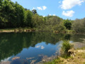
The village of Saint-Dolay overlooks the plateau that borders the south bank of the Vilaine. This flat landscape is cut by a valley with sometimes steep slopes, where the Moulin Neuf stream flows. While moors cover the slopes and heights of the valley, marshes and peat bogs cover the bottom. Add to this variety of vegetation a remarkable geological diversity, and you will have many reasons to explore this route.