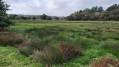
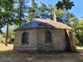
The Coinanton Marshes in Saint-Vincent-sur-Oust

A very lovely walk in the area around Saint-Vincent-sur-Oust through the marshes and woods.

Details

27502800
Creation:
Last update:
Last review:
  • Walking
    Activity: Walking
  • ↔
    Distance: 6.97 mi
  • ◔
    Average duration: 3h 25 
  • ▲
    Difficulty: Moderate

  • ⚐
    Back to start: Yes
  • ↗
    Ascent: + 289 ft
  • ↘
    Descent: - 272 ft

  • ▲
    Highest point: 180 ft
  • ▼
    Lowest point: 10 ft

Photos

Description of the walk

(S/E) From the Salle Jules Ferry, head towards the Route de Redon, cross it and take the road (Route du Chandelier) opposite, running alongside the community hall. Continue along Rue de l’Abbé Monneraye. At the end, turn left, then left again towards Le Cas and the sewage treatment works.

(1) At the wastewater treatment plant, take the small path on the right and continue alongside the plant until you reach a wider track. Carry on until you reach a road.

(2) First turn left then right onto a cul-de-sac which leads onto a track. At the end, facing a stream, turn left until you reach the Marais de Coinanton junction.

(3) Turn left onto the path that passes under a power line; at the crossroads, turn right onto the road towards the hamlet of Les Bois. At the first road, turn right towards La Vacherie.

(4) In this hamlet, take the road on the left between the houses and walk a few hundred metres to reach the first pylon.

(5) At the pylon, enter the woods, take the path on the right and, a few metres further on, take a second path on the right which runs alongside the woods. At the second pylon, take the path on the left which leads into the woods and continue until you reach a road.

(6) Follow it to the right and, at the end of the road, turn left towards the Route de Redon (D764). Cross it carefully and head up to La Grée des Moulins.

(7) Take the path opposite; continue along it, ignoring the small paths on the left, and stay firmly on the main path as you head downhill, where you’ll walk alongside a mountain-bike track.

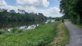
(8) When you reach the fountain, turn left onto the path that runs alongside the road and rejoin the road after a few hundred metres to emerge at the banks of the Oust.

(9) Turn left, following the River Oust towards the Potinais Dam.

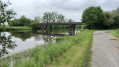
(10) At the dam, follow the towpath to the Ti Kendalc’h descent. Before the descent, cross a small bridge (landmark).

(11) Turn left up the hill towards Ti Kendacl’h, cross the site keeping slightly to the right and continue straight on until you reach the entrance to Saint-Vincent-sur-Oust.

(12) At the entrance, turn left into the first street, then right, and finally left towards the Salle Jules Ferry (S/E).

Waypoints

  1. S/E : mi 0 - alt. 157 ft - Salle Jules Ferry
  2. 1 : mi 0.81 - alt. 66 ft - Wastewater treatment plant
  3. 2 : mi 1.27 - alt. 23 ft - Route
  4. 3 : mi 2.14 - alt. 13 ft - Marais de Coinanton junction, near the - Arz (rivière) - Affluent de l'Oust
  5. 4 : mi 2.8 - alt. 49 ft - La Vacherie hamlet
  6. 5 : mi 2.92 - alt. 102 ft - Entrance to the woodland – 1st pylon
  7. 6 : mi 3.2 - alt. 144 ft - Road junction
  8. 7 : mi 3.54 - alt. 144 ft - La Grée des Moulins
  9. 8 : mi 4.04 - alt. 56 ft - Fountain
  10. 9 : mi 4.28 - alt. 13 ft - Crossroads at the - Oust (rivière)
  11. 10 : mi 4.63 - alt. 16 ft - Potinais Dam. Confluence of the Oust and - Canal de Nantes à Brest
  12. 11 : mi 5.74 - alt. 16 ft - Ti Kendalc’h Hill
  13. 12 : mi 6.78 - alt. 177 ft - Entrance to Saint-Vincent-sur-Oust
  14. S/E : mi 6.97 - alt. 157 ft - Salle Jules Ferry

Notes

Make sure you wear sturdy footwear, as the ground is damp in places.

Worth a visit

At the Potinais dam, take a few minutes to admire the Oust valley.

Reviews and comments

3.8 / 5
Based on 3 reviews

Reliability of the description
4 / 5
Ease of following the route
3.7 / 5
Route interest
3.7 / 5
Philippe Grié
Philippe Grié

Overall rating : 3.7 / 5

Date of your route : Aug 26, 2024
Reliability of the description : ★★★★☆ Good
Ease of following the route : ★★★★☆ Good
Route interest : ★★★☆☆ Average
Very busy route : No

A lovely route to really stretch your legs
Completely flat and shaded

Machine-translated

mondmond
mondmond

Overall rating : 3.7 / 5

Date of your route : Jul 23, 2024
Reliability of the description : ★★★★☆ Good
Ease of following the route : ★★★☆☆ Average
Route interest : ★★★★☆ Good
Very busy route : No

The mileage is higher than stated.

Machine-translated

Alex56350
Alex56350

OK, thanks, I’ve corrected it.

Machine-translated

Christophe 56
Christophe 56

Overall rating : 4 / 5

Date of your route : Nov 19, 2022
Reliability of the description : ★★★★☆ Good
Ease of following the route : ★★★★☆ Good
Route interest : ★★★★☆ Good
Very busy route : No

Hello, there’s just a mistake at waypoint number two: it should read ‘first turn left then right’.

Machine-translated

Other walks in the area

For more walks, use our search engine .

The GPS track and description are the property of this route's author. Please do not copy them without permission.