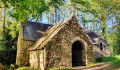
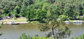
Gannedel Marshes

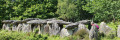
From one season to the next, the Gannedel marsh can be explored under a large sun hat or in wellies! It can be difficult to explore fully when it is flooded, but it is particularly popular in spring when migratory birds stop off there: herons, egrets, ducks and storks all nest there. A local organisation also offers guided tours: Les Rives de Gannedel

Details

n°24734199
Creation:
Last update:
Last review:
  • Walking
    Activity: Walking
  • ↔
    Distance: 4.08 mi
  • ◔
    Average duration: 1h 55 
  • ▲
    Difficulty: Easy

  • ⚐
    Back to start: Yes
  • ↗
    Ascent: + 10 ft
  • ↘
    Descent: - 10 ft

  • ▲
    Highest point: 20 ft
  • ▼
    Lowest point: 7 ft

Description of the walk

Park in the small car park in the village of Gannedel. Before setting off, you’ll see a restored farmhouse dating from the 17th century near the car park.

(S/E) Head south along the departmental footpath, passing between the two small rows of palisades. The path is a mown track through the fields. It is marked with totem poles featuring a blue zone indicating the water level in winter.

(1) Ignore the turn-off to the left for the dairy farm and carry on straight ahead.

(2) Cross the footbridge over the marshes and enjoy the view from the SOUTH observation point, on your right as you cross the footbridge. The blue line indicates the water level in winter. Then turn left twice to join a track suitable for vehicles.

(3) Turn right, then veer right again as you leave the track.

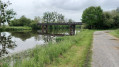
(4) Take a sharp right-hand bend. The route then runs alongside the old branch of the Vilaine, where major works have altered its course. The Penfao rock was cut through in 1780, significantly changing life in the marshes. You should come to a small bridge spanning one of the marshes’ many watercourses.

(5) Cross it and carry on straight ahead, heading north.

(6) About forty metres before a T-junction, turn right. The path becomes wooded again here

(7) Near the hamlet of La Carterais, you’ll find a lovely little fountain by the stream. Carry on straight ahead to reach the car park. But first, you’ll have the chance to enjoy the NORTH observation point (S/E).

Waypoints

  1. S/E : mi 0 - alt. 16 ft - Car park in the village of Gannedel
  2. 1 : mi 0.41 - alt. 20 ft - Dairy farm junction, go straight on
  3. 2 : mi 0.66 - alt. 10 ft - Footbridge/southern observation point
  4. 3 : mi 1.21 - alt. 16 ft - A track suitable for vehicles, on the right
  5. 4 : mi 1.6 - alt. 16 ft - Turn right at the fork
  6. 5 : mi 2.46 - alt. 10 ft - Monkey bridge
  7. 6 : mi 3.36 - alt. 10 ft - Turn right at the fork
  8. 7 : mi 3.67 - alt. 13 ft - La Carterais, fountain
  9. S/E : mi 4.08 - alt. 16 ft - Car park in the village of Gannedel

Notes

In winter, wellies are essential. In summer, a hat and mosquito repellent.

Worth a visit

In the village, before you set off, you’ll see a restored farmhouse near the car park; it dates from the 17th century. It faces south. The oldest houses in the village face the marshes, to the west. The marshes were the village’s main source of livelihood until the end of the 18th century.

Take a good look at the posts installed for the storks,

Reviews and comments

5 / 5
Based on 1 review

Reliability of the description
Not used
Ease of following the route
Non utilisé
Route interest
5 / 5
Padrig ar brikir
Padrig ar brikir

Overall rating : 5 / 5

Date of your route : Sep 28, 2026
Reliability of the description : Not used / Not applicable
Ease of following the route : Not used / Not applicable
Route interest : ★★★★★ Very good
Very busy route : Yes

A lovely walk, but the route is no longer up to date. The footbridge has apparently been rebuilt but is no longer in the same place, and part of the route between numbers 2 and 3 no longer exists.

Machine-translated

Other walks in the area

For more walks, use our search engine .

The GPS track and description are the property of this route's author. Please do not copy them without permission.