


 Country:
 City:
City:


Starting point at the old La Grée railway station, near the Voie Verte.
(S/E) Head north and follow a small road, leaving the old station and the car park on your right. Immediately ignore a road on the right. Take a second road on the right.
(1) Follow this and pass through the hamlet of Sagalon. Continue straight on along the small road, which soon gives way to a track. Ignore the next track on the left (marker 61) and carry on straight ahead until you reach a T-junction.
(2) Then turn left and follow theGR®39(red and white markings). Cross a small road (marker 77) and continue straight ahead on theGR® until it turns right.
(3) Continue straight on. Pass the Fontaine de Normand (hard to spot, on the left in a bend). Cross a small road and continue straight ahead for a few tens of metres. Take thefirst path on the right, which climbs slightly to a T-junction.
(4) Turn left and walk past the wind turbines on your right. At the next T-junction, turn right. Carry on straight ahead (north) until you reach a T-junction.
(5) Turn right and walk past the farm buildings on your left. Then walk past the wind turbines on your right until you reach the junction with theGR®39.
(6) Carry on straight ahead, crossing theGR®. Pass the hamlet of La Héraudière. Cross a small road and follow the path opposite until you reach the next road (D42).
(7) Cross it carefully, continue straight ahead and, after about 150 m, you’ll reach the Chêne de Brelon (a remarkable, large-spreading tree, planted in May 1598). Carry on straight ahead and, at the T-junction, turn right. Further on, turn left onto the path leading towards a small copse. Turn right at the edge of the copse and walk alongside it on your left. You’ll come out onto a road.
(8) Follow it to the left. Carry on straight ahead and pass the hamlet of Saint-Joseph. At the T-junction, turn right. Ignore the turn-off on the left leading to the hamlet of La Chapelle de Bagaron and, after about a hundred metres (elevation 103), look out for two paths running perpendicular to the road, one on the left and one on the right.
(9) Carry on straight ahead along the road as it descends. After about 300 m, turn left onto a wide path with no hedges. Walk on roughly level ground, then head downhill. At the next junction (elevation 70), follow the path on the left as it climbs. At the following junction, turn left again onto a small, tree-lined path. Join the road you left earlier.
(9) Cross over and take the Chemin de Bagaron straight ahead. Walk downhill to a pond.
(10) Turn left, cross a stream (a damp but passable section) and walk alongside the pond on your right. Continue straight on until you reach the small road at a place called Bagaron. Turn right and carry on until you reach the D42.
(11) Cross it carefully and follow the path opposite. Take thefirst path on the left after an orchard and walk alongside it on your left. Continue until you reach a road.
(12) Follow it to the right, taking care. Stay on this road, which bends left then right, and ignore the access roads on the left leading to the hamlets of l’Evenais and la Carriais. Just after the bridge over a stream, turn right onto a small road and follow it to the end at a crossroads (elevation 72).
(13) Turn left onto a path through the trees (on the right, private access to the Landes de Bagaron). You’ll reach a junction and theGR®39.
(14) Follow theGR® to the left, straight on, due south, until you reach a road. Leave theGR®39. Cross this road and continue along the path opposite. Pass under a high-voltage power line and you’ll immediately come to a junction with the Voie Verte.
(15) Turn right onto this path and join the (S/E).

 Visorando Member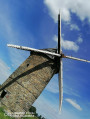


 Easy
Easy 
